First Impressions
No. 07 - Part 02 - Derby Road
w/e 06 November 2022
All of this week's pictures were taken with a Nikon D3300
After Manor Fields Drive,
the steepest part of Derby Road is behind us and it levels off
before slightly rising again from Oakwell Drive to White Lion
Square.
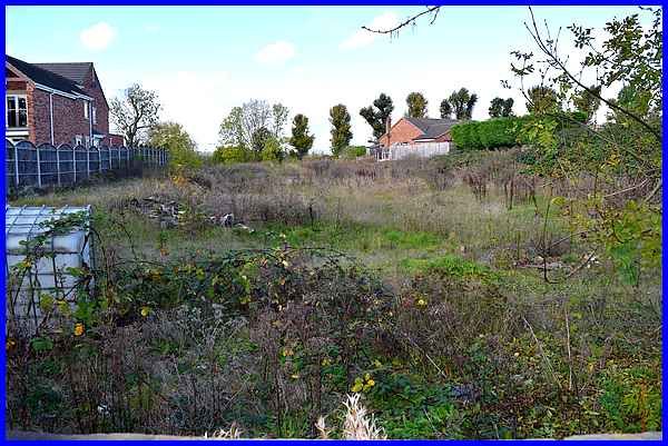
Resuming at Manor Fields Drive though, the area on the right
hand side of the road is shielded by many trees and shrubs. This
was once the site of the Oakwell Brickworks and for a time in
the not so distant past was being considered as a housing development
site. Those plans fell through though due to the "contaminated
ground". The shell of the Hoffman kiln still stands on the
site and some images of it taken in September 2004 can be seen
on this page. The
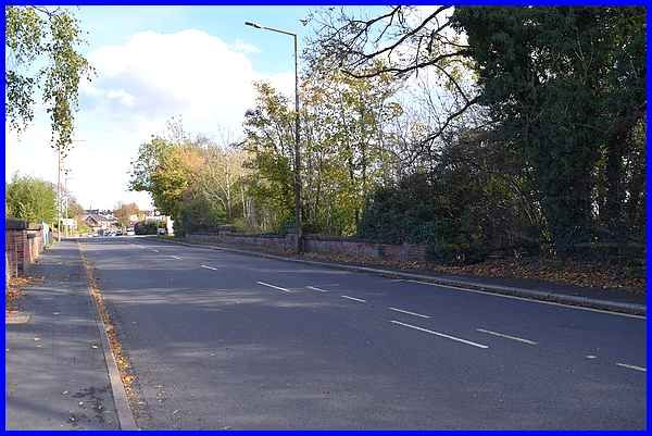
walls on either side of Derby Road in the image above mark the
position of another bridge, this one being over the Stanton Branch
of the Great Northern Railway.
|
Anyone looking over the wall though and expecting to see the
railway lines would be disappointed as the cutting has been filled
in and returned to nature.
|
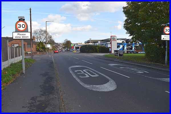
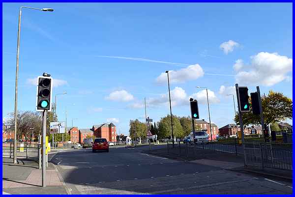
After the bridge the speed limit drops from 40mph to 30mph and
on the right the former Ilkeston Colliery site is now home to
a petrol filling station and the Ron Brooks motor trader's site.
On the left is another small housing development, Charter Park
followed by some allotments.
|
Ancient maps show a footpath which in recent years ran between
the allotments and the Fire Station to the Recreation Ground.
When the Fire Station was upgraded and redeveloped, the footpath
was closed and it has never reopened.
|
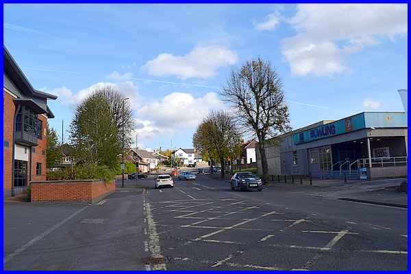
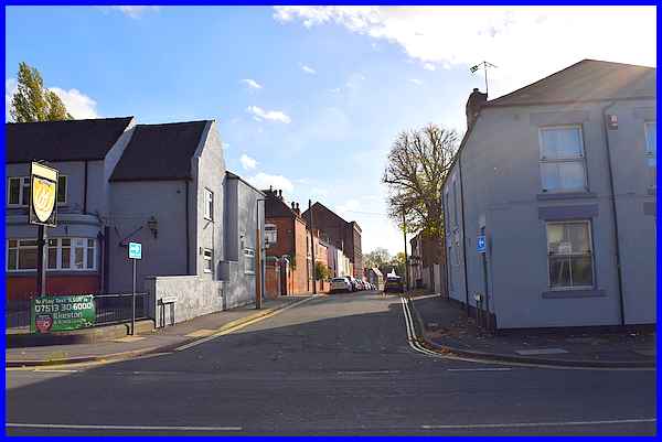
Opposite the Fire Station, seen here on the left, which stands
on the corner of Oakwell Drive, is the MFA Bowl, a 10 pin bowling
alley.
|
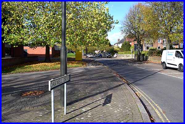
A left turn at the traffic lights would take us via Oakwell Drive,
King George Avenue, Bristol Road and Manners Road to the northern
end of Chalons Way, the point where we ended several of the other
nine roads into Ilkeston. This route though along Derby Road
continues straight on at the light to the southern end of Chalons
Way.
|
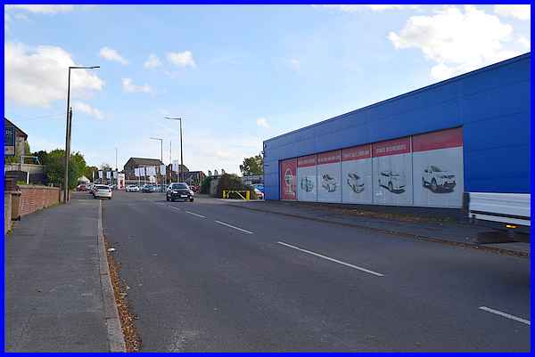
The road now passes another motor trader, Bristol Street Motors,
which trades from the site of the former Co-Op Bakery and Dairy
site. The large building in the distance is that of Cluny Lace
on Belper Street, a long-established company and the only one
in the country still producing Leavers Lace.
|
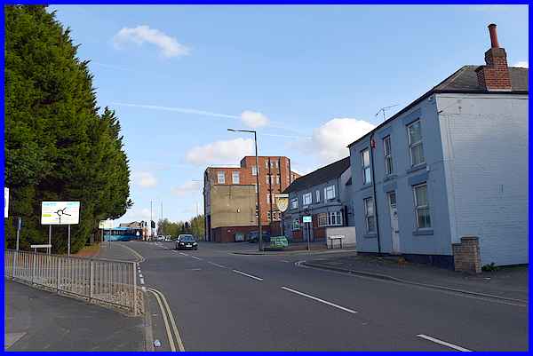
Now nearing the top of Derby Road, the road sign indicating the
Chalons Way roundabout, the large building in the centre of the
image is No. 1 Derby Road. Now a Business Centre and known as
Toll Bar House, for many years it was the home of the East Midlands
Electricity Board. Next to it were some old cottages and the
Three Horseshoes pub and opposite where the trees are, was another
row of cottages.
|
The Three Horseshoes stands on one corner of Belper Street. On
the other corner the property has been converted into residential
flats but it used to be another pub called The Miner's Arms.
The large building part way down Belper Street is the same one
we saw earlier and is that of Cluny Lace. Back in 2003 when we
were following the Town Walk, we were treated to a tour of the
factory (link).
|
Our walk up Derby Road concludes at the Chalons Way island where
it joins the other southern routes into the town. In the next
route in this series, the eighth, we'll follow Heanor Road from
the north to meet Chalons Way at the northern extremity of the
road.
|
