First Impressions
No. 08 - Part 01 - Heanor Road
w/e 05 February 2023
All of this week's pictures were taken with a Nikon D3300
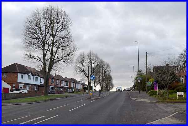
We've now reached the 8th of
the nine main roads leading into Ilkeston and this one, Heanor
Road, approaches Heanor, Marlpool and Shipley and all places
in the north.
I remember being taught at school many years ago, that Ilkeston
sits on the last hill at the southern end of the Pennines which
means the Heanor and Marlpool must be on the penultimate hill.
The road from Heanor passes through Marlpool drops down through
Shipley and then rises again slightly before crossing the boundary
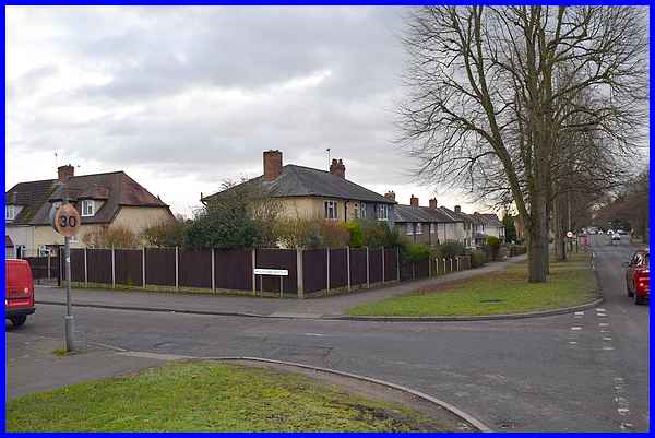
into Ilkeston. The sign for Ilkeston marking the boundary and
the change from Hassock Lane South, Shipley to Heanor Road, Ilkeston
can be seen to the left of the central refuge.
|
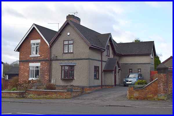
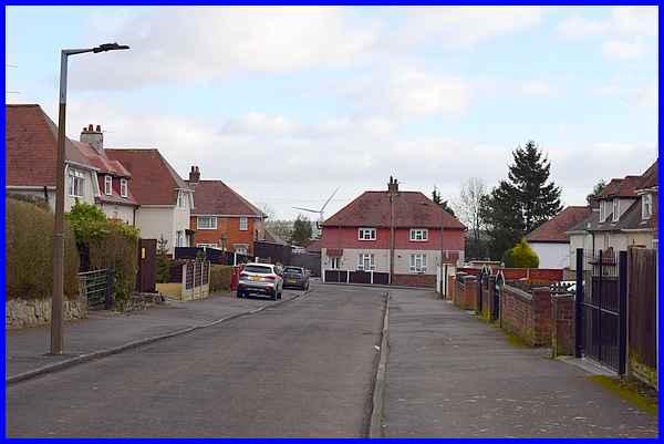
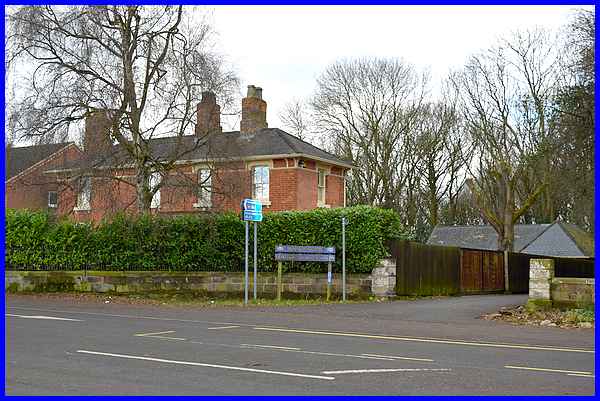
One of the first building on the right on the brow of the hill
is this pair of large semi-detached houses. Old maps show a school
on this site and the appearance of this building suggests that
these dwellings were converted to residential properties from
that school.
|
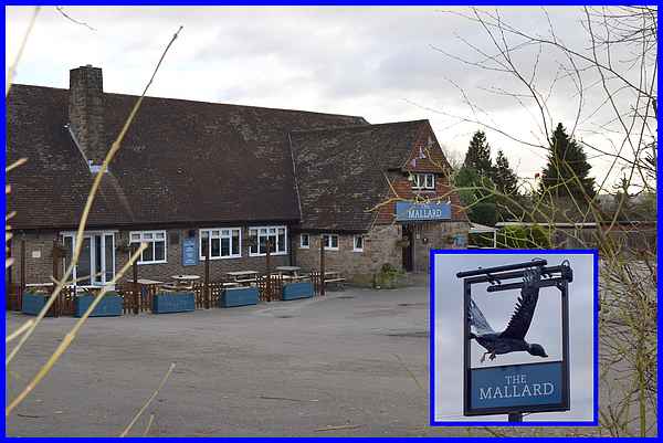
On the opposite side of the road is The Mallard, a pub built
on the site of the former Brick and Tile Inn. The pub sign shows
that the name refers to the bird rather than the famous steam
train. An image of the Brick and Tile can be seen on the Picture
The Past website - insert DCER000048
into the Keyword search box and click on the resulting photo
for more details.
|
From The Mallard, Heanor Road gradually descends towards Ilkeston
and in this view the tower of St Mary's Church in the town centre
can just be seen on the sky line at the far end of the road.
It's only about a mile and a half away but to reach it means
a further descent before a rise up the hill to the Market Place.
|
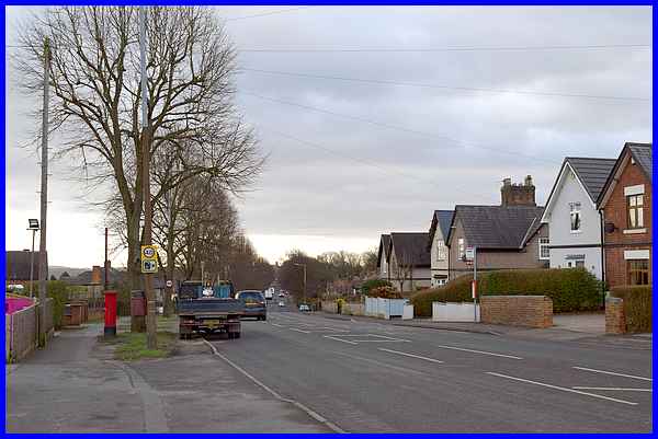
After passing Woodside Crescent - a narrow unmade road that is
just an access to a few properties - the next road on the left
is Woodland Avenue. This leads to the Cotmanhay Farm Estate.
|
Wikipedia tells us that Cotmanhay was once a Viking settlement
and that a flint discovered in Cotmanhay Wood indicates that
the area was inhabited several thousand years BC. It is now a
suburb of Ilkeston and is overshadowed by the wind turbine at
Newthorpe.
|
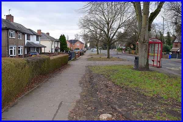
The title of this series is "First Impressions" and
the impression given of Heanor Road to the first time visitor
would be one of wide tree lined avenues with grass verges and
detached and semi-detached properties set well back from the
carriageway. Pleasant as it is, it's a little at odds with the
town's mining and industrial heritage.
|
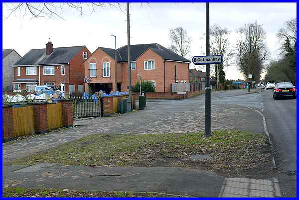
The next road on the left is the main road into Cotmanhay and
is called Church Street. Cotmanhay and Shipley Parish Church
stood a little way down Church Street but was a victim of subsidence
caused by extensive coal mining in the area and was demolished
in the latter half of the last century. It was replaced by a
modern building on the adjacent Vicarage Street. Other buildings
on the corner of Church Street and Heanor Road have also been
demolished and replaced by residential properties but the old
buildings that housed shops can be seen in a photo at Picture
The Past by searching for DCER000416
|
Opposite Church Street is the entrance to a lane running through
Shipley Wood which, on some maps, is also referred to as Church
Street. The large building next to it was originally the Cotmanhay
Lodge on the Miller-Mundy's Shipley Hall Estate. (See Picture
The Past ref. DCER000304 for an image from c.1905)
|
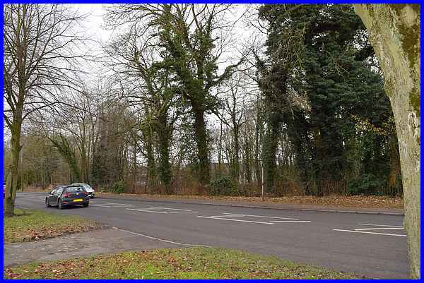
The houses on the east side of Heanor road from The Mallard to
Church Street back on to the Cotmanhay Farm Estate but those
on the west side are backed by Shipley Wood. The wood continues
beyond the entrance opposite Church Street and after a little
way a building can be seen through the trees. This is Ilkeston
Hospital and that is from where we'll continue in the next part.
|
