Latest Images
Ilkeston Cam on Holiday
Part 01 - Weston Super Mare
w/e 12 July 2026
All of this week's pictures were
taken with a Nikon D3300 camera.
It must be getting on for 50 years since we were
last in Weston Super Mare and a lot has changed since then. So
much so in fact, that these few days away were more of a voyage
of exploration than a memory jogger as our memories of the previous
visit were not backed up by what we witnessed this time. Different
this time but still enjoyable.
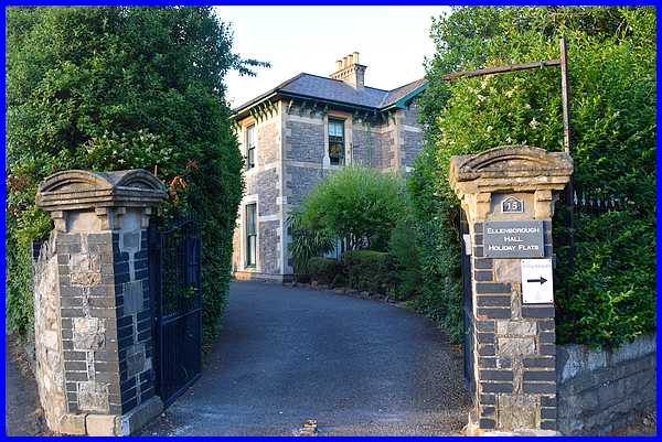
Our home from home for the duration of our holiday was a ground
floor apartment in this building and once we checked in and unpacked,
we started our exploration with a 300 yard (275m) walk down the
the sea front..
To record this photo as your favourite
from this week's selection vote for "Home From Home"
below.
|
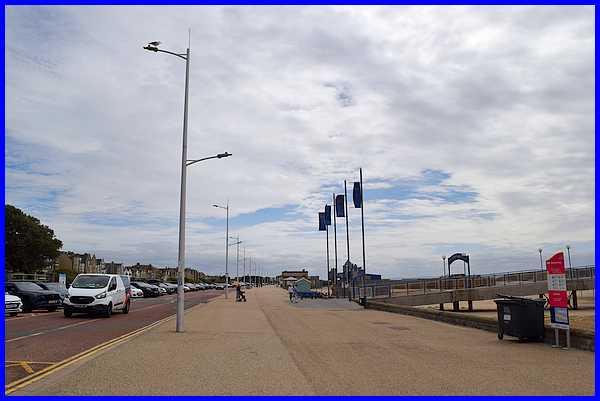
Crossing Beach Road we followed a short path to reach the broad
Marine Parade and looked south.
To record this photo as your favourite
from this week's selection vote for "Marine Parade South"
below.
|
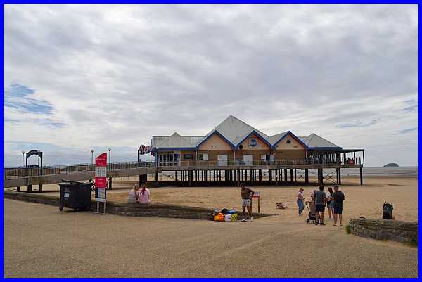
At the end of a short pier is Revo Glo Golf, a miniature
golf course.
To record this photo as your favourite
from this week's selection vote for "Revo Glo Golf"
below.
|
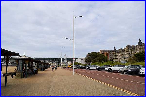
We turned away and walked towards the town centre along Marine
Parade. The 'pavement' side of Marine Parade is a shared route
for pedestrians and cyclists so both have to be wary of each
other. The road is one way and one side of it provides ample
parking for visitors with easy access to the beach.
To record this photo as your favourite
from this week's selection vote for "Marine Parade North"
below.
|
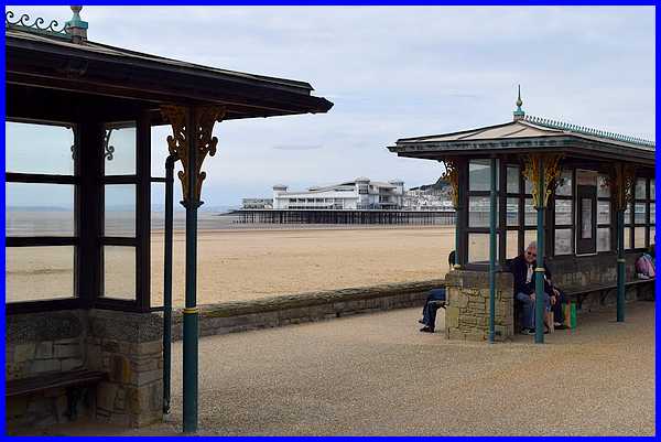
There are numerous shelters along this part of Marine Parade
and we found them a useful windbreak from a strong sea breeze.
To record this photo as your favourite from this week's selection
vote for "Shelters" below.
|
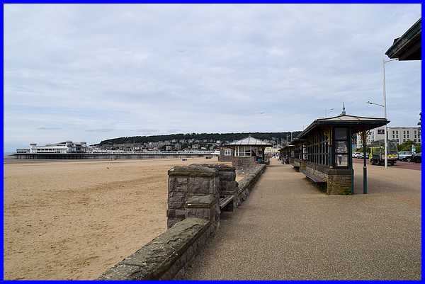
Braving the breeze we continued between the shelters and the
sea wall towards the town centre and had some good views of the
Grand Pier before returning to our accommodation.
To record this photo as your favourite
from this week's selection vote for "Grand Pier" below.
|
A couple of days later we repeated the walk along the sea front
in calmer conditions and under a lovely blue sky. We were in
Weston Super Mare between two heatwaves and were really grateful
for the pleasant weather.
To record this photo as your favourite
from this week's selection vote for "Sea Front" below.
|
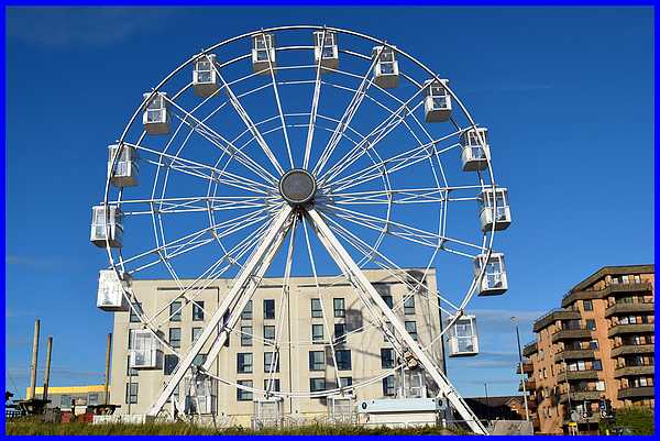
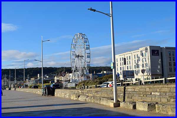
It seems no holiday resort these days is complete without a Big
Wheel and Weston is no exception.
To record this photo as your favourite
from this week's selection vote for "Big Wheel" below.
|
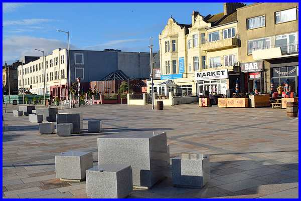
Leaving Marine Parade, we crossed the road into Princess Royal
Square. Apparently the Square was developed as part of a sea
front enhancement project that began in 2007 replacing the former
beach lawns. And that explains why this part of Weston is so
different to our 50 plus year old memories.
To record this photo as your favourite
from this week's selection vote for "Princess Royal Square"
below.
|
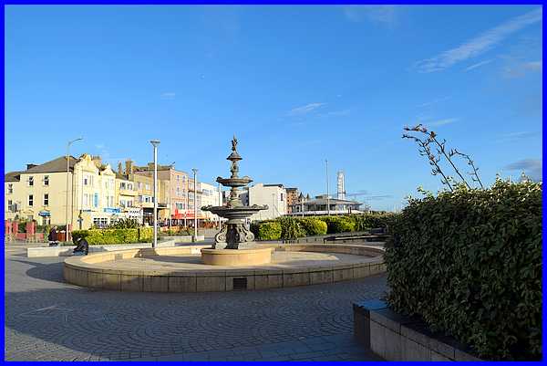
In the Square is Coalbrookdale
Fountain, a Grade II Listed Building dating from the nineteenth
century. It is one of a series of fountains produced by the Coalbrookdale
Company from 1845 onwards.
To record this photo as your
favourite from this week's selection vote for "Coalbrookdale
Fountain" below.
To be continued.
|