Kimberley - Part 04 - Up, Up & Away
w/e 13 February 2011
All this week's pictures were taken
with a Kodak DX6490
We began our walk through Kimberley in the west and
have meandered eastwards to reach the town centre. In this part
we continue in an easterly direction and climb up to the Stag
Inn, Knowle Hill and Kimberley Cemetery, or as I've titled this
part, Up, Up and Away.
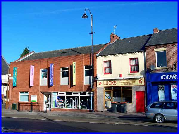
Picking up the route on Main Street near the former Primitive
Methodist Chapel, the next building along is Kimberley Library.
The library is obviously a very useful amenity for the local
population and although the architect has made an attempt to
blend this comparatively new building with its surroundings,
personally I don't think he has completely achieved that objective.
The library now stands on the site of the YMCA building that
originally opened in 1908 and was known as Hardy House.
|
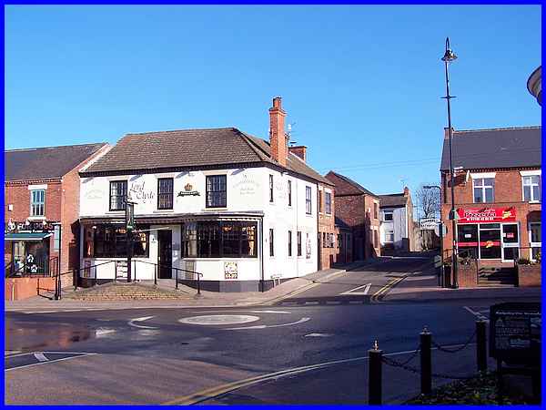
A little further along and opposite the end of Greens Lane (formerly
Factory Lane) is another of Kimberley's pubs. This is the Lord
Clyde. Comparison of two photos in a book of old postcard pictures
indicate that the raised entrance and the bay windows were added
to the frontage some time after the first decade of the twentieth
century but before 1933.
|
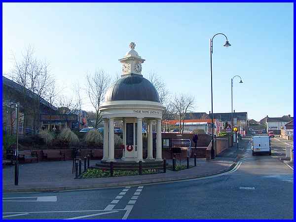
Diagonally across the same junction from the Lord Clyde is the
War Memorial which was unveiled by Sir Dennis Readett-Bailey
(chairman of the Giltbrook Leather Co.) and dedicated by the
long serving (1890-1932) rector, Rev. Frederick Hart in 1921.
In those days it was surrounded by an open aspect but by 1956
an extension to Wolsey's factory that stood on the opposite side
of Factory Lane had been built to house hosiery machines, a dying
plant and the dispatch department. Production continued through
the sixties until cheap foreign imports took their toll eventually
causing Wolsey's to close and the factories to be demolished.
The site is now occupied by Sainsbury's supermarket. Despite
an attempt to re-site the memorial it still stands where it was
originally installed and the landscaped area around it has a
number of notice boards and information panels supplementing
the names on the monument of those who gave their lives in the
service of the country.
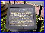 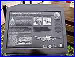 One
such panel (left) indicates that the monument was rededicated
after the Second World War and is also in memory of those who
served in more recent conflicts. Another panel (right) commemorates
the 50th Anniversary of 617 Squadron's Dam Busters Operation
and Rear Gunner Sgt. Richard Bolitho of James Street Kimberley,
who was killed on 17th May 1943 when his aircraft crashed. One
such panel (left) indicates that the monument was rededicated
after the Second World War and is also in memory of those who
served in more recent conflicts. Another panel (right) commemorates
the 50th Anniversary of 617 Squadron's Dam Busters Operation
and Rear Gunner Sgt. Richard Bolitho of James Street Kimberley,
who was killed on 17th May 1943 when his aircraft crashed.
|
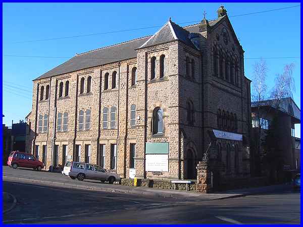
  Moving away from the War Memorial along
Nottingham Road (left) we reach an imposing building on the corner
of Broomhill Road (right). Now converted into business premises,
this is the former United Methodist Free Church, the third Methodist
church (along with St Paul's on High Street and the Prims on
Main Street) near the town centre. The United Church was built
with local stone in 1890 and seated 700 worshippers. Moving away from the War Memorial along
Nottingham Road (left) we reach an imposing building on the corner
of Broomhill Road (right). Now converted into business premises,
this is the former United Methodist Free Church, the third Methodist
church (along with St Paul's on High Street and the Prims on
Main Street) near the town centre. The United Church was built
with local stone in 1890 and seated 700 worshippers.
|
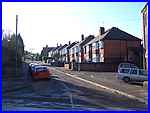
  In those days Nottingham Road
still went by the name of Main Street. Broomhill Road also had
another name but was renamed in 1938. Prior to that it was known
as Cemetery Road and although our route will take us to cemetery
we will reach it via the gentle slope of Nottingham Road (left)
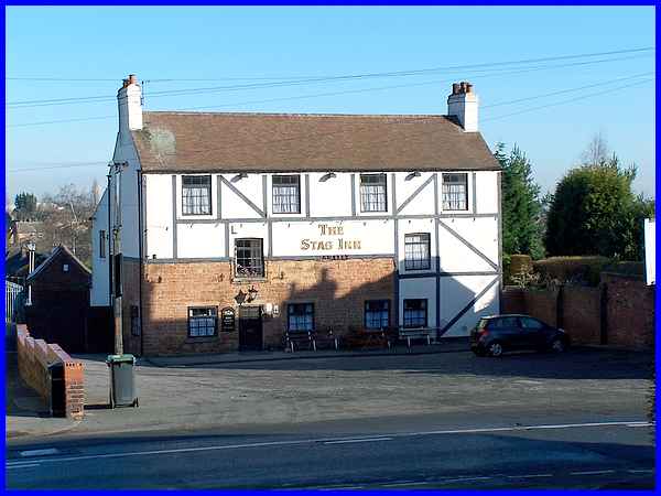
and then up the steep Knowle Hill from where we get a good view
of the Stag Inn (right and above). In those days Nottingham Road
still went by the name of Main Street. Broomhill Road also had
another name but was renamed in 1938. Prior to that it was known
as Cemetery Road and although our route will take us to cemetery
we will reach it via the gentle slope of Nottingham Road (left)
and then up the steep Knowle Hill from where we get a good view
of the Stag Inn (right and above).
The half timbered Stag Inn has its roots in the early eighteenth
century when it was located in a row of four cottages. Deeds
for the inn at the National Archives are dated 1753 and it is
believed it was built some years before that. In the 1860s it
was called The Reindeer and during its history it can claim to
have been a farmhouse and a coaching inn with an attached blacksmith's.
|
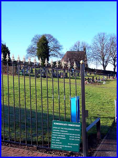
From opposite the Stag Inn, Knowle Hill rises steeply up by the
Kimberley Cemetery and towards Swingate. It had become apparent
by the middle of the nineteenth century that a suitable site
for a new cemetery was needed and an offer of this site on The
Knowle by Earl Cowper, the largest landowner in the area, was
accepted with the first burial being carried on November 10th,
1883.
|
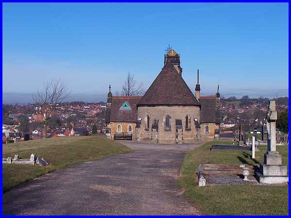
The mortuary chapel that, until the 1950s sported a bell turret,
was designed by Richard Charles Sutton of Nottingham who also
laid out the grounds.
|
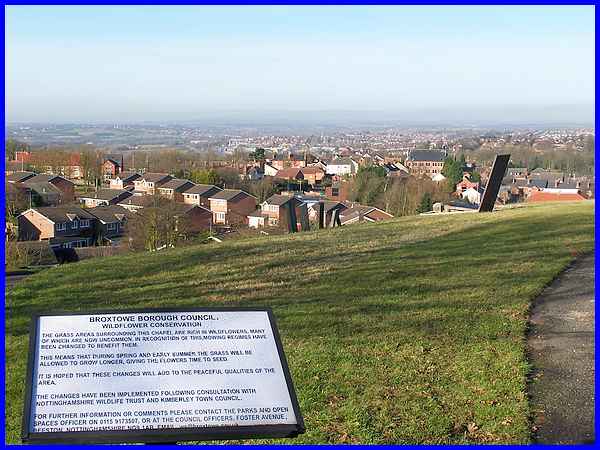
Part of those grounds now on the top of the hill have been designated
by Broxtowe Borough Council as a Wildflower Conservation area.
The sign goes on to say that the grass areas are rich in uncommon
wildflowers and that mowing schedules have been revised to give
the flowers more time to seed.
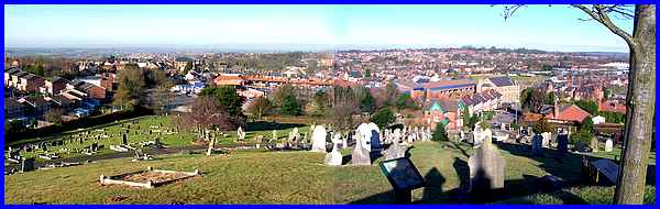
The views from this high point over Kimberley into both Nottinghamshire
and Derbyshire especially on a clear day, make the climb up Knowle
Hill well worthwhile. I had originally intended to finish the
walk through Kimberley here but as we are so close to Swingate,
we may as well continue to a fifth part.
|
