Kimberley - Part 03 - Victorian, Before & After
w/e 06 February 2011
All this week's pictures were taken
with a Kodak DX6490
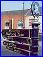 The
signposts point to the Victorian Shopping Area in Kimberley but
the street in question that they point to was there long before
Victoria's reign. In fact in this part of the series we will
be looking at the area of the town that was at the heart of the
village before it expanded during the Industrial Revolution.
Prior to that, the properties in the village centre on what is
now High Street were in the midst of a rural, agricultural setting.
A map dating from about 1765 shows two more streets running in
a north-easterly direction off High Street. These are Greens
Lane and James Street and it is James Street that is now labelled
the Victorian Shopping Area and is where we begin this continuation
of our walk through the town. The
signposts point to the Victorian Shopping Area in Kimberley but
the street in question that they point to was there long before
Victoria's reign. In fact in this part of the series we will
be looking at the area of the town that was at the heart of the
village before it expanded during the Industrial Revolution.
Prior to that, the properties in the village centre on what is
now High Street were in the midst of a rural, agricultural setting.
A map dating from about 1765 shows two more streets running in
a north-easterly direction off High Street. These are Greens
Lane and James Street and it is James Street that is now labelled
the Victorian Shopping Area and is where we begin this continuation
of our walk through the town.
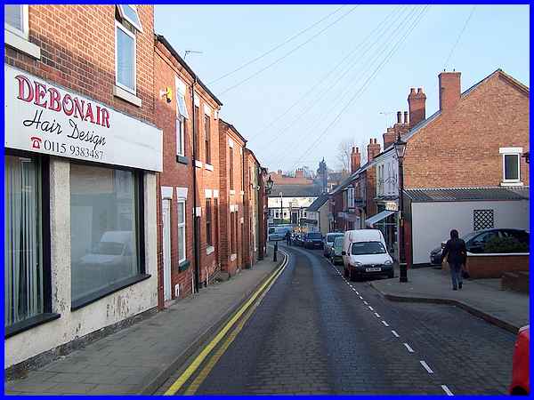
James Street rises gently uphill from Main Street and is a mix
of small independent businesses and residential properties. Whilst
it is good to see these small businesses side by side, in the
current economic climate how long the existence of such shops
in the face of competition of national concerns can continue
must surely be a worry for their owners.
|
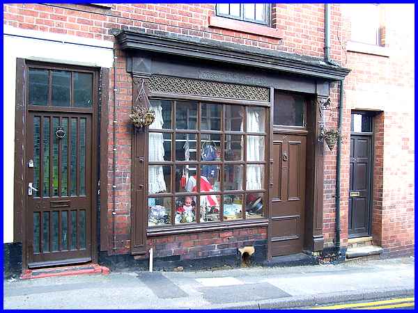
One particular shop looked more "Victorian" than any
other in the street with the name Greensmith's Stores in embossed
letters above the window but somehow it didn't exhibit the appearance
of a thriving business venture.
|
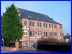 At the
top of James Street where it meets High Street is the former
St Paul's Methodist Chapel. Built in 1884 it was one of several
Methodist chapels in the town At the
top of James Street where it meets High Street is the former
St Paul's Methodist Chapel. Built in 1884 it was one of several
Methodist chapels in the town 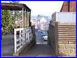 but by 1973 it had been converted and
was being used by Kimlon Holdings as can be seen in an image
on the Picture The Past website (click here). Since then the frontage has
been obscured by a number of trees and the building has undergone
further modifications to become residential accommodation (left). but by 1973 it had been converted and
was being used by Kimlon Holdings as can be seen in an image
on the Picture The Past website (click here). Since then the frontage has
been obscured by a number of trees and the building has undergone
further modifications to become residential accommodation (left).
A little further along High Street a footpath (right) leads through
to Regent Street at the bottom of which another chapel is visible
on Main Street.
|
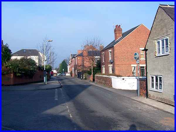
High Street seen here looking back from near to its junction
with Greens Lane is a continuation of Church Hill where we began
the first part of our walk through Kimberley. This section of
the narrow road was the centre of the village shown on that 1760s
map and was then known simply as The Street as it had been since
at least 1653.
|
 Another
track meandered in from Nottingham roughly where Main Road is
now situated but The Street continued up the hill to Swingate
(to the right in this view), Knowl Common and on to Strelley.
James Street and Greens Lane were just rural lanes that linked
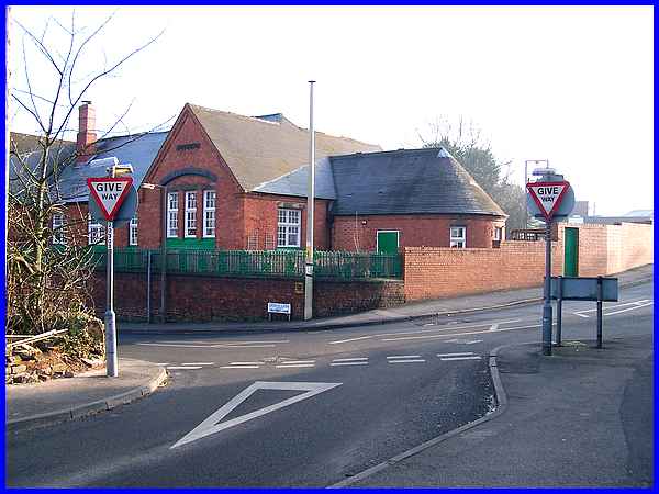
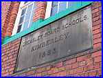
to the track from Nottingham. By 1883 however the Greasley Board
School, Kimberley had been built at the junction of Greens Lane
and High Street. Board Schools were established after the 1870
Education Act and required the attendance of all children. Although
the buildings still exist, they are now used by the Cherubs Day
Nursery which opened in 2003. Another
track meandered in from Nottingham roughly where Main Road is
now situated but The Street continued up the hill to Swingate
(to the right in this view), Knowl Common and on to Strelley.
James Street and Greens Lane were just rural lanes that linked
to the track from Nottingham. By 1883 however the Greasley Board
School, Kimberley had been built at the junction of Greens Lane
and High Street. Board Schools were established after the 1870
Education Act and required the attendance of all children. Although
the buildings still exist, they are now used by the Cherubs Day
Nursery which opened in 2003.
|
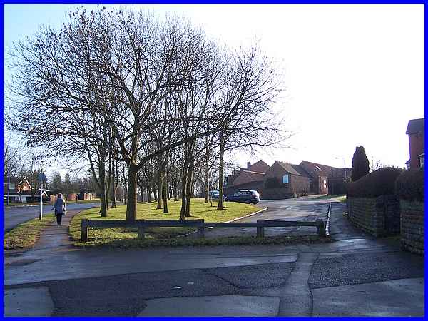
Another nursery, the privately owned Little Oaks is a little
further up the hill towards Swingate. This is housed in a purpose
built structure within the footprints of a farm building that
was originally part of the neighbouring Manor Farm. Manor Farm
was the most important farm in the area and was marked on that
old map. In an estate survey of 1765 it was described as "Ann
Clay's Farm" having come into her hands via her father-in-law
(which probably in today's parlance means her step-father).
|
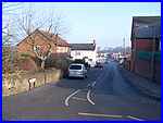 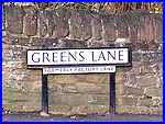 I
walked only a little way up the hill for the above image but
our route is along Greens Lane (left) and returning to its junction
with High Street, the road name signs indicate that it was "Formerly
Factory Lane" (right). I remember travelling by bus along
Factory Lane when visiting relatives at Swingate in my youth
and suspect that many locals will still refer to the road as
Factory Lane. I
walked only a little way up the hill for the above image but
our route is along Greens Lane (left) and returning to its junction
with High Street, the road name signs indicate that it was "Formerly
Factory Lane" (right). I remember travelling by bus along
Factory Lane when visiting relatives at Swingate in my youth
and suspect that many locals will still refer to the road as
Factory Lane.
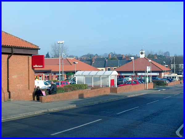
A small shopping precinct now stands on the site of the factory
that gave its name to the street and the modern shops are in
stark contrast to those of the Victorian area. With the Industrial
Revolution, framework knitting developed from a cottage industry
to become a major employer in the knitting, lace and stocking
trade and the Victoria Mills factory was built here in 1880 by
Richard Birkin, one of the most important names in the industry
at the time. Originally built for the manufacture of lace, the
factory was eventually taken over by Wolsey's a name well-known
for quality hosiery but cheap foreign imports resulted in its
closure and it was demolished in 1983.
|
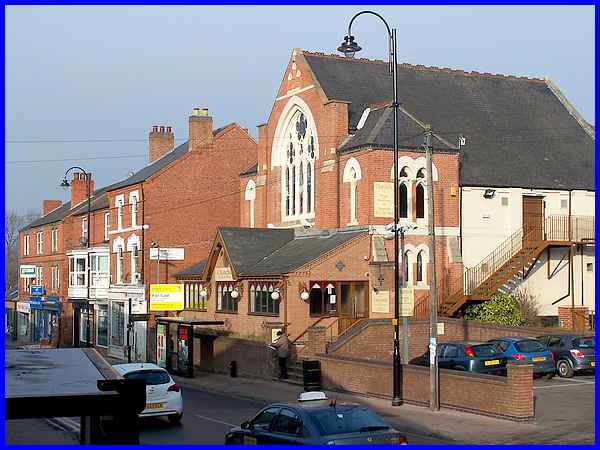
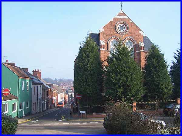
Cutting across the car park at the shopping precinct to the top
of the steps down to Main Street provides a good view of the
chapel we saw earlier from a distance along the footpath to Regent
Street from High Street. This was the Primitive Methodist Chapel
which opened in 1876 with seating for 608 people. Since its closure
in 1962 the building has been used for various businesses including
a supermarket and a bar and restaurant. The yellow and white
sign outside shows that it is once again up for sale.
|
