Kimberley - Part 05 - Swingate
w/e 20 February 2011
All this week's pictures were taken
with a Kodak DX6490
To complete our walk through Kimberley we move into
the area called Swingate which is separated from the rest of
the town by the A610 road from Ripley and Eastwood to Nuthall
and Nottingham. Leaving Kimberley Cemetery by the top gate we
find that Knowle Hill has been truncated and bisected by the
A610.
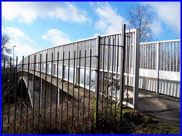
  Vehicles
could previously travel the whole length of the narrow Knowle
Lane but since the 1980s only a high footbridge has crossed the
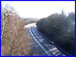
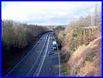
A610 here. From the bridge, the A610 can be seen (left) swinging
towards Nuthall and in the other direction (right) the only vehicular
route, apart from bridle roads, into Swingate is visible so Swingate
really is a community within a community. Vehicles
could previously travel the whole length of the narrow Knowle
Lane but since the 1980s only a high footbridge has crossed the
A610 here. From the bridge, the A610 can be seen (left) swinging
towards Nuthall and in the other direction (right) the only vehicular
route, apart from bridle roads, into Swingate is visible so Swingate
really is a community within a community.
|
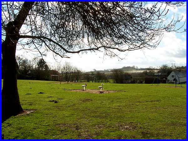
On the other side of the footbridge is an open recreational area
that more closely resembles the rural setting of the Knowl Common
marked on an old map dating from about 1765 before the Industrial
Revolution took place.
|
 Coal mining was
a major contributor to the Industrial Revolution and Kimberley
Colliery was established at Swingate on a site to the right Knowle
Lane. The road from the footbridge now runs at the side of the
recreational area (left) to the built up area. The mine was owned
by Thomas North and was in production between 1852 and 1897.
It was shown on a 1885 map of the area but by Coal mining was
a major contributor to the Industrial Revolution and Kimberley
Colliery was established at Swingate on a site to the right Knowle
Lane. The road from the footbridge now runs at the side of the
recreational area (left) to the built up area. The mine was owned
by Thomas North and was in production between 1852 and 1897.
It was shown on a 1885 map of the area but by  the 1901 edition it had already had the word "disused"
added. It remained in use for many years after this though pumping
water from underground, some of which was actually used in the
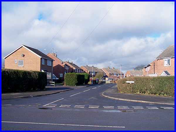
production of beer. Thomas North was a self made man and he owned
several mines in the area. He became Lord Mayor of Nottingham
in 1844. The site of the colliery is now occupied by a housing
development mostly built in the late 1950s and early 60s including
Clive Crescent (above) and Kimberley Primary School (right). the 1901 edition it had already had the word "disused"
added. It remained in use for many years after this though pumping
water from underground, some of which was actually used in the
production of beer. Thomas North was a self made man and he owned
several mines in the area. He became Lord Mayor of Nottingham
in 1844. The site of the colliery is now occupied by a housing
development mostly built in the late 1950s and early 60s including
Clive Crescent (above) and Kimberley Primary School (right).
|
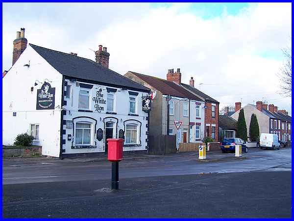
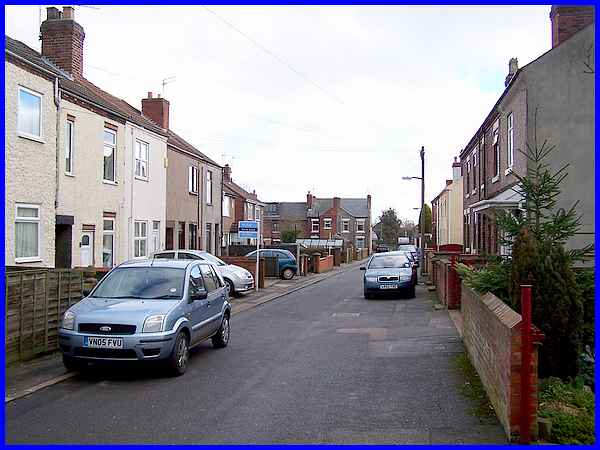
Inextricably linked with the early mining industry were pubs
and chapels and both could be found in close proximity to North's
pit. The continuation of High Street that we saw earlier in this
series has now become Swingate which is the name of the road
as well as the area. At its junction with Knowle Lane across
from the colliery site stands The White Lion which would have
been well used by the miners. Typical miners' dwellings have
also survived alongside the pub and the smaller residence behind
the two conifers to the right of the picture is a converted chapel.
|
The ridge of high ground between Ilkeston and Nottingham where
Swingate is situated makes it the ideal spot for masts and aerials
such as the UHF Relay Station that relays TV transmissions from
Waltham. On the same site there are also a number of other aerials
for mobile phones etc and all may be seen from the end of the
road.
|
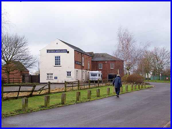
Off Swingate (the road) is Babbington Lane and this is where
we find the Queen Adelaide, a pub that takes its name from the
wife of William IV. It was built by Joseph Needham as a lace
factory on land purchased from the Duke of Rutland when his estate
was broken up in 1816 and did not become a pub until about 1878.
The thinking is that competition from larger factories and the
proximity to local collieries made the sale of beer more of a
commercial proposition than the production of lace. The Queen
Adelaide became one of Hanson's tied pubs when purchased in 1891
by the brewery in Kimberley.
|
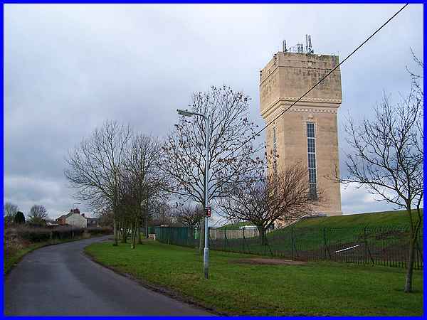
A little further along Babbington Lane which eventually peters
out into a bridle road to Babbington Village is the water tower,
a feature that enables Swingate to be pinpointed from miles around
as it stands proud on the skyline.
|
  A footpath off Babbington Lane
leads back to the heart of Swingate and the end of streets like
West Street (above) seen from the path and North Street (left)
seen from Swingate both of which are opposite the former colliery
site and both with more of those dwellings that would have been
occupied by the miners. A left turn from the bottom of either
street leads back down the hill to High Street re-crossing the
A610 from where the high footbridge (right) that we crossed earlier
can be seen again. This concludes our walk through Kimberley
and Swingate but from here it is just a short walk back to the
town centre or down Church Hill to the starting point for our
walk. A footpath off Babbington Lane
leads back to the heart of Swingate and the end of streets like
West Street (above) seen from the path and North Street (left)
seen from Swingate both of which are opposite the former colliery
site and both with more of those dwellings that would have been
occupied by the miners. A left turn from the bottom of either
street leads back down the hill to High Street re-crossing the
A610 from where the high footbridge (right) that we crossed earlier
can be seen again. This concludes our walk through Kimberley
and Swingate but from here it is just a short walk back to the
town centre or down Church Hill to the starting point for our
walk.
|
