Part 02 - Church to Chapel
w/e 29 April 2018
All of this week's pictures were
taken with a Kodak DX6490
Information for this series has been sourced from
various places including the"Long Eaton Centenary Town Trail"
leaflet (CTT) and the"Long Eaton Townscape Heritage Initiative"
booklet (THI).
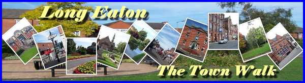
We ended Part 01 of this walk with a picture of the NatWest and
opposite the bank is Long Eaton's War Memorial in front of St
Laurence's Churchyard. The memorial was designed in the form
of an Old English cross by Sir Ninian Comper and erected here
in 1921. The CTT leaflet (published 1995) describing an anticlockwise
route says to walk past the memorial "and the Refuge Building
(1895)" to reach York Chambers which we again saw in Part
01. I could find no reference either on site nor on old maps
to the Refuge Building so can only assume that it is the one
on the left of this image.
|
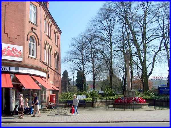
To the right of the War Memorial as we continue in a clockwise
direction as per the THI booklet route are the gates to St Laurence's
Churchyard. The church itself has its origins in the late Norman
period of the twelfth century and is by far the oldest building
still standing in Long Eaton.
|
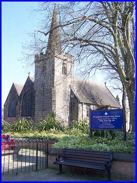
On entering the churchyard a glance to the left reveals the rear
of the ?Refuge? building, no. 34 Market Place and the York Chambers.
Not only did several of these properties receive THI funding
for work on the frontage but also for the roof and outbuildings.
The CTT leaflet states that once three almshouses stood in front
of the church and that the last cottage in the Market Place was
not demolished until 1963.
|
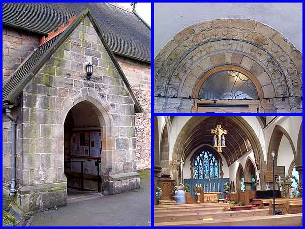
The church itself is a Grade II* listed building and the original
Norman part forms the south aisle and Lady Chapel. The chancel
arch is early eleventh century but the growth of Long Eaton in
the nineteenth meant that the church was granted its own incumbent
in 1864. It was enlarged to a design of G E Street with a nave,
chancel and north aisle in 1866. The south porch is worthy of
close inspection for it contains a Norman arch featuring sixteen
different ravens’ heads in the stonework above the door
to symbolize the defeat of the devil.
|
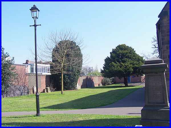
As well as the almshouses that stood in front of the church,
to the left of it were several thatched cottages and farm buildings.
The Church Hall is just visible behind the tree on the right
but on the other side of the boundary wall on the northern side
of the church, old maps including one from 1881 show that among
the buildings was a brewery approximately where the large tree
on the left now stands.
|
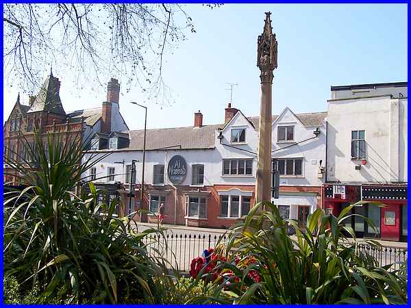
Returning to the Market Place we can look across from the churchyard
past the War Memorial to the Al Naseeb Restaurant. The restaurant
occupies what was once the Old Bell public house which is another
building in the town with ancient foundations. It is thought
the present building dates from about 1700 and was almost certainly
the village pub. It is known that there was a village meeting
room on the first floor and that school classes were held there
before the town's first purpose built school was erected.
|
The CTT leaflet makes reference to Austin's chocolate shop alongside
the Old Bell. This no longer exists but was probably the shop
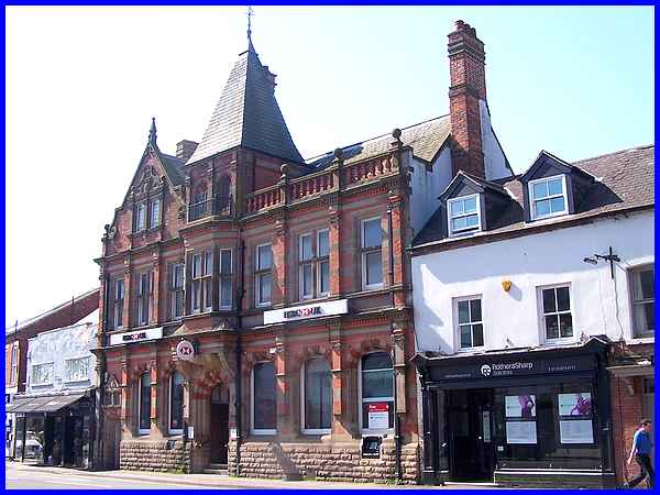
on the right of this picture as the next building along is HSBC
bank. This was built in 1891 to a design of Albert Bromley's
of Nottingham for the Nottingham Joint Stock Bank. Formerly the
Midland Bank, this is Grade II listed.
|
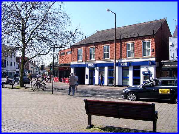
A little further along on the same side of the Market Place is
a more modern looking building which currently houses the Royal
Bank of Scotland. This building was converted about 1923 for
the William Deacons Bank from an existing building.
(Two days after adding this page to the site, RBS announced
that they would be closing this branch on August 28th 2018 along
with another 161 branches during the year resulting in 792 job
losses.)
|
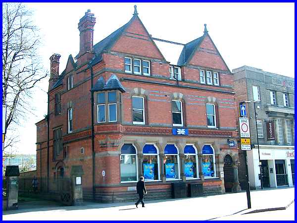
Returning to the east side of the Market Place there is yet another
bank next to St Laurence's Church - the Halifax. Designed by
the well-known Nottingham architect Watson Fothergill this was
built in 1889 for Samuel Smith and Co, a Nottingham bank. All
these banks in Long Eaton's Market Place including the NatWest
which was originally built as the Nottingham and Nottinghamshire
Bank are evidence of the town's growing wealth in the Victorian
era due to the lace and to a lesser extent, railway industries.
|
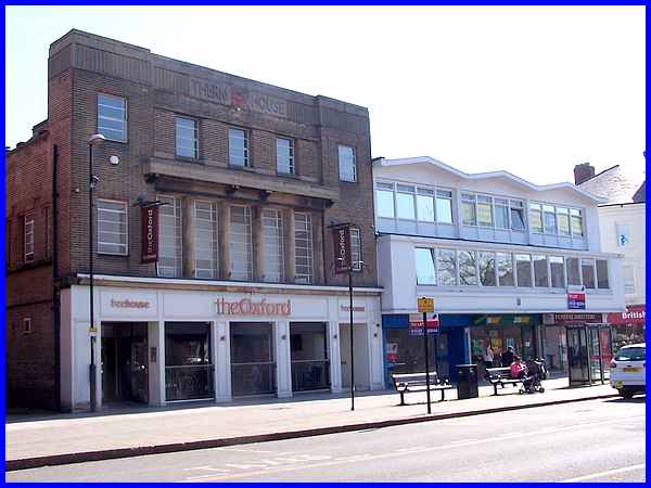
Next to the Halifax is Therm House - see the name in the stonework
at the top of the facade - which was built as an Art Deco style
building in the 1930s as a showroom for the Long Eaton Gas Company.
Ironically now a pub it faces the Old Bell across the Market
Place. I titled the second part "Church to Chapel"
as we began looking beyond the war Memorial into St Laurence's
Churchyard and it closes with the building next to the Halifax
on the corner of Union Street. That is because that old map of
1881 I referred to earlier also shows that this was the site
of a Methodist Chapel (Free United) with a burial ground and
Sunday School behind. A chapel was still shown on maps published
in the 1960s.
|
