First Impressions
No. 08 - Part 03 - Heanor Road
w/e 19 February 2023
All of this week's pictures were taken with a Nikon D3300
This final part of the route
along Heanor Road has seen many changes over the years and the
impression of a first time visitor is much different today to
one from years gone by. It really is amazing from what you can
learn by studying old maps and the development in this area becomes
obvious quite quickly.
A map published in 1884 - that's before the old hospital and
Granby School were built - shows small plots of land on both
sides of the road between Charlotte Street and a bridge over
the railway line. There are only a couple of isolated buildings.
By 1901 the hospital and school are shown as is Rutland Farm
near the hospital. There are a few more houses and many more
small plots on the open land behind them which, by 1921, were
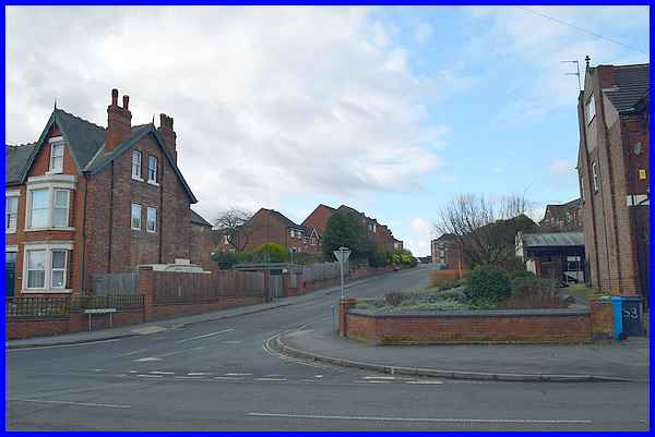
labelled "Allotment Gardens". A small housing estate,
consisting of blocks of two and four houses, was built on the
fields between the farm buildings and the allotments on the western
side of Heanor Road. The estate was accessed by a single road
and one of the entrance pillars at the end of Boweswell Road
is dated 1933. The eastern side of Heanor Road was still allotments.
|
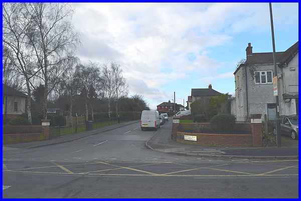
It was not until later that properties were built along the eastern
side of Heanor Road but there are still allotments behind them
today. Back on the western side though the allotments were swallowed
up in this century by another housing estate not much bigger
in area than the Boweswell Road Estate. From Heanor Road this
is accessed along Grey Meadow Road but is also linked from Boweswell
Road. This new estate although not much bigger is much more densely
populated with two, three and even four storey blocks.
|
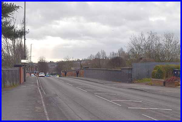
From here on there is a change to the character of Heanor Road
at the old railway bridge which crossed a route linking Nottingham
and Derby. Prior to Dr. Beeching's cuts in the 1960s a steam
train could be caught at Ilkeston North Station on the western
side of the bridge direct to the centre of both cities.
|
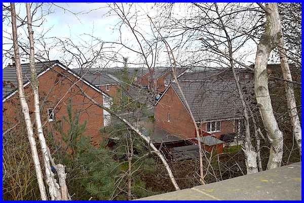
Looking east from the bridge back then would have revealed the
railway line heading off out of the town towards the Bennerley
Viaduct. Today the view is over the rooftops of another new housing
development off Cotmanhay Road.
|
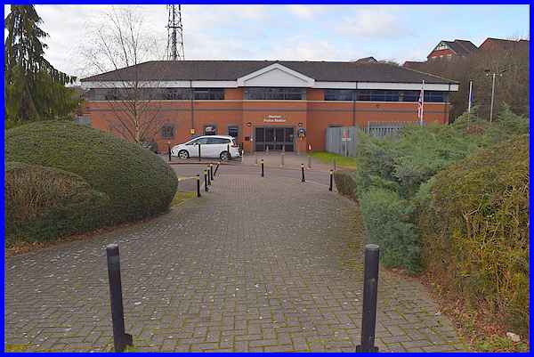
The railway station site is now occupied by Ilkeston's Police
Station, behind which is the Old Station Surgery.
|
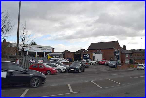
Beyond the bridge the road takes on a commercial and industrial
aspect and opposite the entrance to the Police Station and Surgery,
is the HiQ Tyres & Autocare Centre.
|
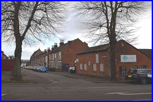
Next is Factory Lane and referring back to those old maps shows
that the terraces on the right were built some time between 1901
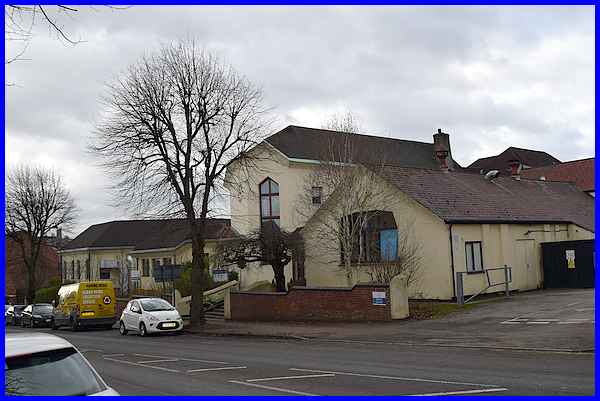
and 1921. At the far end is Holy Trinity Church which is shown
on the 1901 map but not on the 1881 edition. There was however
an Infant School on the left hand side at the far end in 1881
and that remained well into the second half of last century but
the whole of that side now is more recent housing. The building
on the corner of Heanor Road was once a Hosiery factory.
|
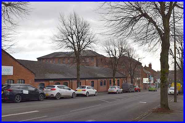
The large building seen here behind the former hosiery factory
was once a lace factory. Both factories were there pre 1881 and
I assume the terraces on Factory Lane were originally built for
workers in the factories.
|
Back in 1881, on the right hand side of Heanor Road from the
Railway Station to the end, were a number of "Yards",
short lanes leading to a variety of small properties. Now most
of the area is taken up with the headquarters of Weleda (UK)
Ltd which was founded in Switzerland in 1921. The UK company
was set up in 1925 and the name was originally given to the company
by Rudolf Steiner. Prior to the headquarters being here this
was the site of Michael House School, one of about 700 schools
worldwide founded on Steiner's principles.
|
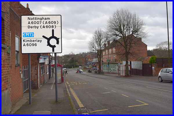
In the second part of this route I mentioned four sets of traffic
lights on Heanor Road and the fourth set is at the pedestrian
crossing almost at the end and within sight of the northern island
at the end of Chalons Way. the next and final part of the First
Impressions series will also end at that island.
|
