First Impressions
No. 03 - Part 03 - Nottingham Road
w/e 10 January 2016
All of this week's pictures were
taken with a Kodak DX6490
At the start of Part 2 of this series I wrote about
hitting the wall that marathon runners often encounter as it
had been eighteen months since Part 1. Unfortunately that "wall"
grew even bigger and the gap to this part has been over two and
a half years. As we begin a new year, I resolved to start demolishing
the wall and make an effort to drive through to an eventual conclusion
so here goes with the next part.
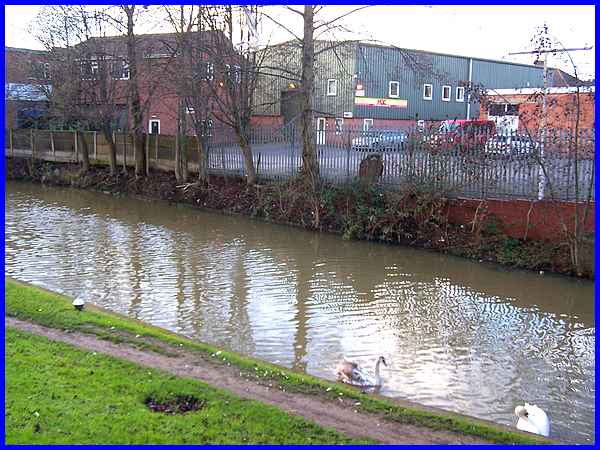
We concluded Part 2 on the northern side of the bridge over the
Erewash Canal and begin now on the southern side of the road
where we can look across the canal to the industrial units opposite.
It was from here in the 1880s that the Gallows Inn Brickworks
operated.
|
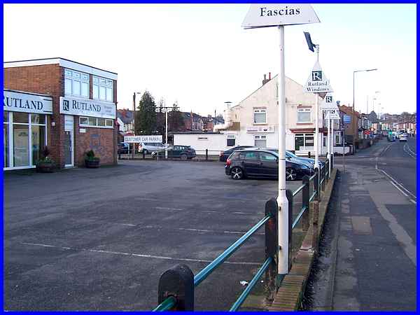
The town of Ilkeston grew from a number of small communities
that merged over the years to become the town we know today.
One such community was clustered at the bottom of Nottingham
Road in the Gallows Inn area on both sides of the canal. Back
in 1881 there were a number of small buildings on what is now
the Rutland Windows car park and approximately where the cars
can be seen parked was a malthouse. None of the buildings or
the road seen beyond on the left hand side of Nottingham Road
existed then between the Malthouse and the Mission Hall on the
corner of Little Hallam Lane. This was just an open piece of
land with a footpath running across it to a lane which ran from
the south to join Little Hallam Lane. The lane was eventually
developed to become Corporation Road.
|
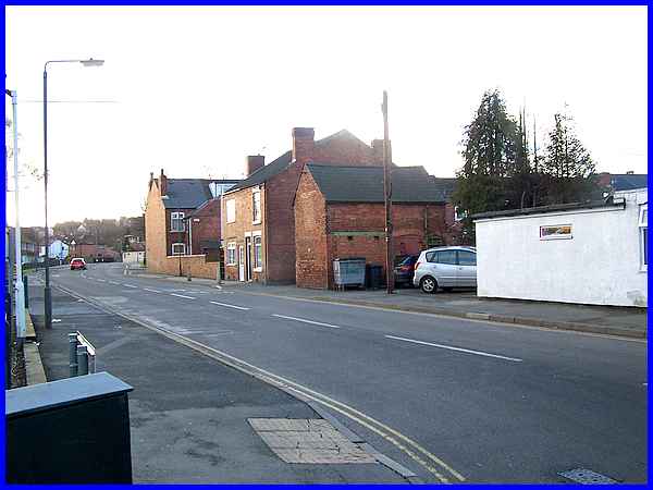
By 1900 the open land had been developed and a road, Thurman
Street, driven through to link with the lane forming The Triangle
(opposite the red car) before joining the lane that was to become
Corporation Road.
|
Thurman Street was constructed directly opposite Brooke Street
which dates from before 1881 as the OS map of the year shows
it already in existence with a terrace of houses on the left
and another further along on the right. Brooke Street has since
been extended and developed with many more newer properties.
|
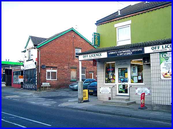
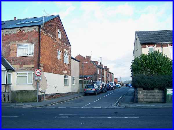
The next street along is Adam Street, unadopted in 1881 and still
unadopted now. Ilkeston's main shopping street, Bath Street,
once boasted large stores such as Woolworths, Marks and Spencer
and British Home Stores which have now all sadly gone from there
but, like many other towns, it also had many small independent
corner shops that could be found all over the town. Many of these
too in living memory have disappeared but there are still quite
a number in the Gallows Inn area as can be seen at the junction
of Nottingham Road and Adam Street.
|
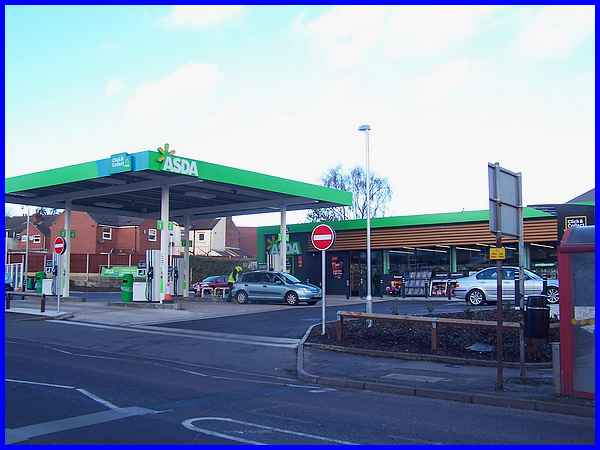
On the corner of Roberts Street, the next street along Nottingham
Road there used to be a petrol station but this was demolished
last year to be replaced by ..... a petrol station! This petrol
station though is owned by Asda and also incorporates a mini-supermarket
so one wonders if and how long the corner shops can survive.
|
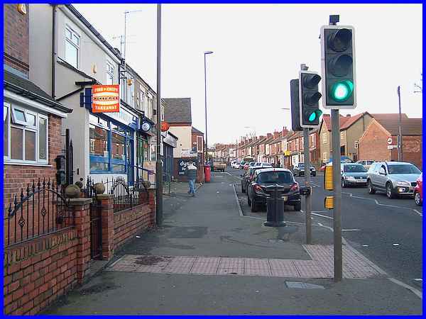
Some of the shops opposite are not in direct competition with
the supermarket and Johnny's Fish and Chip Shop for one should
not be affected. The Post Office is due to close soon and plans
are afoot to move its services to the Happy Shopper (another
corner shop) about 100 yards up the road.The lay by in front
of the shops is a fairly new addition and allows short term parking
to provide access to the shops.
|
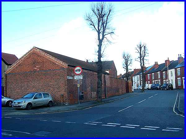
On the opposite corner of Roberts Street to the petrol station
is a solid rather featureless brick building which I believe
at one time in the last decade was due to be demolished and the
site developed. That never happened and the existing building
was just modified to create its existing appearance.
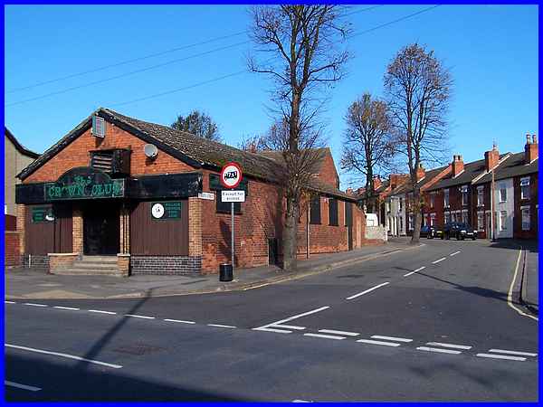
Back in October 2008 when I took this picture, the building the
former Crown Club has ceased operation and closed its doors for
the last time. Another difference to notice between the two pictures
is how the trees have been "pruned" since 2008. I'm
no tree surgeon but ....
|
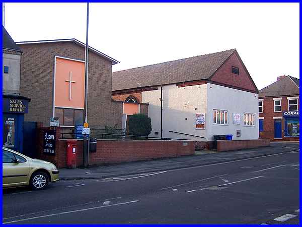
Standing opposite Roberts Street is the Nottingham Road Methodist
Church, two interconnected buildings from different periods of
history. The newer part on the left dates from 1958.
|
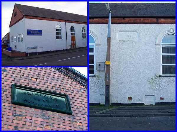
The older part of the church on the corner of Little Hallam Lane
has a stone panel on the gable from 1897. It stands on the site
of the Mission Hall marked on the 1881 map. There is another
stone inscription which can be seen from Little Hallam Lane and
this reads "Primitive Methodist Sunday School 1883".
Rather than repeat it here you can read more about the history
of the church on the Ilkeston (South) - Places of Worship page
from January 2012. Before moving on to the next part it's perhaps
worth pointing out that fourteen bombs fell on Ilkeston between
August 31st and September 29th 1940 and about half of them landed
in the Gallows Inn area with five of them between the Erewash
Canal and Little Hallam Lane. The intended target would have
been the nearby Stanton Ironworks.
|
