Trowell - Spring Boards
w/e 01 April 2012
All this week's pictures were taken
with a Kodak DX6490
With the fine dry weather of the last week it felt almost like
summer but when I took these photos even though the temperatures
were in the seventies Fahrenheit (over 20C) it was still only
March. I was out walking around the town most days and for this
particular set of images walked from near the Festival Inn at
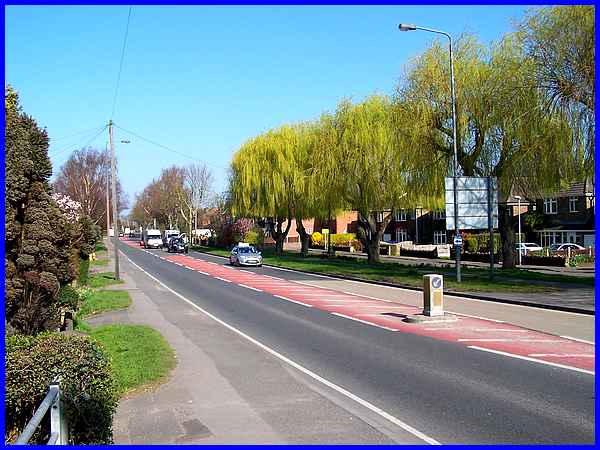
Trowell back into Ilkeston via the Erewash Canal. This first
shot from my starting point opposite the Festival is back along
Ilkeston Road towards Ilkeston.
|
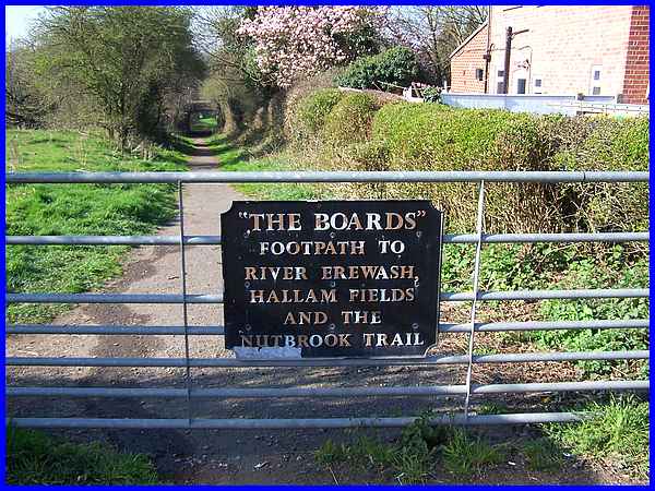
It was here though that I left Ilkeston Road to walk along "The
Boards" to the Erewash Canal. This footpath has been called
"The Boards" for as long as I can remember and I can
only guess at the origin of its name but as it crosses the River
Erewash and the low lying land around it I imagine that wooden
boards were possibly used as stepping aids to enable passage
through marshy areas in wet weather.
|
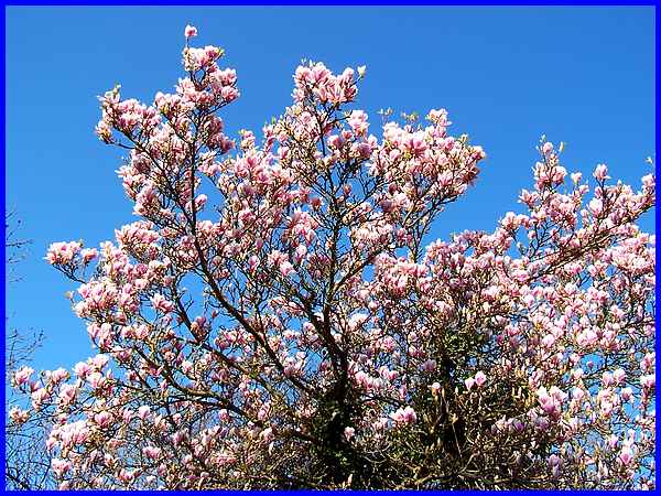
I titled this page "Spring Boards" as a play on words
for it could be assumed that the fine weather is a springboard
into summer as well as the name of the footpath but the budding
leaves and blossom most definitely say it's still the spring
of the year and this magnolia picked out against the clear blue
sky confirms the fact.
|
Just beyond the magnolia tree pretty yellow flowers (weeds?)
were scattered at the side of the path near the railway bridge
that carries the line from the east and Nottingham into the Erewash
Valley. The line joins the main line through the valley and continues
northwards to Sheffield.
|
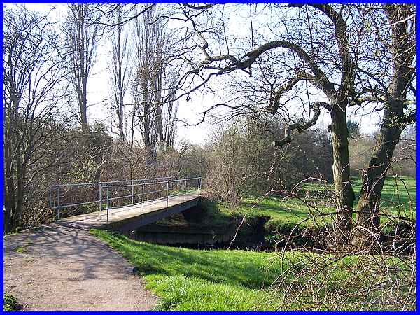
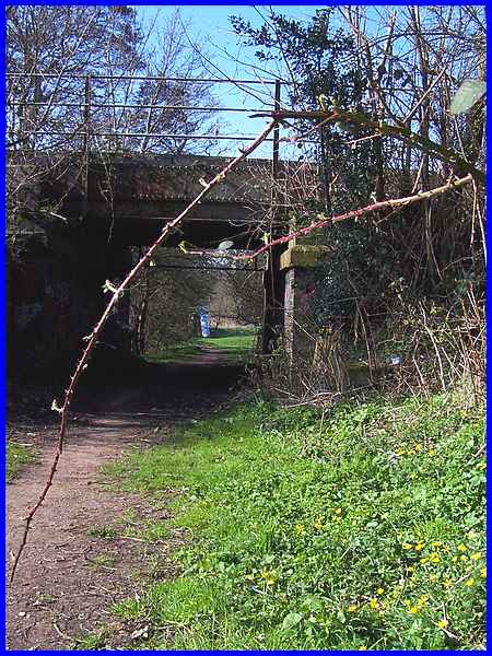
Following the path round leads to another bridge in a very short
distance but this one is over the River Erewash. When I was here
in January 2007 (link)
the water was almost up to the same level as the bridge and all
the surroundings were flooded.
|
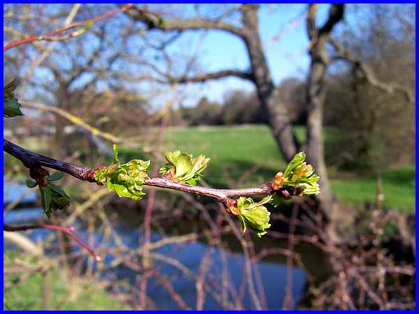
Although I took this image of the leaf buds as further evidence
of the season it also shows the low level of the river that has
been caused by the relatively dry winter which in turn has led
to drought conditions and even hosepipe bans in other parts of
the country. Current thinking suggests that this part of the
East Midlands will escape such bans as there will be sufficient
supply to meet demand despite the low levels in some reservoirs..
|
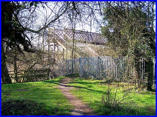
A third and final bridge along The Broads is the footbridge over
the main north/south railway line and once over this it is only
a few more steps to the Erewash Canal.
|
The narrow strip of land southwards between the railway line
and the canal is called Nutbrook Junction after the culverted
brook under the Erewash Canal. Stretching some 600 plus yards
the area has a varied landscape and a leaflet published in 1996
indicates a path through the area also detailing some of the
flora and fauna that can be seen there. Today however the northern
access takes a little bit of finding and the path is partially
blocked by a fallen tree and brambles.
|
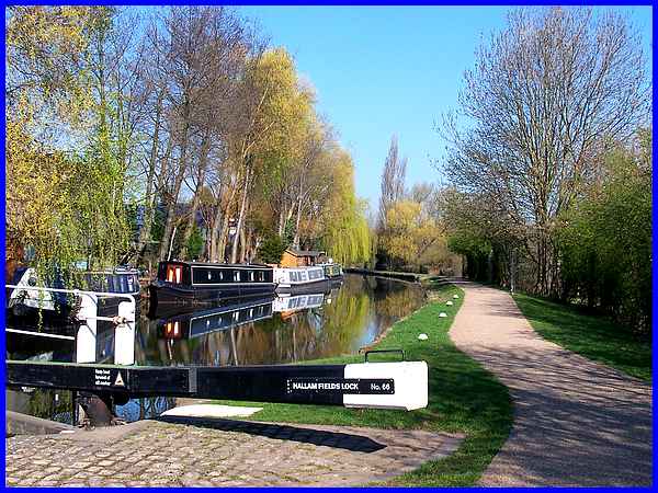
I had intended to walk through Nutbrook Junction and return via
the canal towpath but finding the route blocked I made my way
back to where The Broads footpath joins the canal near the Hallam
Fields Lock.
|
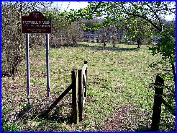
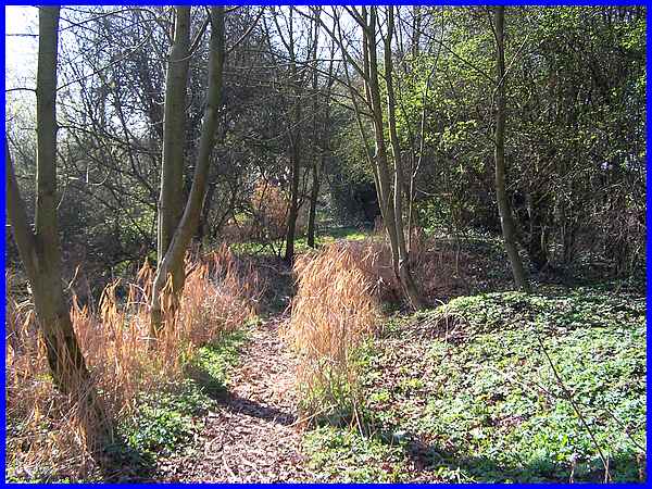
The same leaflet I referred to earlier also contains information
about the area to the north of the railway footbridge that extends
for about a quarter of a mile. This area is called the Trowell
Marsh Nature Reserve and according to the leaflet there is "limited
access" but unlike Nutbrook Junction, it appears that the
access is now much easier. This area is noted for its scrub,
grassland, swamp and species-rich marshy meadow but once again
the dry conditions meant that at the end of March the conditions
underfoot were quite firm.
From here I continued along the canal towpath back into Ilkeston
following the same route as walked in 2009 for the first part
of the Lock to Lock series which can be seen by clicking here.
|
