Ilkeston - The River
Erewash
w/e 21 January 2007
All
this week's pictures were taken with a Kodak DX6490
 High
winds and heavy rain caused damage and disruption across the
country last week including here in the East Midlands. Overhead
power lines were brought down, properties were damaged and several
people lost their lives as a direct consequence of the weather
but Ilkeston seems to escaped quite lightly. The rain did have
an effect on the River Erewash so I decided to repeat last August's
trip up the eastern side of the town when we saw the six locks on the Erewash Canal. The river,
canal and the railway for that matter, follow roughly parallel
routes through the valley so we'll start once again at Hallam
Fields on the footpath to Trowell (left). High
winds and heavy rain caused damage and disruption across the
country last week including here in the East Midlands. Overhead
power lines were brought down, properties were damaged and several
people lost their lives as a direct consequence of the weather
but Ilkeston seems to escaped quite lightly. The rain did have
an effect on the River Erewash so I decided to repeat last August's
trip up the eastern side of the town when we saw the six locks on the Erewash Canal. The river,
canal and the railway for that matter, follow roughly parallel
routes through the valley so we'll start once again at Hallam
Fields on the footpath to Trowell (left).
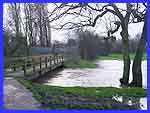
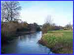
Apart from where the footbridge crosses (small image above),
it is difficult to ascertain the exact position of the river's
course as it meanders through the fields due to the flooding
but the raised pipeline is a good pointer. The railway line is
to the left of the this view and the Erewash Canal and Hallam
Fields Lock just beyond that.
|
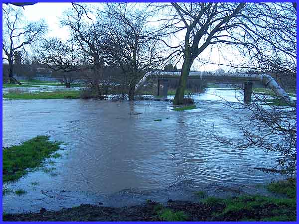
The next lock along the canal is at Gallows Inn and here the
river and the canal are separated by the Gallows Inn Playing
Fields, the railway tracks having crossed the river. At some
time in the past, the river course was rerouted from its meandering
way to run straight along the length of the recreational area.
Also in the past, whippet racing was held between the river and
the rugby pitch but I have not heard of any recently. If any
were to be held in these conditions the going would be described
as "heavy" as the ground, although not flooded, was
thoroughly waterlogged.
|
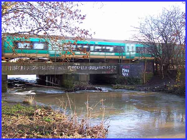
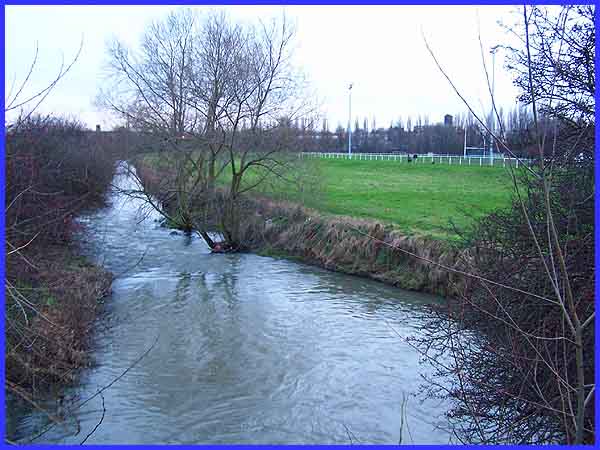
 At Green's
Lock the canal and the river are separated by an industrial estate
but near the next lock, Potter's, they are only a few steps apart
where the river swings under another railway bridge to continue
its journey southwards. We are in fact following the route northwards
and the small image left shows the view in that direction from
the bridge over the river adjacent to Potter's Lock on Mill Lane.
This is near to the location in times past of a flour mill powered
by water from the river. What amazes me about the main picture
above is why anyone would risk life and limb to deface the bridge
with speeding trains above and deep water below! At Green's
Lock the canal and the river are separated by an industrial estate
but near the next lock, Potter's, they are only a few steps apart
where the river swings under another railway bridge to continue
its journey southwards. We are in fact following the route northwards
and the small image left shows the view in that direction from
the bridge over the river adjacent to Potter's Lock on Mill Lane.
This is near to the location in times past of a flour mill powered
by water from the river. What amazes me about the main picture
above is why anyone would risk life and limb to deface the bridge
with speeding trains above and deep water below!
|
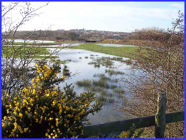
As we move up the valley to the east of the town towards Barker's
Lock and Stenson's Lock on the canal, the river marks the boundary
between the neighbouring counties of Derbyshire and Nottinghamshire.
Seen here from Newton's Lane on the Nottinghamshire side, the
bends in the river can be made out in the Erewash Valley. On
top of the raised bank running across the picture is the railway
line and the river passes under this again just to the left of
centre via a bridge that can be seen through the gap in the trees.
Beyond that is the New Manor Ground, home of Ilkeston Town F.C.
and just a little further on is the canal and Barker's Lock.
|
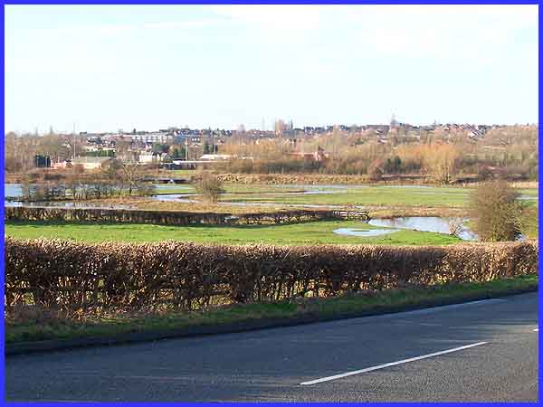
This is another view of the railway bridge but this time on the
Derbyshire side of the river and from further along Newtons Lane
where it rises to cross over the railway. This is also a good
vantage point to see the flooded fields with the Ilkeston skyline
behind.
|
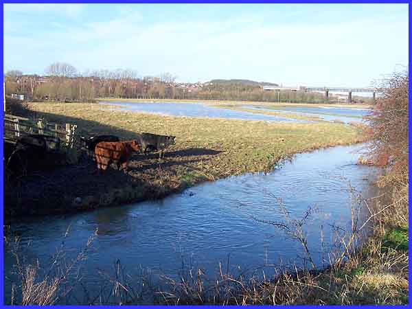
Back on the Nottinghamshire side (just) this is the view along
the valley but this time to the north. Here there is extensive
flooding in the fields and it is very soggy underfoot for the
cattle. If someone were to substitute sand for the mud, this
could almost be a shot of the seaside with even a "pier"
stretching out into the ocean. Now there's a thought, Ilkeston-On-Sea
in landlocked Derbyshire! Back to reality, the trees in the distance
mark the route of the railway and also the position of Stenson's
Lock on the Erewash Canal on the other side of the tracks.
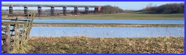
The "pier" is in fact the now defunct but listed structure,
Bennerley Viaduct, which used to carry another railway line across
the River Erewash. The Erewash could not of course by any stretch
of the imagination be called a major river but it does feed into
the Trent and lends its name to many organisations, a council
area and even a parliamentary constituency. Perhaps we could
get the Europeans to make this a wine lake .....
|
