Ilkeston Town Walk - Stage 18 - Lower Market Place
w/e 18 January 2004
We resume the town walk still in the grounds of St Mary's Church
overlooking the Lower Market Place but can see graves on both
sides of the church wall. (Sorry that's just my sense of humour).
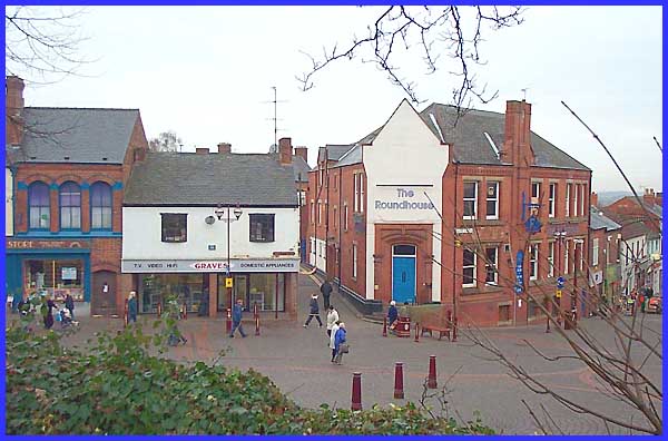
Graves, the electrical retailer, stands on the corner of St Mary
Street which is where our walk will eventually lead us. The Roundhouse,
on the other corner, is actually the first property on Bath Street
and many Ilkestonians will remember it before its name change
as The Harrow Inn or, as we say in these parts, Th'Arrer. Those
that can remember back as far as the sixties when Bob Dylan was
just starting to make a name for himself and Donovan, trying
to "Catch The Wind" was being put forward as Britain's
answer to him, may also recall the Folk Club that was held in
one of the upper rooms. Local talent performed there on a regular
basis putting their own interpretation on new and traditional
tunes. Does anyone remember the words to "Green Stamps",
a parody sung to the melody of "Greensleeves"?
|
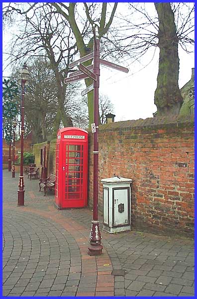
We have to go back even further in time now to 1903 for this
transformer box that stands between the guide post and the telephone
kiosk. This was installed in conjunction with the town's new
tram system to supply electricity to market traders. The last
electric tram ran in Ilkeston in 1931. Now the city of Nottingham
has just seen the inauguration of a Light Transit Railway system
on its streets - that's a tram to you and me - so in another
thirty years or so I wonder if they will have progressed to trackless
vehicles? Where Ilkeston leads ......
|
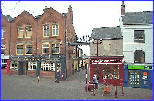
Directly opposite the transformer box and joining the Market
Inn to the hair salon is a cast iron bridge. The salon used to
be Barton's Fruit Shop and it is thought that the bridge was
the result of common ownership of the properties in the nineteenth
century. In this day and age when pub lunches are in vogue, if
Barton's had still been in business, it would have been an ideal
route to transfer fresh fruit and vegetables direct to the kitchens.
|
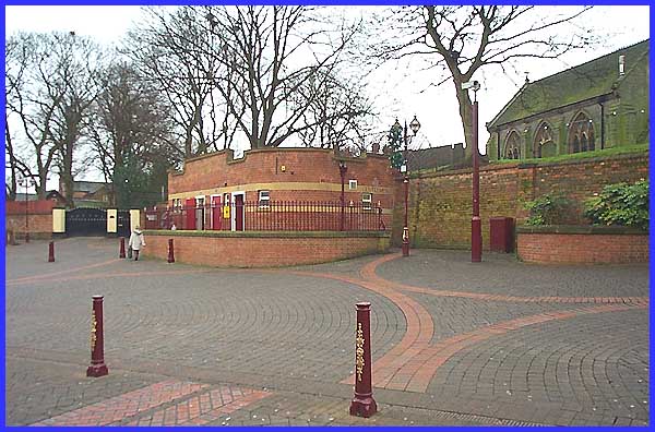
I do not usually go around taking photos of public conveniences,
even those that have been refurbished several times. The last
change to these toilets saw amongst other things, the doors moved
from the ends to the centre of the building. The word "Gentlemen"
can be seen at the right hand side of the building above the
position of the previous door but the reason for this picture
is that the toilets stand on the site of the Butter Market. The
Lower Market Place was the site of the original Town Market.
|
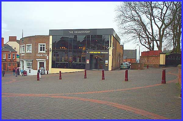
Lloyds TSB, previously the Derbyshire Trustee Bank, has
stood at the eastern end of the Lower Market Place on the corner
of East Street for many years. The Observatory, a J D Wetherspoon
Freehouse, is a fairly recent transformation having previously
been a Kwiksave supermarket but before that the imposing facade
of the Liberal Club graced the site. Built in the late 1880s
the club occupied the site until 1955, the building being demolished
some six years later.
(Search the Picture
the Past site for DCER000015.jpg to see a photo of the club).
The narrow footpath by the wall to the right of the Observatory
is called Anchor Row and, like the Anchor Inn on Market Street,
derives its name from a proprietor Anchor Carrier. This footpath
too had a former name, Gypsy Lane, and if we were to follow it,
we would soon reach the Erewash Museum, the starting and finishing
point for our Town Walk.
|
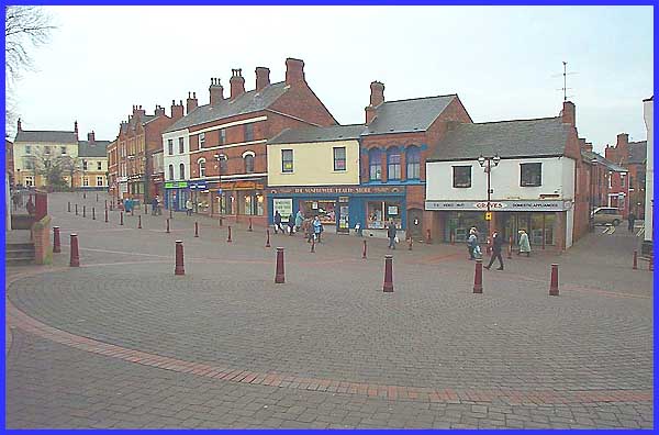
But our walk is far from over. Next we will walk along St Mary
Street on the extreme right of this picture and return via Burns
Street to the Upper Market Place outside the Sir John Warren,
the building on the extreme left of the picture. On a cold January
day in 2004, it is hard to imagine the market traders have bartered
on this patch of land for over 750 years but the fact is that
in 1252, Hugh de Cantelupe granted the right to hold a Thursday
Market here and trading has continued ever since.
|
