First Impressions
No. 03 - Part 01 - Nottingham Road
w/e 08 January 2012
All this week's pictures were taken
with a Kodak DX6490
At the start of a new year, we'll also begin to follow
the third route of this occasional series looking at the main
roads into Ilkeston. Working in a clockwise direction we have
already followed Millership Way and Station Road so now move
on to Nottingham Road.
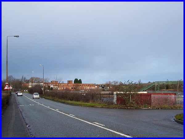
We actually begin this route though just outside the town boundary
on Ilkeston Road at Trowell in the county of Nottinghamshire.
Not only is this one of the roads into Ilkeston from the south,
it is also the main road through Trowell from Nottingham. On
the right of this image is the footbridge over the railway line
that runs through the Erewash Valley and the entrance on the
right once gave access to the Trowell Station site and goods
yard that was here until it became a victim of Dr. Beeching's
axe in the sixties. Another structure that prior to the night
of 25/26 June 2010 would have been seen towards the centre of
the picture, was the Eagle Mill. It was on that night that a
fire engulfed the building and it was subsequently demolished.
There is a video of the fire on YouTube.
|
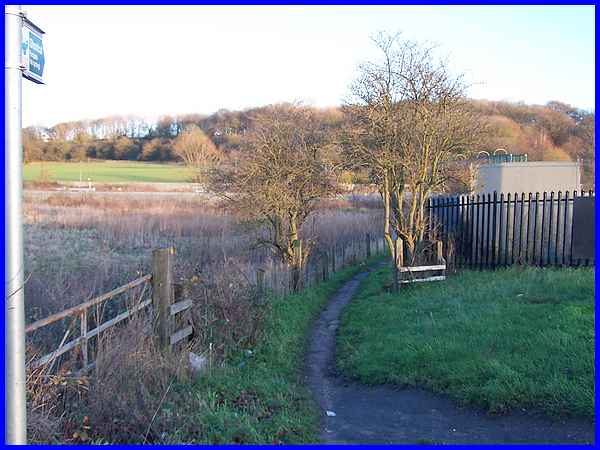
The chevrons in the previous picture indicate where the Ilkeston
Road ends and turns to cross the River Erewash. It is also the
point where this pubic footpath leads to the footbridge over
the railway and on up to the Nottingham Canal. It was by this
path that we completed the Dragonfly Trail and it also marks the conclusion
of a Sentimental Journey where the image of the footbridge in
the final
part also shows the Eagle Mill.
|
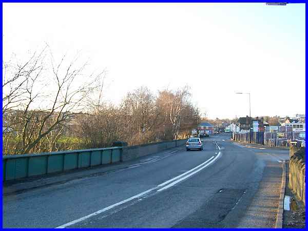
So from where the footpath joins at the corner and the road turns
to cross the River Erewash we enter Derbyshire and reach Nottingham
Road in Ilkeston.
|
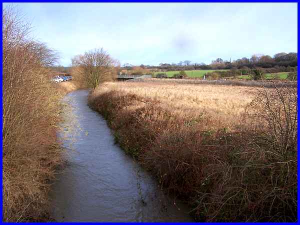
From the bridge the river that marks the boundary between the
counties can be seen meandering its way from the north as can
one of several railway bridges across the water feature that
are common throughout the valley. Up on the right, the hedge
line marks the route of the now disused Nottingham Canal whilst
vehicles parked at the side of the river on the left are on the
Furnace Road Industrial Site.
|
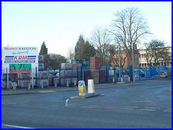
The entrance to Furnace Road from Nottingham Road is adjacent
to the road bridge over the river and ex-pats may be surprised
to see the welcome to Ilkeston sign by KRM Building Supplies
on this corner. Previously a garage and petrol station stood
here and the building behind now occupied by Belfield Furnishings
once served as a distribution depot for Cadbury's chocolate.
|
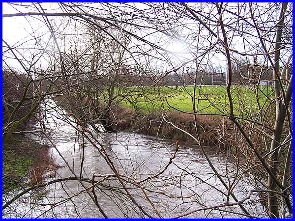
 On
the south side of the bridge, the view along the river shows
that the channel has been straightened out to run alongside the
Gallows Inn Playing Fields.The playing fields were a post war
project and were opened to the public in 1957. The creation of
the playing fields and straightening of the river involved the
construction of a flood area between the two and in the 1960s
it was not unusual to see whippet racing (similar to greyhound
racing but along a linear route rather than on oval circuit in
a stadium) being conducted here. Many years ago the town gallows
stood near here and although they have long since been removed
the area still retains the name. On
the south side of the bridge, the view along the river shows
that the channel has been straightened out to run alongside the
Gallows Inn Playing Fields.The playing fields were a post war
project and were opened to the public in 1957. The creation of
the playing fields and straightening of the river involved the
construction of a flood area between the two and in the 1960s
it was not unusual to see whippet racing (similar to greyhound
racing but along a linear route rather than on oval circuit in
a stadium) being conducted here. Many years ago the town gallows
stood near here and although they have long since been removed
the area still retains the name.
|
