Derby's Heritage Part 10 - Romans, Saxons & Victorians
w/e 31 October 2010
All this week's pictures were taken
with a Kodak DX6490
At the end of Part 9 we had just entered the site
of the Roman fortifications built about 80AD and called Derventio.
The fort was almost square in shape and continuing to the end
of Old Chester Road takes us to the south west corner of the
site where the only remaining prebendal farmhouse still stands
and that is where we will begin this part.
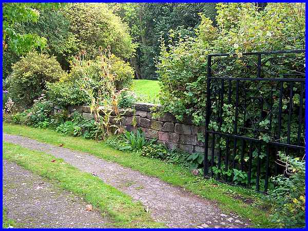
Today the house is a private residence and access to it is not
usually possible for the general public but back in September
when this image was captured, the lady of the house led a guided
walk of the area from the Little Chester Heritage Centre and
allowed those taking part not only to explore the gardens but
also to take photographs. She also pointed out this wall near
the entrance to the property which it is believed has survived
since Roman times as the construction is identical to that of
Hadrian's Wall in the north of the country.
|
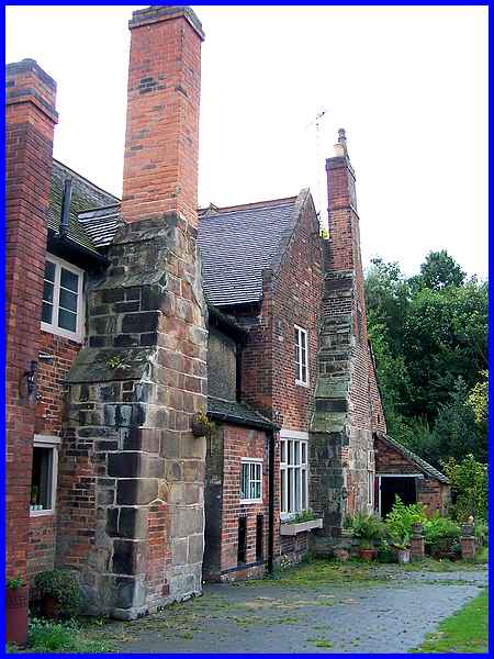
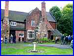  The Stone House
Prebend (above and left) was originally a timber framed building
and timbers can still be seen at the rear of the building where
there is also a plaque (right) bearing the date 1594. These three
images were also taken in September this year. The bricked up
doorway in the mediaeval chimney gave access to the chimney when
it was the practice to send small boys up as chimney sweeps. The Stone House
Prebend (above and left) was originally a timber framed building
and timbers can still be seen at the rear of the building where
there is also a plaque (right) bearing the date 1594. These three
images were also taken in September this year. The bricked up
doorway in the mediaeval chimney gave access to the chimney when
it was the practice to send small boys up as chimney sweeps.
Stone House Prebend not only stands on the site of an Ancient
Monument but it is also a listed building.
|
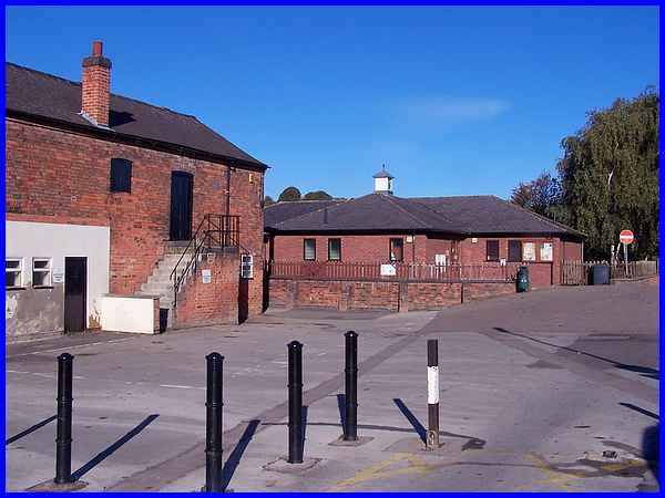
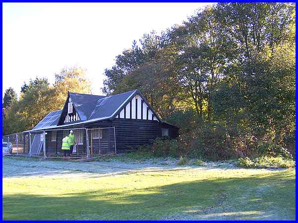
The rest of the images in this part were taken towards the end
of October 2010 and this one shows the Community Centre at the
entrance to Darley Park. This is still within the site of the
Roman fortifications but in the north western quarter.
|
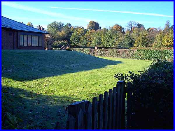
The Romans remained at Deventio until 350AD and Anglo Saxons
settled in the area sometime after 500AD. It was during the eighth
century that the area became part of the Saxon kingdom of Mercia
and a town was established south of the fort. This town called
Northworthy later developed to become Derby but in 917AD a battle
took place "within the gates" of Derby where the Saxon
Queen Aethelflaed defeated the Danes. It is thought that the
site of the battle may also have been the site of the Roman fort
but what is certain is that this small plot of land at the rear
of the Community Centre was a Saxon burial ground as the remains
of a number of bodies dating from the period were discovered
here.
|
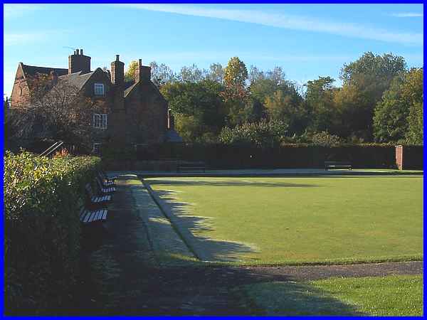
The Saxon cemetery lay just outside the northern ramparts of
the Roman fort which continued across the middle of what is now
the bowling green. The building that overlooks the bowling green
is Derwent House, a seventeenth century building but with a much
earlier core that probably dates from the same time as Stone
House Prebend.
|
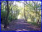  The
clay ramparts that bounded the Roman defences in the late second
century were reinforced with a 9ft (2.7m) thick wall about a
hundred years later and the western boundary ran parallel to
the River Derwent near the route of today's riverside path (left).
The path leads to a sports ground overlooked by Stone House Prebend
known as Parker's Piece which still shows evidence of ridge and
furrow agriculture, The
clay ramparts that bounded the Roman defences in the late second
century were reinforced with a 9ft (2.7m) thick wall about a
hundred years later and the western boundary ran parallel to
the River Derwent near the route of today's riverside path (left).
The path leads to a sports ground overlooked by Stone House Prebend
known as Parker's Piece which still shows evidence of ridge and
furrow agriculture,
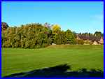
The cricket pavilion on Parker's Piece was built in 1924 and
had to be positioned further to the left than originally intended
when a Roman hypocaust was discovered. There is nothing to be
seen today but excavations in 1924 revealed the foundations of
a room heated by circulating hot air from a furnace under the
floor which was raised on stone pillars. The building would have
had stone walls decorated with painted plaster and a tiled roof.
Despite the work currently being done on the pavilion, it is
unlikely that physical evidence of its existence will last as
long as the Roman remains.
|
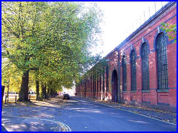
 Exiting
Parker's Piece onto City Road, the main feature southwards and
overlooking Chester Green is Sir Alfred Haslam's Union Foundry.
The foundry was a union of two earlier businesses, one of 1822
at the south end of the site and another of 1783 from a little
further south. It was established by Sir Alfred Haslam in 1868
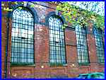
and was incorporated in 1873. The building that now stands empty
was built in three stages between 1873 and 1899 and is a fine
example of Victorian architecture with round arched windows (right)
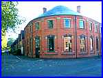
and decorative blue and yellow brickwork. Exiting
Parker's Piece onto City Road, the main feature southwards and
overlooking Chester Green is Sir Alfred Haslam's Union Foundry.
The foundry was a union of two earlier businesses, one of 1822
at the south end of the site and another of 1783 from a little
further south. It was established by Sir Alfred Haslam in 1868
and was incorporated in 1873. The building that now stands empty
was built in three stages between 1873 and 1899 and is a fine
example of Victorian architecture with round arched windows (right)
and decorative blue and yellow brickwork.
Haslam's secured their place in industrial history by developing
the first large scale refrigeration systems for warehouses and
ships which allowed frozen meat to be imported particularly from
the southern hemisphere countries in South America and also from
Australia.
  Although our route from
here is by the side of the foundry to leave the Little Chester
area by crossing the river, for completeness it is worth continuing
down City Road to view the semi-circular building on the corner
of St Paul's Road (left). This was the recreation centre and
canteen for Haslam's workers whilst a little further on in Mansfield
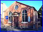
Street is the Primitive Methodist Chapel (right) of 1865. Although our route from
here is by the side of the foundry to leave the Little Chester
area by crossing the river, for completeness it is worth continuing
down City Road to view the semi-circular building on the corner
of St Paul's Road (left). This was the recreation centre and
canteen for Haslam's workers whilst a little further on in Mansfield
Street is the Primitive Methodist Chapel (right) of 1865.
|

 But returning
to Haslam's foundry our route follows the the line of the former
Great Northern Railway (later London North Eastern Railway) which
has now been converted into a car park at the side of the building.
This leads to the bridge over the Derwent that was constructed
in 1877 by Andrew Handyside, another name well-known worldwide
in Victorian engineering circles. Handyside's made castings,
bridges, towers, and piers that were transported to places all
around the globe. The construction of the bridge (right) across
the Derwent is perhaps best appreciated in the reflection seen
from the riverbank. But returning
to Haslam's foundry our route follows the the line of the former
Great Northern Railway (later London North Eastern Railway) which
has now been converted into a car park at the side of the building.
This leads to the bridge over the Derwent that was constructed
in 1877 by Andrew Handyside, another name well-known worldwide
in Victorian engineering circles. Handyside's made castings,
bridges, towers, and piers that were transported to places all
around the globe. The construction of the bridge (right) across
the Derwent is perhaps best appreciated in the reflection seen
from the riverbank.
In the next part we will continue from Handyside's bridge by
turning left but the Heritage Walk can be extended from here
by taking a circular walk to Darley Village and back by Darley
Park. This was a walk we first completed from a different start
point in 2008 but by starting with Part 2 and following the links to Part 3
and Part 1, it will return us to here for the continuation of
our Heritage Walk.
|
