Derby's Heritage Part 09 - Little Chester Detour
w/e 26 September 2010
All this week's pictures were taken
with a Kodak DX6490
Since the initial planning stage for this series
I have added another leaflet to my collection and this one gives
some additional information about locations in the Little Chester
area. So in this part instead of continuing directly from Marcus
Street to Old Chester Road, we'll take a little detour via Camp
Street and Mansfield Road to pick up some of these additional
locations.
 Something
adjacent to the Roman well that we overlooked in the previous
part were the concrete blocks in the grass marking the line of
Ryknield Street (left) but these can be seen as we return down
Marcus Street to Camp Street. Something
adjacent to the Roman well that we overlooked in the previous
part were the concrete blocks in the grass marking the line of
Ryknield Street (left) but these can be seen as we return down
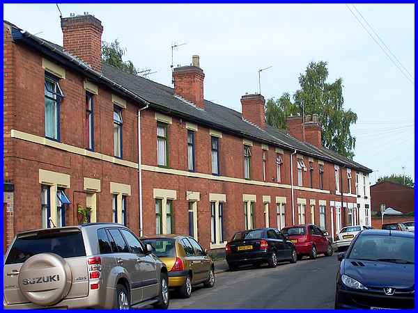
Marcus Street to Camp Street. 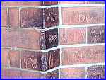 Kirk Street links through to
Old Chester Road and a terrace of Victorian houses (above) in
Kirk Street was built by the Ancient Order of Foresters. The
spacious houses are notable for being built of machine-made bricks
with dressed stone door and window lintels. The 'Little Chester
Trail' leaflet produced by the local history group also points
out the early twentieth century graffiti scratched into the wall
(right) on the corner of Camp Street and Kirk Street. Kirk Street links through to
Old Chester Road and a terrace of Victorian houses (above) in
Kirk Street was built by the Ancient Order of Foresters. The
spacious houses are notable for being built of machine-made bricks
with dressed stone door and window lintels. The 'Little Chester
Trail' leaflet produced by the local history group also points
out the early twentieth century graffiti scratched into the wall
(right) on the corner of Camp Street and Kirk Street.
|

  Turning into Mansfield Road leads to
Old Chester Road but I continued past it into Alfreton Road before
taking this shot of the 'black and white' houses that are examples
of the Edwardian revival of vernacular styles of architecture.
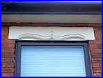
A feature of note on the houses on Mansfield Road are the elaborate
lintels (left and right). The hoardings in the image above hide
the site of an eighteenth century Toll House. Turning into Mansfield Road leads to
Old Chester Road but I continued past it into Alfreton Road before
taking this shot of the 'black and white' houses that are examples
of the Edwardian revival of vernacular styles of architecture.
A feature of note on the houses on Mansfield Road are the elaborate
lintels (left and right). The hoardings in the image above hide
the site of an eighteenth century Toll House.
|
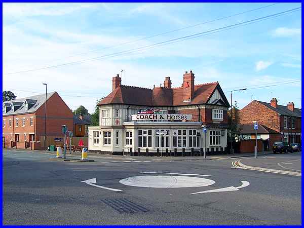
Diagonally across from the hoardings on the corner of Mansfield
Road and Old Chester Road is the Coach & Horses, an Edwardian
building on the site of the earlier Crown Ale House. The car
park at the pub was once a bowling green and customers used to
watch matches from the veranda.
|
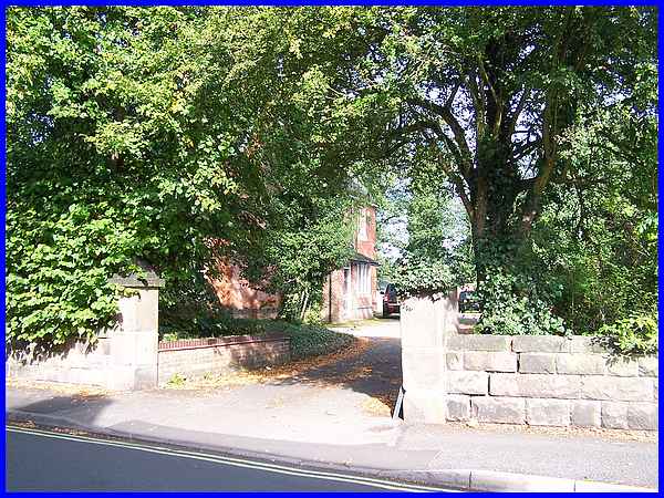
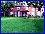
We now continue along Old Chester Road where the tree shrouded
Victorian house was the first vicarage for St Paul's Church.
The modern vicarage next door has another Roman well in the garden
but public access is only possible with prior permission.
|
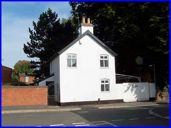
The white house that stands opposite the junction with Kirk Street
is a reminder of the railway age as it was built and owned by
the Great Northern Railway. A blue brick wall visible from the
road is also a remnant of the railways delineating the route
of the tracks.
|
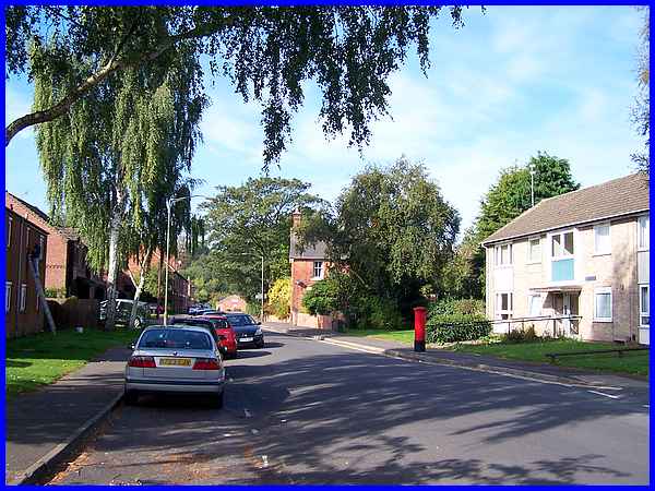
A bridge carried the railway over Old Chester Road about here
and this is where we leave the detour to rejoin the planned route
at the end of Marcus Street. Old Chester Road follows the main
Roman street into the fortifications that were built about 80AD
on the banks of the Derwent and was crossed at right angles approximately
where the red pillar box now stands by Ryknield Street.
|
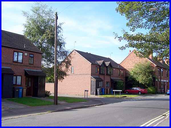
A small town grew up around the fort and the Romans were here
until about 350, After that Anglo Saxons occupied the area from
about 500 and burial sites have been discovered nearby. Following
the Norman conquest of 1066, the area belonged to the collegiate
church of All Saints, which much later became Derby Cathedral.
The church was supported by the revenue from seven farms and
when the College was dissolved in 1547, the prebendal farms were
purchased from the Crown for the town. Today's Derventio Court
stands on the site of one of these farms, Manor Farm, which was
eventually demolished in 1967. Although there is little remarkable
about this scene today, a Roman stone building was discovered
where the houses on the right of Derventio Court now stand whilst
those on the left stand on the nine feet thick wall of the Roman
defences. It was at this point that Old Chester Road passed through
the east gate into the Roman fort.
|
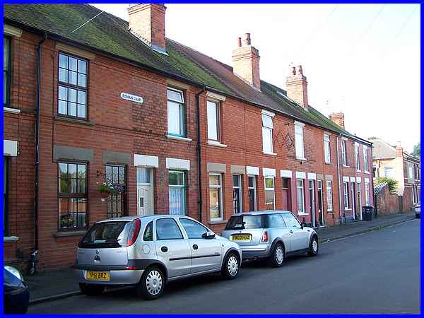
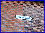  Roman remains had also been found earlier
when Sir Alfred Haslam built these houses for his work force
in 1886 and a plaque on the wall stating "Roman Camp"
(left) commemorates the discovery. The nineteenth century saw
much development in the area including Haslam's foundry and many
of the houses in the vicinity from this period also have the
Haslam diamond (right) built into the brickwork. Roman remains had also been found earlier
when Sir Alfred Haslam built these houses for his work force
in 1886 and a plaque on the wall stating "Roman Camp"
(left) commemorates the discovery. The nineteenth century saw
much development in the area including Haslam's foundry and many
of the houses in the vicinity from this period also have the
Haslam diamond (right) built into the brickwork.
|
