"Lock to Lock"
Ilkeston - Station Road to Barker's
w/e 09 August 2009
All this week's pictures were taken
with a Kodak DX6490
Continuing our walk between the "Locks on the Erewash Canal" we resume
midway along the longest section at Station Road and in this
part will proceed as far as Barker's Lock near the bottom of
Awsworth Road.
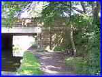
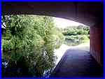
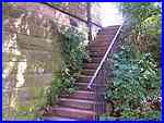  In
the first part of this section we followed the route along the
western side of the canal but must now return to the eastern
side and descend to the towpath from Station Road via a steep
flight of steps (left). Passing under the Station Road bridge
Mill Street is visible on the opposite side (right & above).
I am not aware of any such incidents but unsuspecting drivers
could well end up with a damp end to their journey! In
the first part of this section we followed the route along the
western side of the canal but must now return to the eastern
side and descend to the towpath from Station Road via a steep
flight of steps (left). Passing under the Station Road bridge
Mill Street is visible on the opposite side (right & above).
I am not aware of any such incidents but unsuspecting drivers
could well end up with a damp end to their journey!
|
Behind the properties on Mill Street is Johnny's. Like The Ashes
(Gordon Street Playing Fields) seen earlier in the walk Johnny's
also has an official name, the Wash Meadow Play Area, designated
by the local Council but this is very rarely used by Ilkeston
folk who prefer the names that have been in common use for generations.
|
A footbridge crosses the canal leading to Johnny's from the towpath.
It also acted as a shortcut for people walking from the bottom
end of town to the Waterside Retail Park off Station Road which
is beyond the metal fence seen here on the right. A gate in the
fence was recently locked by the owners, preventing access to
the Retail Park the reason given being that it was a deterrent
to shoplifters who were plaguing the site. However as we walked
past the locked gate we noticed that a panel in the fence nearby
had been removed. By whom it is unknown but it is highly unlikely
to be a permanent arrangement.
|
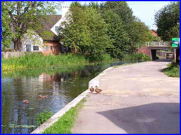
  The footbridge
is a good vantage point to see the newly constructed bridge carrying
Millership Way that was opened in 2008 by Government Minister
Geoff Hoon and Derbyshire County Council member Brian Lucas.
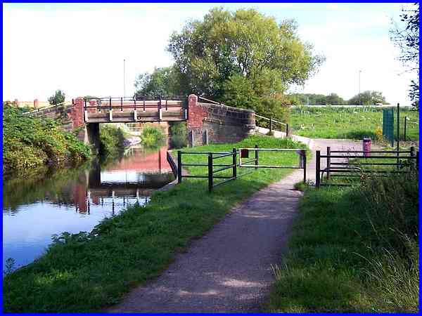
Returning to the towpath we pass under the new bridge (left)
and continue (right) towards Awsworth Road and Barker's Lock. The footbridge
is a good vantage point to see the newly constructed bridge carrying
Millership Way that was opened in 2008 by Government Minister
Geoff Hoon and Derbyshire County Council member Brian Lucas.
Returning to the towpath we pass under the new bridge (left)
and continue (right) towards Awsworth Road and Barker's Lock.
For more views in this area from Millership Way see Parts
3 & 4 of the First Impressions series.
From this point to Awsworth Road we are following the same route
as that featured in the Town Walk but in the opposite direction.
See Parts 29 and 30 of the walk with photos from 2004/5 to compare.
|
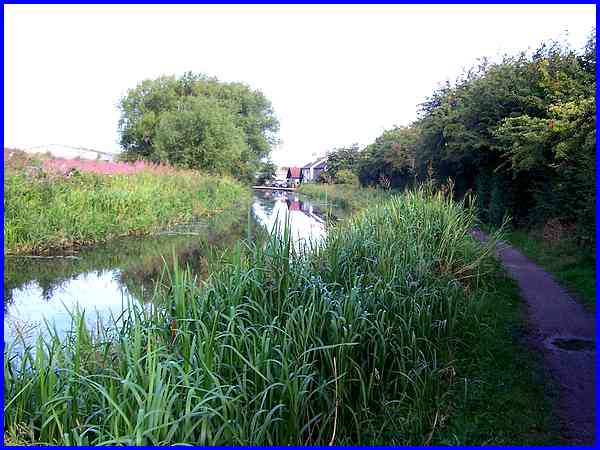
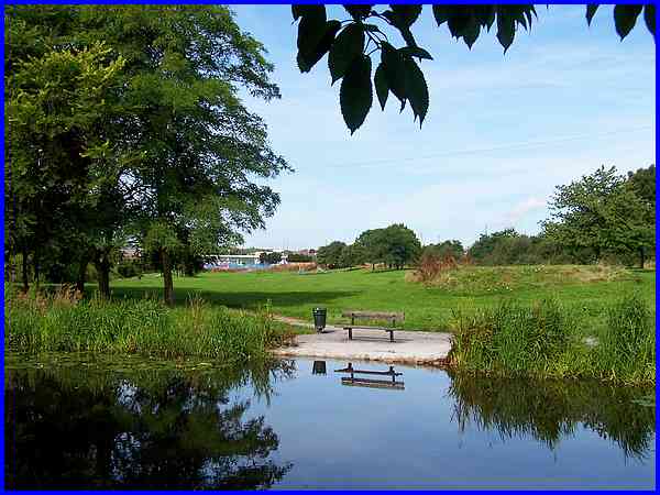
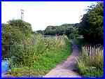
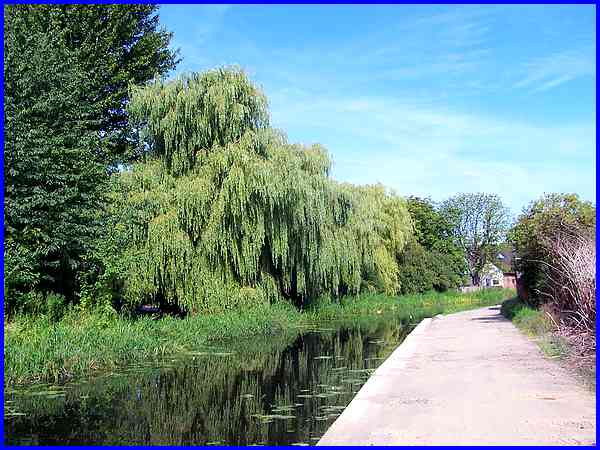
For the next couple of hundred yards or so the canal loses its
urban feel and takes on a more rural countenance with unmade
ground on the left and a high hedge and tree shrouded view on
the right. In the distance however a large industrial building
and some residential properties soon come into view.
|
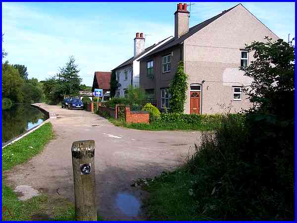
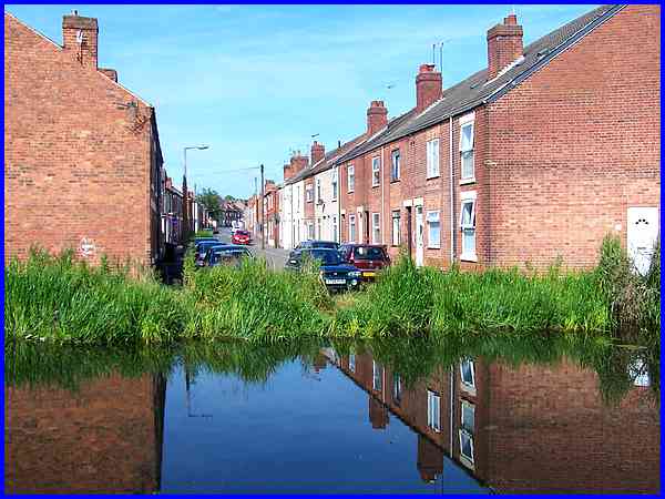
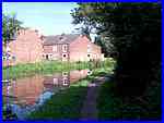
Four semidetached houses and a bungalow comprise those residential
properties at the side of the canal and are probably in one of
the remotest and most secluded spots within the town boundary.
Old maps label these properties as Canal Side but they now go
by the name of Fairview and if you are after a bit of seclusion,
one of them is currently for sale.
|
For the rest of the route to Awsworth Road, the towpath widens
sufficiently to allow the passage of vehicles but pedestrians
and car drivers too for that matter have to proceed with care
as the path is full of potholes. The right hand side is now flanked
by the rear of many small industrial units but the trees on the
opposite side shielding the Springfield Gardens and Redland Close
housing offer a much more pleasing aspect.
|
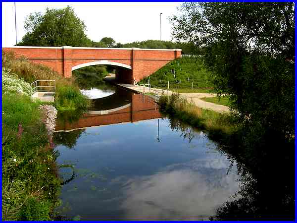
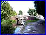 Most
of the area on the right between the canal and the River Erewash
is filled with light industrial concerns but there is a terrace
of residential properties near Awsworth Road and again for those
seeking a house backing on to the canal there are several "For
Sale" boards here. The recession probably accounts for the
slow movement of sales in the housing market and could also be
a factor in the state of the Bridge Inn, the rear of which can
be seen here. The pub is currently boarded up and has been closed
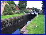
for quite a while but our objective in this part is straight
on as the gates of the lock can be seen under the Awsworth Road
bridge. Most
of the area on the right between the canal and the River Erewash
is filled with light industrial concerns but there is a terrace
of residential properties near Awsworth Road and again for those
seeking a house backing on to the canal there are several "For
Sale" boards here. The recession probably accounts for the
slow movement of sales in the housing market and could also be
a factor in the state of the Bridge Inn, the rear of which can
be seen here. The pub is currently boarded up and has been closed
for quite a while but our objective in this part is straight
on as the gates of the lock can be seen under the Awsworth Road
bridge.
|
