Sandiacre - Stoney Clouds Viewpoint
w/e 05 March 2017
All of this week's pictures were
taken with a Kodak DX6490
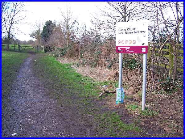
This is not the first time we've been to Stoney Clouds for Ilkeston
Cam but after more than 15 years of doing the website, it's inevitable
that we should return to some places. We first visited in 2003
(link),
touched on it during the Sandiacre Village Trail and passed through
on a six mile Walk
in the Clouds.
|
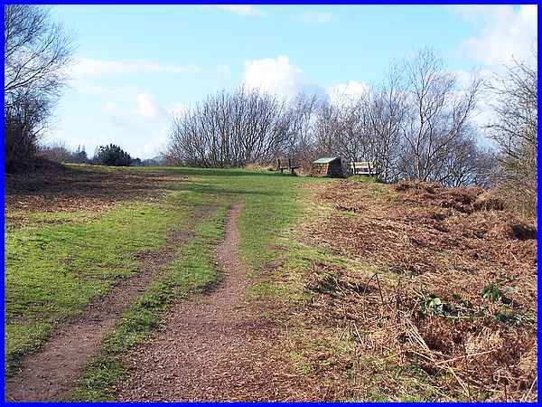
This time we made for the viewpoint which as we discovered in
that "Walk in the Clouds" occupies some of the highest
ground in Erewash.
|
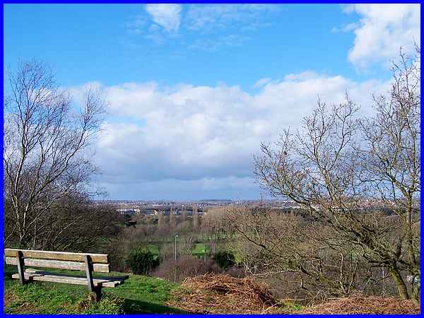
 The
leaflet describing that walk also says that it is possible to
"enjoy breathtaking views over the Trent and Erewash Valleys"
but the last time I was here during the Autumn Footprints Festival
last September, the views were severely curtailed by the misty
conditions (right). This time there were no such issues and even
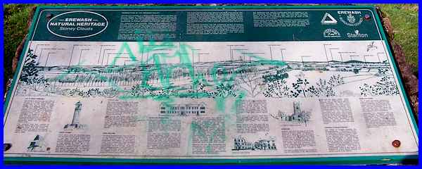
without the aid of the panoramic drawing on the informative display
(below) at the viewpoint, we were able to pick out many of the
familiar landmarks in the surrounding area. It is such a shame
though that the display has become the object for some senseless
graffiti. The
leaflet describing that walk also says that it is possible to
"enjoy breathtaking views over the Trent and Erewash Valleys"
but the last time I was here during the Autumn Footprints Festival
last September, the views were severely curtailed by the misty
conditions (right). This time there were no such issues and even
without the aid of the panoramic drawing on the informative display
(below) at the viewpoint, we were able to pick out many of the
familiar landmarks in the surrounding area. It is such a shame
though that the display has become the object for some senseless
graffiti.
|
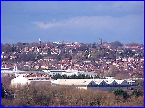
Towards the left from the viewpoint over the industrial units
on the former Stanton Ironworks site and the Quarry Hill Industrial
Site are the houses on the south side of Ilkeston with the spire
of the URC and the tower of St Mary's in the town centre clearly
visible on the skyline.
|
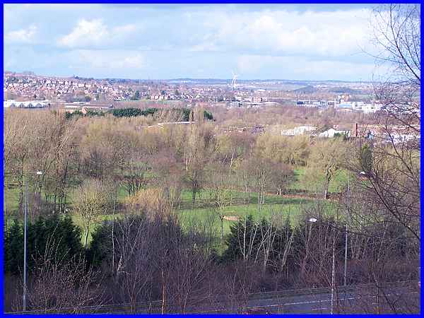
To the right of Ilkeston town centre the view is over the Erewash
Valley Golf Club along the Erewash Valley, past the wind turbine
at Newthorpe to Eastwood in the distance.
|

Further still to the right, the water tower, another smaller
wind turbine at Swingate Farm and the TV relay mast all at Swingate
lie beyond Trowell Village. If you look closely at the bottom
left hand corner of the image, you may be able to make out the
Festival Inn and St Helen's Church tower (almost immediately
below the water tower).
|
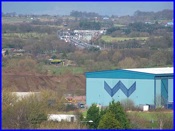
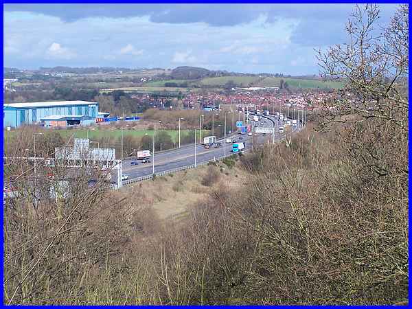
Looking past the large West's Transport Depot on the Stanton
site, the yellow marking denoting the low railway bridge can
be seen and beyond that the M1 motorway snakes northwards towards
the Trowell Services.
|
The views from Stoney Clouds are interesting especially for people
like me who have an interest in their local surroundings but
the one downside to this location is the constant drone of rubber
on tarmac as the heavy traffic rushes past on the busy M1. If
you can overlook or ignore the noise you could spend hours up
here but it is inconceivable to me that planners of the proposed
HS2 railway intend to realign the M1 in this area and I dread
to think of the chaos and frayed tempers this will cause to drivers
both on the motorway and also the surrounding road network.
|
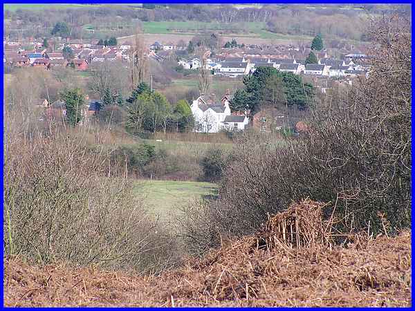
Stoney Clouds of course is a Local Nature Reserve and there is
another one beyond the cluster of houses at Stanton Gate. The
motorway is just out of shot to the left and the houses in the
middle distance are at Trowell to the left and Stapleford to
the right.
|
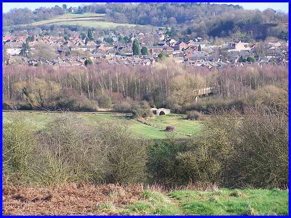
As we descended from the high point, we looked across the valley
over the stone bridge crossing the Erewash Canal and the footbridge
over the railway line beyond the trees which obscure the River
Erewash to Stapleford and Burnt Hill at Bramcote. There are many
more features visible from the viewpoint including Crich Stand
nearly 14 miles away but we decided to leave some for another
day.
|
