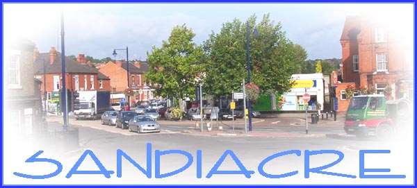
Having left the Erewash Canal behind in the previous
part of our walk through Sandiacre, we will continue in this
part in a northerly direction along Town Street and Lenton Street.
Town Street was formerly called Church Street with good reason
as there were several churches and chapels in the vicinity. We
have already passed the location of at least two chapels. First
there was the the building near the canal bridge at the start
of our walk and then in Part 4 we were close to the site of the
Primitive Methodist Chapel on Mill Lane that is now being developed
as a housing estate.
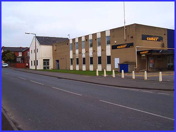
As we begin our walk on Town Street, a prominent building is
the Comet electrical store. When this was built an existing house
and adjacent row of cottages had to be demolished but another
existing building was  incorporated
into the design of the store. It is thought that this old building
- painted white in the image above - was erected in 1826 as a
Wesleyan Methodist Chapel. By the turn of the 19th/20th century
it had been converted into a grocery store and was known as the
Italian Warehouse. It continued as a grocer's shop until the
early 1970s. Redevelopment of the area has taken place opposite
the shop but there used to be a lane called Taft's Terrace and
a row of thatched cottages in the vicinity of what is now Kings
Road (right) . It was here that Charles Wesley preached in an
upstairs loft and it is perhaps his legacy that accounts for
the number of chapels that were built nearby. The name "Taft"
has been preserved in a small cul-de-sac off Church Street as
Taft Avenue. (There are a couple of pictures and more information
about the Italian Warehouse at Picture
The Past - search for images DCER000254 and DCER001029). incorporated
into the design of the store. It is thought that this old building
- painted white in the image above - was erected in 1826 as a
Wesleyan Methodist Chapel. By the turn of the 19th/20th century
it had been converted into a grocery store and was known as the
Italian Warehouse. It continued as a grocer's shop until the
early 1970s. Redevelopment of the area has taken place opposite
the shop but there used to be a lane called Taft's Terrace and
a row of thatched cottages in the vicinity of what is now Kings
Road (right) . It was here that Charles Wesley preached in an
upstairs loft and it is perhaps his legacy that accounts for
the number of chapels that were built nearby. The name "Taft"
has been preserved in a small cul-de-sac off Church Street as
Taft Avenue. (There are a couple of pictures and more information
about the Italian Warehouse at Picture
The Past - search for images DCER000254 and DCER001029).
|
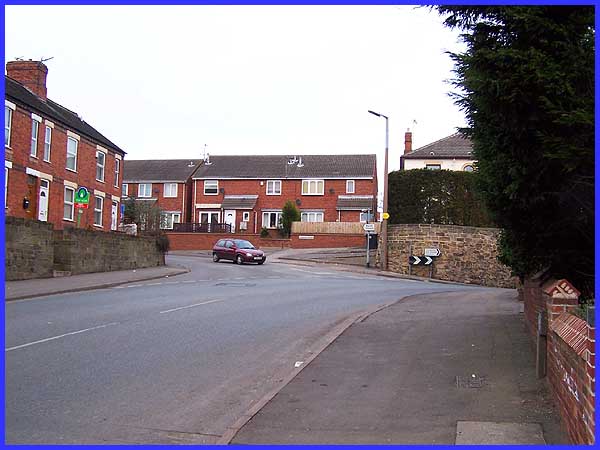
The "Comet chapel" (if I can call it that) was replaced
in 1878 by another one at the junction of Church Street and Lenton
Street. Today's Church Street still meets Lenton Street/Town
Street at the same junction but the chapel was demolished in
the early 1970s and the houses seen in the centre of this image
were built on the site. (Again there is an image of this Wesleyan
Methodist Chapel at Picture
The Past - DCER001030).
|
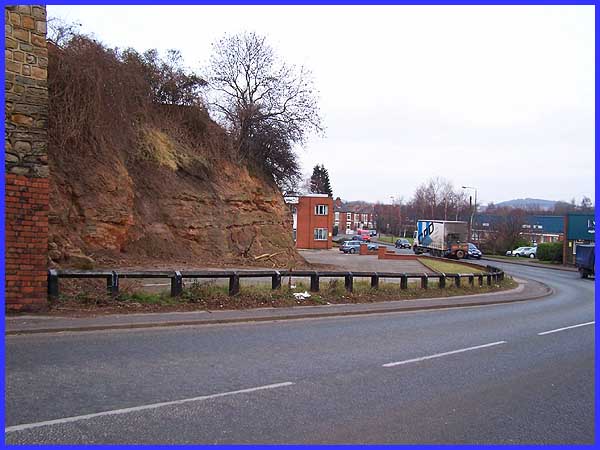
As we turn into Lenton Street the first point of interest is
the old quarry on the left where sand was extracted for use in
local industries. It was used in the iron making process at several
ironworks to the north both at Stanton and also at the Gallows
Inn works and Bennerley works in Ilkeston. Later the sand was
also used in construction work for new housing at Long Eaton
to the south.
|
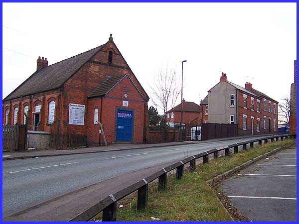
But if you thought we'd finished with the religious buildings
you'd be wrong for opposite the quarry is yet another structure
that was erected as a chapel. I have been unable to find any
information about this one but it is now used as an aquatic centre
selling all manner of equipment and supplies to do with marine
life. Jesus said "Follow me and I will make you fishers
of men." It seems that at least one of the buildings built
to praise Him has now gone full circle and is occupied by a man
of fishes!
|
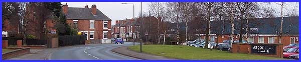
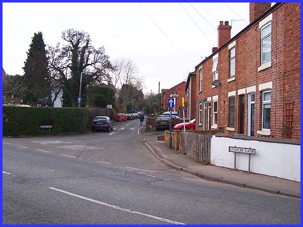
A little further along Lenton Street, there are a number of industrial
units occupying an area called the Ascot Park Estate. This rather
grand name has superseded the Lawrence Street Starch Works -
the name the site was known as after Lawrence Hall of Bramcote
built starch works here in 1837.
The starch works were purchased by J J Coleman who closed them
in the late nineteenth century, the buildings subsequently being
used as an iron foundry. The name however has remained in the
lane opposite. The point also marks the place where Lenton Street
becomes Ilkeston Road. We are now almost at the northern boundary
of Sandiacre and although this is now the main road from Sandiacre
to Ilkeston, up to 1900 it was little more than a footpath through
marshy land.
|
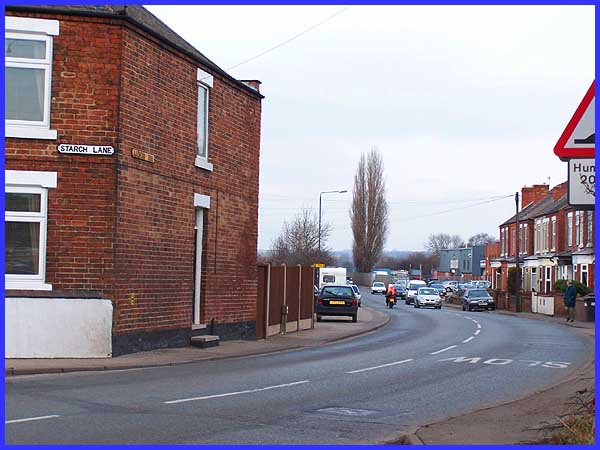
In those days the main route to Ilkeston would have been up Station
Road (which is at the other end of Starch Lane) and over the
higher ground via Stanton By Dale. And that is the way we must
go to continue our walk in the next part with a look back at
the origins of the settlement.
|