This part of our exploration of Sandiacre picks up
the walk on the towpath of the Erewash Canal. It will take us
along the canal and we will see a few notable buildings before
crossing it via a footbridge to reach Town Street.
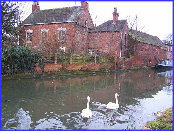
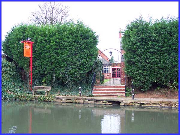
The swans that we saw when we were last here just over a month
ago are certainly not camera shy and graciously swam into shot
again as I positioned myself for this picture of Peartree House.
The house actually predates the canal and originally had land
attached to it that stretched as far as the River Erewash (see
Part 3). Another claim to local fame is that it was once the
residence of one George Russell, the local veterinary surgeon.
|
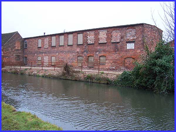
Adjacent to Peartree House stands a two storey building that
dates from the early nineteenth century. This is only half the
building it used to be as it was built as a four storey cotton
doubling factory with a pitched roof but a combination of high
winds and fire eventually reduced it to its present height.
|
 For
many of the walks featured on Ilkeston Cam I have sourced much
of the information from leaflets produced by the colaberation
of a number of organisations. One of those was the Erewash Groundwork
Trust, now known as Groundwork Erewash Valley, and their offices*
can be seen across the canal between the former factory and the
Plough public house. I am again relying on one of their 'Village
Walks' leaflets for much of the information contained in these
pages on Sandiacre but as it was published in 1984 I am finding,
and regret that, changes in the area mean that some of the historical
heritage of the village has been lost forever. One such area
in particular will become apparent as we cross the canal towards
Town Street. For
many of the walks featured on Ilkeston Cam I have sourced much
of the information from leaflets produced by the colaberation
of a number of organisations. One of those was the Erewash Groundwork
Trust, now known as Groundwork Erewash Valley, and their offices*
can be seen across the canal between the former factory and the
Plough public house. I am again relying on one of their 'Village
Walks' leaflets for much of the information contained in these
pages on Sandiacre but as it was published in 1984 I am finding,
and regret that, changes in the area mean that some of the historical
heritage of the village has been lost forever. One such area
in particular will become apparent as we cross the canal towards
Town Street.
*NB. Groundwork are no longer at this site having moved to
premises in Langley Mill.
But before we reach that point we must proceed a little further
along the canal towpath and first pass the Plough. Little can
be seen of the public house from this side of the canal but the
inn sign and the adjacent landing stage will surely have tempted
a fair number of narrow boat owners over the years. Such visitors
may have noticed some hand made bricks in the rear wall of the
pub suggesting that part of the building is over 200 years old.
|
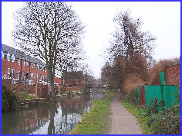
From opposite the Plough our objective, the footbridge, is clearly
visible but the left hand side of the canal has recently changed
from its former appearance due to the construction (still ongoing
at the time of writing) of a new housing development.
|
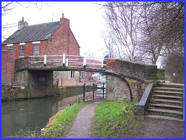
The bridge which leads to Mill Lane has cast iron beams on stone
abutments but the original wooden decking has been replaced by
concrete. It originally led to the village's water powered corn
mill which obviously gave rise to the name of the lane.
|
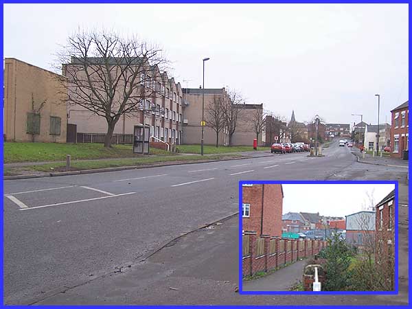
The inset in the picture above shows the view from the bridge
along Mill Lane towards Town Street and this is one of the areas
where some of the history of the village that I mentioned above
has been lost. The leaflet declares that this area once contained
three storey frame knitters houses, a wheelwright and a maltsters.
There was also the old Post Office and the Primitive Methodist
Chapel but sadly all vestiges of theses buildings have disappeared
to be replaced by the new housing development and a number of
light industrial units. The chapel was built in 1833 and at the
time of writing of the leaflet was still being used by an engineering
business, at one time being used as a brass foundry. The main
picture shows Town Street (formerly Church Street) from near
the junction with Mill Lane. Opposite the junction the Co-op
stood for many years in a purpose built shop having previously
been founded in a converted stable on the street in 1872. By
1895 there were 40 shops in Sandiacre serving a population that
increased fourfold from 1851 to 4000 by 1901. The population
is now about 10000 and quite a few of those will live in the
houses and flats on the left that now line Town Street.
|