Town Walk 2026 - Part 10 - St Mary's & Lower Market
Place
w/e 01 February 2026
All of this week's pictures were
taken with a Nikon D3300 camera
This part equates to part of Stage 16 and all
of 17 and 18 of the original Town Walk from 2003 and 2004.
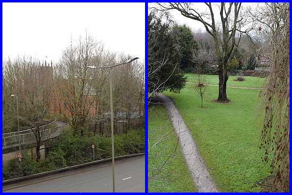
The last images in Stage 16 of the original Town Walk in 2003
served only to illustrate that the churchyard at St Mary's had
been split in two by Chalons Way. Both taken from the footbridge
over the road, the view of the right above is remarkably similar
to the one from twenty plus years ago but tree growth along the
side of Chalons Way and new buildings in the intervening period
have not only obscured the other part of the churchyard but most
of the church as well.
|
It is not suggested that anyone following the Town Walk should
make a detour to the bridge over Chalons Way as it would involve
a lot of to-ing and fro-ing. We continue the route now though
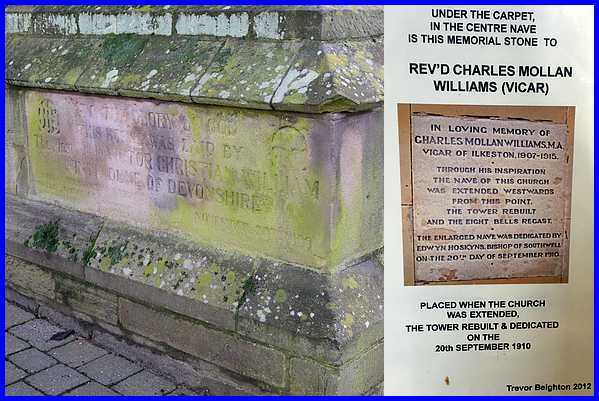
at St Mary's Church. I think it is a well-known fact that "the
tower was moved westwards when the nave was extended in 1909/10"
and that a "cornerstone at the foot of the tower
commemorates the rebuilding". What is perhaps not so
well-known is that a memorial stone was laid in the central aisle
marking the point from where the extension began. It is now hidden
underneath the carpet that runs along the length of the aisle
but marked by a notice on the end of one of the pews.
|
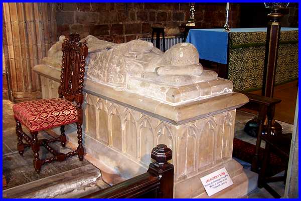
Stage 17 of the original Town Walk shows several views of the
interior of St Mary's but before we move on, here are another
couple of interesting features. First, situated next to the altar
is the Crusader's Tomb of Nicholas de Cantelupe, Lord of the
Manor of Ilkeston in the 13th century. It was during restoration
work in the mid 1800s that the tomb of William de Cantelupe (died
(c) 1308) was dismantled and removed. That of his father,
Nicholas, was removed from the chancel aisle and installed beneath
the east window.
|
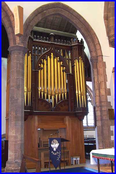
The organ too has an interesting history having been purchased
in 1866 from St John’s Church in London. Whilst there in
Paddington, it is believed to have been played by Mendelssohn.
It was moved to its current position in 1990.
|
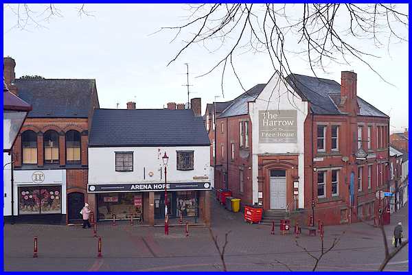
Moving on from the church but still in the churchyard, this is
the view over the Lower Market Place towards St Mary's Street
where the route will take us next. Back in 2004 I joked that
there were "graves on both sides of the church
wall" as the Arena Hope shop opposite was then occupied
by electrical retailer, Vic Graves. I also reminisced about
the Folk Club that was held in the The Harrow Inn in the 1960s.
In 2004 The Harrow went by the name The Roundhouse but since
then it has reverted to its previous name. The inn,
"the first property on Bath Street", was built
about 1900 on the site of the original Harrow Inn but the new
building was given the rounded corner we see today to make it
safer for pedestrians, horse drawn traffic and later the trams
which came in 1903.
|
It was also in 1903 that the "transformer box
that stands between the guide post and the telephone kiosk"
was "was installed in conjunction with the town's new tram
system to supply electricity to market traders." The
transformer box is still there but the telephone box has been
removed.
|

In 2004 the caption for a picture similar to this read "Directly
opposite the transformer box and joining the Market Inn to the
hair salon is a cast iron bridge. The salon used to be Barton's
Fruit Shop and it is thought that the bridge was the result of
common ownership of the properties in the nineteenth century."
There's not a great deal to add really.
|

The same can be said about the public conveniences
on the Lower Market Place that "stand on the site of
the Butter Market" except that a defibrillator has now
been attached to the wall. It is worth repeating however that
"the Lower Market Place was the site of the original
Town Market" when today's Market Place was occupied
by schools in the 1800s.
|
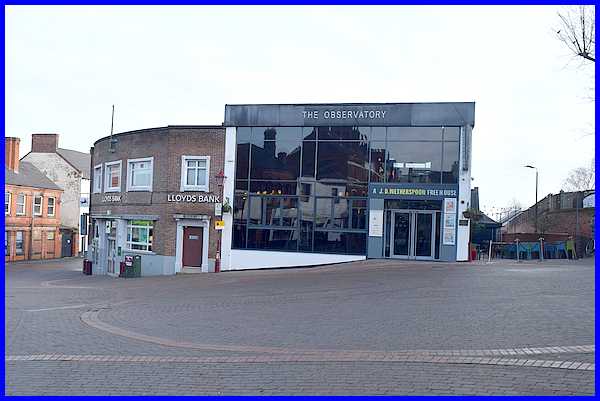
This photo of Lloyds, "previously the Derbyshire
Trustee Bank," that " has stood at the eastern
end of the Lower Market Place on the corner of East Street for
many years" and "The Observatory, a J D Wetherspoon
Freehouse" built "on the site of Kwiksave supermarket"
which itself was built where the Liberal Club had once stood,
is again very similar to the one from 2004. When comparing the
two however, I noticed something that I had completely forgotten
about. There used to be a curving line of bollards leading from
in front of the Bank to the public conveniences. Anyone following
the Town Walk could easily curtail the route here and walk down
the side of The Observatory and back to the starting point at
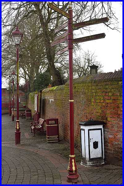
the Erewash Museum, The path "is called Anchor Row and,
like the Anchor Inn on Market Street, derives its name from a
proprietor Anchor Carrier."
|
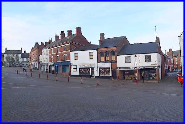
As in the original Town Walk we will leave the Market Place at
this point and as previously "will walk along St Mary
Street on the extreme right of this picture and return via Burns
Street to the Upper Market Place outside the Sir John Warren,
the building on the extreme left of the picture." One
thing to note though before moving on is not only the disappearance
of the bollards but also that there are far fewer market traders
today taking advantage of Hugh de Cantelupe's granting in 1252
of "the right to hold a Thursday Market here" than
there were even twenty years ago. The phrase "Use it or
lose it" comes to mind.
|
