Ilkeston Town Walk - Stage 25 - Manners
Link
w/e 15 August 2004
All this week's
pictures were taken with a Kodak DX6490
For the majority of the Town Walk, I have
been following the route as detailed in one of a series of leaflets
produced by the Erewash Groundwork Trust in conjunction with
a number of other organisations. I have made a number of detours
and diversions of my own to include various points of interest
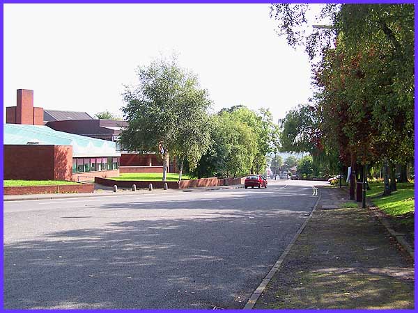
but here the leaflet offers a choice of routes. Leaving Victoria
Park (on the right), the shorter route would take us straight
down Manners Road past the Victoria Leisure Centre (left) to
the bottom of Bath Street and then back to the Museum. I am choosing
to turn left here into Manners Avenue to follow the route described
as the Cotmanhay Loop which will extend the walk by about a mile
and a half to approximately four miles in total.
|
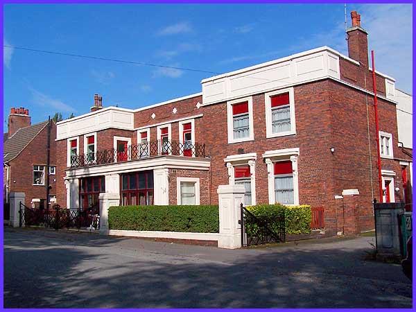
But before we continue, a glance
to the left reveals a nursing home that in a previous life served
as the Mines Rescue Station. I'm not sure exactly when the building
was erected but it has a distinct feel of the early part of the
last century and is in stark contrast to the nearby futuristic
looking Victoria Leisure Centre. The site of Manners Colliery
was behind this building and is now the location of an industrial
site. We shall head towards this as we continue our walk but
quickly turn off before we reach it.
|
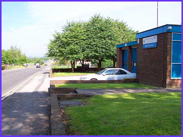
We are now on Manners Avenue heading towards
the industrial estate - the road just beyond the Ambulance Station
on the right is Manor Road. Ambulances now operate out of the
same building as the Fire Service on Oakwell Drive but the building
shown here is still used by the ambulance service as the Facilities
Division. On the far left of this picture is a signpost that
bears the words "Manners Link". This is a footpath
that leads behind Ilkeston School and provides an alternative
route back to the Rutland Recreation Ground.
|
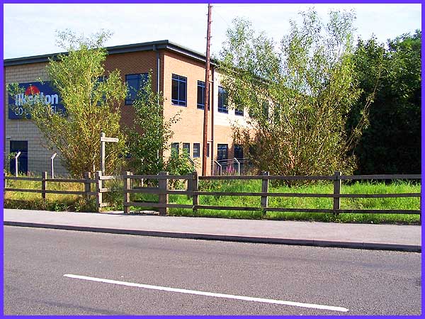
Diagonally across is another similar signpost
pointing along a footpath in the opposite direction towards Heanor
Road. Both paths follow the route of a disused railway line.
Ilkeston Co-Op has a travel agency that is well-known around
the East Midlands and although there is a branch within the Co-Op
store in the centre of town, this building at the side of the
Manners Link footpath houses the headquarters of the Travel Division.
|
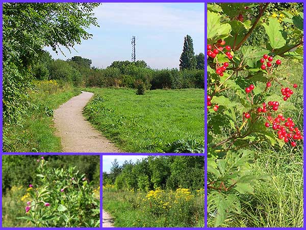
It is difficult to imagine as we follow the footpath that we
are walking along the course of the former Great Northern Railway.
Until Dr. Beeching wielded his axe in the 1960s, steam engines
hauled their carriages and wagons along here between Nottingham
Victoria and Derby Friargate. The route has now returned to nature
and although it is in close proximity to both industrial and
residential areas it is a quiet oasis for wildlife. I met only
one person as I walked along the path and that was a traffic
warden - don't suppose he issued many parking tickets along here!
The leaflet, now over ten years old, mentions a pond on the left
hand side but there is no obvious sign of this. However I walked
along the path after almost thirty six hours of constant August
rain and when I stepped off the path to take the image of the
right of the composite above, found myself ankle deep in water.
BE WARNED - stay on the path!
|
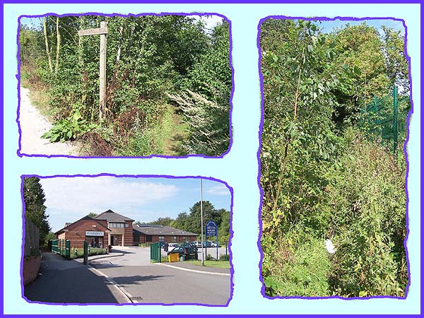
Near the end of the path is another signpost and we are advised
to turn left here (top left above) along a "new" path
(right) through a passage in the hedgerow and along a dirt track
between allotments to Boweswell Road. I have twice attempted
this route and would not advise it unless you are suitably clad
in waterproof and nettle and thorn proof clothing. Instead I
would recommend following the main path to Heanor Road by the
side of the Old Station Surgery (bottom left) and reaching Boweswell
Road by my alternative route which we'll follow in the next stage
of the Town Walk.
|
