The Hallam Fields
Industrial Trail - Part 5 - The Canal Turn
w/e 20 November 2005
All
this week's pictures were taken with a Kodak DX6490

In horse racing parlance, the Canal Turn is a feature of the
Aintree Racecourse in Liverpool but here in Part 5 it only refers
to the U turn we will make as we explore both sides of the Erewash
Canal continuing along the towpath to Stanton Lock where we will
cross the canal to return up the other side along the Nutbrook
Trail.
|
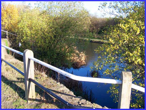
 About a hundred
yards from where the canal crosses the Nut Brook (see Part 4)
there is a widening of the canal on the western bank. This small
image (left) shows the widening from the towpath but the larger
view above is from the opposite side of the canal. The cause
of this widening can be accurately dated to the afternoon of
September 29th 1940. A lone Heinkel 111 dropped a bomb narrowly
missing the nearby casting plant and making a large crater in
the canal bank. Danny Corns, whose memories are the basis for
this series, was a witness to this as were many other local people.
Danny says, "We knew then that the war had arrived!" About a hundred
yards from where the canal crosses the Nut Brook (see Part 4)
there is a widening of the canal on the western bank. This small
image (left) shows the widening from the towpath but the larger
view above is from the opposite side of the canal. The cause
of this widening can be accurately dated to the afternoon of
September 29th 1940. A lone Heinkel 111 dropped a bomb narrowly
missing the nearby casting plant and making a large crater in
the canal bank. Danny Corns, whose memories are the basis for
this series, was a witness to this as were many other local people.
Danny says, "We knew then that the war had arrived!"
|
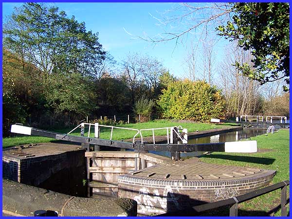
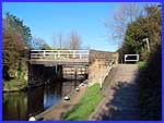
But returning to the towpath on the eastern bank the next point
of interest we reach marking the southern extremity of the Industrial
Trail is Stanton Lock. This was formerly called Whitehouse Junction
Lock and previously there were buildings on both sides of the
canal here. The grassed area in the centre of this picture was
the location of the lock house that was demolished in the 1960s.
A lock-keeper who lived here in the 1920s by the name of Joe
Trolley, later ran the Boys' Institute on Crompton Street while
an earlier lock-keeper's wife, Mrs Goodwin tragically drowned
in the canal in 1905.
|
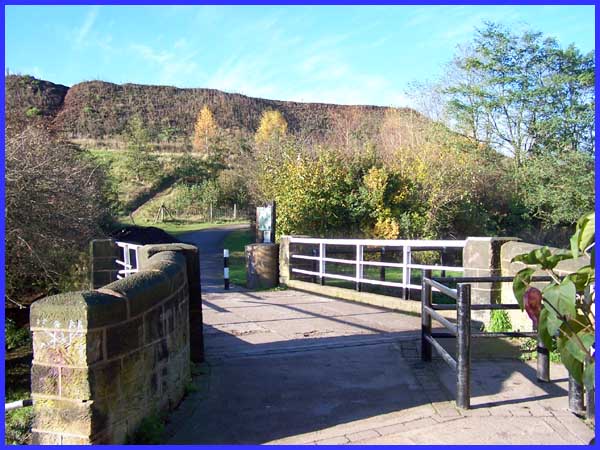
 Adjacent to
the lock is a bridge over the canal and this is where we pick
up the Nutbrook Trail which we will follow back towards Crompton
Road (formerly Street). The Nutbrook Trail is a nine mile pedestrian
and cycle route between Long Eaton and Shipley. The lock and
the lock house were for many years overshadowed by a giant cinder
tip created by the dumping of furnace slag. This was later used
for road building and other purposes but when iron working ceased
at Stanton, the remains of the tip were left in situ. Today the
tip is still there although nature is doing its best to claim
it back and give it a more natural look Adjacent to
the lock is a bridge over the canal and this is where we pick
up the Nutbrook Trail which we will follow back towards Crompton
Road (formerly Street). The Nutbrook Trail is a nine mile pedestrian
and cycle route between Long Eaton and Shipley. The lock and
the lock house were for many years overshadowed by a giant cinder
tip created by the dumping of furnace slag. This was later used
for road building and other purposes but when iron working ceased
at Stanton, the remains of the tip were left in situ. Today the
tip is still there although nature is doing its best to claim
it back and give it a more natural look
|
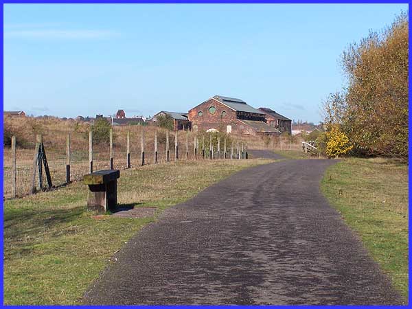
  At this point the Nutbrook Trail is
a wide tarmac path with grassy verges and has a number of wooden
benches providing a comparatively pleasant environment so different
to its industrial past. On a bitterly cold and windy November
day, it was no place to dally although I did pause for a few
photos. The buildings seen here were Big Shop and Butcher's Shop
in their heyday while to the left of them in the distance is
the tower of St Bartholomew's Church - this is a much changed
scene from bygone days. At this point the Nutbrook Trail is
a wide tarmac path with grassy verges and has a number of wooden
benches providing a comparatively pleasant environment so different
to its industrial past. On a bitterly cold and windy November
day, it was no place to dally although I did pause for a few
photos. The buildings seen here were Big Shop and Butcher's Shop
in their heyday while to the left of them in the distance is
the tower of St Bartholomew's Church - this is a much changed
scene from bygone days.
|
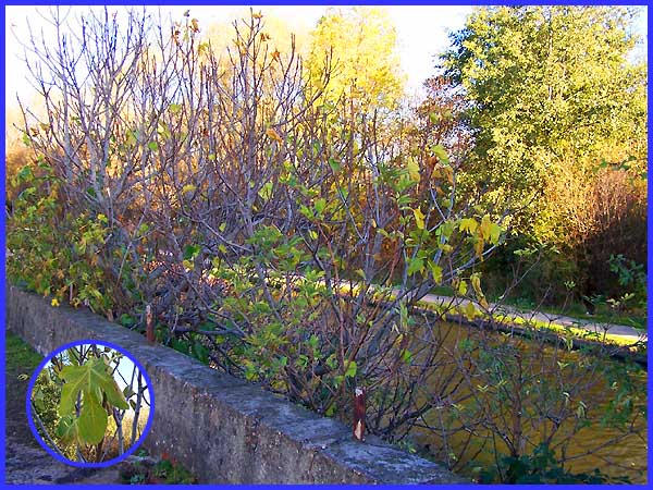
As we approach the buildings passing the bomb crater seen earlier,
the upper branches of a fig tree can be seen above the wall that
runs alongside the canal. The trail on this side of the canal
is a few feet higher than the towpath on the opposite side and
the tree appears to cling precariously to the wall, its trunk
emerging from a narrow strip of earth between the canal and the
wall.
|
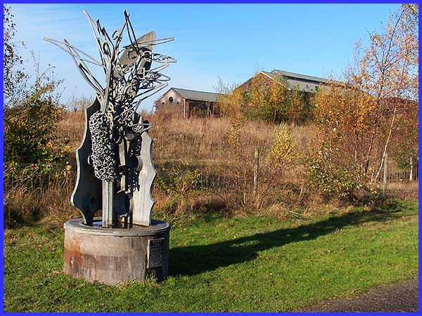
Near the fig tree at the side of the path is the Wild Weed Vetch
sculpture. This was produced by Hilary Cartmel and Michael Johnson,
metal work sculptors who have worked in partnership since 1985
and is one of three commissioned for the Nutbrook Trail. Because
of the area's iron making history this is surely a fitting and
appropriate place for a metal sculpture.
|

