Derby's Heritage Part 22 - It's All In The Names
w/e 30 October 2011
All this week's pictures were taken
with a Kodak DX6490
In the previous part we passed a number of streets
named after figures from the past significant in the history
of Derby and much of this part follows the same theme. A little
research into the street names can reveal a great deal of the
history and heritage of an area and even the naming of new thoroughfares
will contribute to the history for future generations to explore.
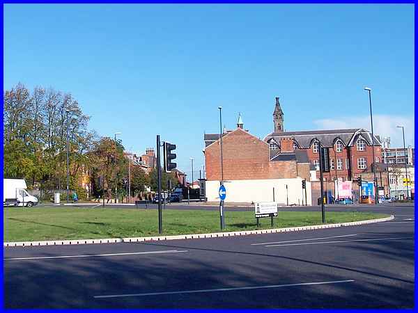
One such thoroughfare only recently completed has resulted in
a large new island named Mill Hill Corner being constructed.
To the left it has been named Mercian Way after the Regiment
that has evolved from the former Sherwood Foresters, well known
in these parts for recruiting members from Derbyshire and Nottinghamshire.
Green Lane (directly ahead) originally continued straight through
to Normanton Road which is the direction we will follow after
negotiating the new island by crossing Babington Lane (right)
and the continuation of the new road (immediately to the right).
|
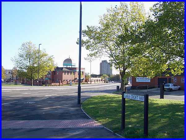
The new road continues through to Osmaston Road and is named
Lara Croft Way in honour of Core Design, the company that developed
the Tomb Raider computer game in 1995. Core Design was set up
in Derby in 1988 and was acquired by Eidos Interactive in 1996.
Although the company has gone through various acquisitions and
development work for further games in the series has been transferred
to America, it is fitting that the new road cutting a swathe
through this part of Derby is named after the cyber heroine who
has cut a swathe through not only the video games world but also
the film industry with Angelina Jolie in the title role.
|
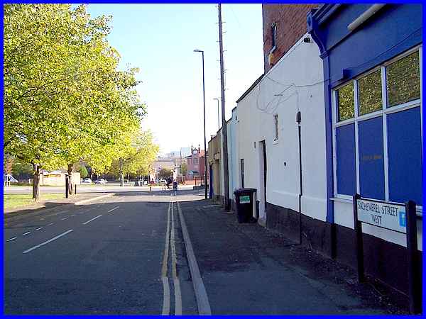
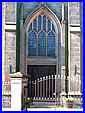
Lara Croft Way has bisected Sacheverel Street (above) and Wilmot
Street and each of these names has a story to tell. Sacheverel
Street took its name in 1831 from the ancient Derbyshire family
of Sacheverell who owned Babington House, Grounds of the house
were sold to enable the street to be built. Wilmot Street also
built in the grounds of Babington House was also named after
a Derbyshire family. Wilmots owned Osmaston House but the street
that carries their name owes its name to the branch of the family
that inherited Stainsby House at Smalley from the Sitwells. They
assumed that name in addition to their own and thus became associated
with Babington Hall.
|
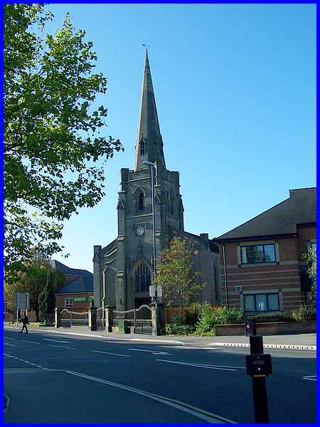
 Turning
our attention briefly to the other side of Normanton Road the
impressive features of a church form the most striking building
and an inscription in the stonework above the door (left) says
Christ Church with the date in Roman numerals of 1840. The spire
stands at 350 feet above sea level and the church was actually
built between 1838 and 1840 as part of St Werburgh's Parish by
Bridgart builders of Derby to architect Matthew Habershon's design.
Remaining as Turning
our attention briefly to the other side of Normanton Road the
impressive features of a church form the most striking building
and an inscription in the stonework above the door (left) says
Christ Church with the date in Roman numerals of 1840. The spire
stands at 350 feet above sea level and the church was actually
built between 1838 and 1840 as part of St Werburgh's Parish by
Bridgart builders of Derby to architect Matthew Habershon's design.
Remaining as 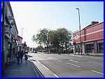 Christ
Church until 1976, it was designated a Grade II Listed Building
in 1998 and now serves the community as the Serbian Orthodox
Church of Apostles St Peter and St Paul. Christ
Church until 1976, it was designated a Grade II Listed Building
in 1998 and now serves the community as the Serbian Orthodox
Church of Apostles St Peter and St Paul.
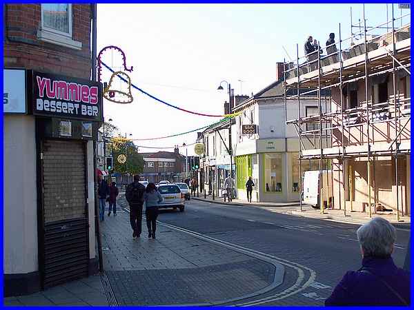
A little further along Normanton Road, a large store (right)
on the right at a crossroads confusingly has a large sign saying
"Mill Hill Corner" and the road off to the right is
the original Mill Hill Lane that took its name from a windmill
that records show was demolished in 1816.
|
The road opposite Mill Hill Lane at the crossroads
is Charnwood Street (centre below) and running parallel to it
and either side of it are Leopold St (below left) and Melbourne
St (below right). Before the construction of Lara Croft Way Leopold
Street and Charnwood Street were one way in opposite directions
to cope with the volume of traffic but they are now much quieter
with the new road truncating Leopold Street at the far end.
Each of the streets like the others already mentioned reveals
a history. Leopold Street was named after Queen Victoria's fourth
son Prince Leopold George Duncan Albert and dates from 1867 with
the first houses being built shortly afterwards. Charnwood Street
also first saw the light of day at the same time but owes its
name to Charnwood Forest in Leicestershire. Footpaths in both
streets were unadopted until 1877.
Melbourne Street too was unadopted in 1877 but had its origins
in the earlier Love Lane which dates from at least 1852 when
it was just a country lane popular with courting couples. The
original name therefore was perhaps descriptive until after the
death in 1871 of Alderman Robert Pegg, Mayor of Derby in 1855.
Alderman Pegg lived in Melbourne House which he named after his
birthplace in South Derbyshire and when the street was improved
taking in part of the grounds of the house it was renamed. It
was another resident of the village of Melbourne that lent his
name to the settlement that has grown to become the capital of
Victoria in Australia when it was named in 1837 after the British
Prime Minister William Lamb, the 2nd Viscount Melbourne.
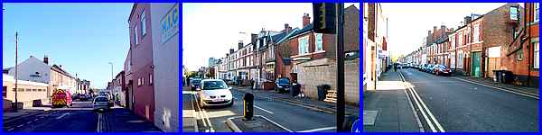
After crossing Melbourne Street there is another parallel road
running between the Normanton and Osmaston roads. This one again
dating from the mid 1870s is Hartington Street but while the
source of this name is known it has an interesting story associated
with it. It was originally intended to be named Harvey Street
although this name is the subject of some conjecture. The street
was lined with lime trees planted at the expense of the railway
contractor 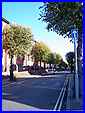 Alderman Sir Abraham
Woodiwiss who we came across earlier (Part 16) in The Strand where he financed
the culverting of Markeaton Brook. The name "Harvey"
does not appear to have any connection to the Woodiwiss family
but it is possible that it was selected as it was the middle
name of Sir Abraham's friend, William Harvey Whiston (1843-1922)
a solicitor and long standing member of the Liversage Charity.
The charity was responsible for another street in the area that
adopted the name of Whiston Street in his honour. Sir Abraham
built several properties in Hartington Street (right) and it
was eventually named after statesman Sir Henry Compton Cavendish,
Marquis of Hartington (1833-1908). Sir Henry later became the
8th Duke of Devonshire whose family seat is still in Derbyshire
at Chatsworth. Alderman Sir Abraham
Woodiwiss who we came across earlier (Part 16) in The Strand where he financed
the culverting of Markeaton Brook. The name "Harvey"
does not appear to have any connection to the Woodiwiss family
but it is possible that it was selected as it was the middle
name of Sir Abraham's friend, William Harvey Whiston (1843-1922)
a solicitor and long standing member of the Liversage Charity.
The charity was responsible for another street in the area that
adopted the name of Whiston Street in his honour. Sir Abraham
built several properties in Hartington Street (right) and it
was eventually named after statesman Sir Henry Compton Cavendish,
Marquis of Hartington (1833-1908). Sir Henry later became the
8th Duke of Devonshire whose family seat is still in Derbyshire
at Chatsworth.
So far we have looked into the history of the streets off Normanton
Road but this road follows the ancient route south towards Burton
via Normanton-by-Derby, hence the name. We are only following
Normanton Road as far as Grove Street seen here on the left but
from here on lights and decorations were visible across the road.
I believe that although these may be early for Christmas they
may also be part of Diwali celebrations, the Festival of Lights,
as the Normanton suburb of the city is home to many of Derby's
Asian communities.
|
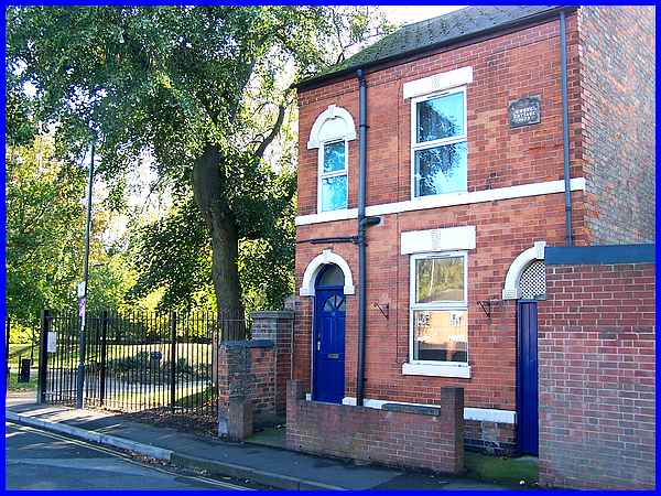
 Grove
Street is just a short street that was built in 1807 when houses
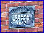
sold for just £40. Near the end of the street an engraved
stone built into the last house on the right shows that Grove
Cottage dates from much later in the century in 1875. The street
originally ran through to Osmaston Road but redevelopment has
curtailed that route for vehicles but not for foot traffic as
the road now leads to Derby Arboretum. The Arboretum has been
developed from a group of trees or grove that led to the naming
of the street when it was originally built by the Grove Street
Building Club. Grove
Street is just a short street that was built in 1807 when houses
sold for just £40. Near the end of the street an engraved
stone built into the last house on the right shows that Grove
Cottage dates from much later in the century in 1875. The street
originally ran through to Osmaston Road but redevelopment has
curtailed that route for vehicles but not for foot traffic as
the road now leads to Derby Arboretum. The Arboretum has been
developed from a group of trees or grove that led to the naming
of the street when it was originally built by the Grove Street
Building Club.
|
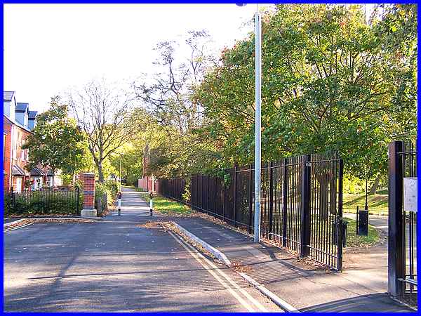
From here on until we reach Osmaston Road we will turn our attention
to the Arboretum which itself has a fascinating history. In this
view from outside Grove Cottage, we can see the new development
on the left that has curtailed the road, a footpath leading forward
towards Osmaston Road with the first entrance to the Arboretum
on the right. A second entrance can be seen further along the
footpath at the end of the railings also on the right.
|
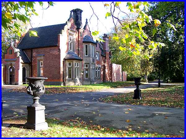
The second entrance is adjacent to Grove Lodge and it is from
here that guided walks around the Arboretum occasionally start
but leaflets are also available detailing a Tree Walk which can
be enjoyed at leisure. The lodge was designed by Edward Buckton
Lamb (1806–1869) an architect in the modern Gothic style.
In the next part we will explore more of the Arboretum.
|
