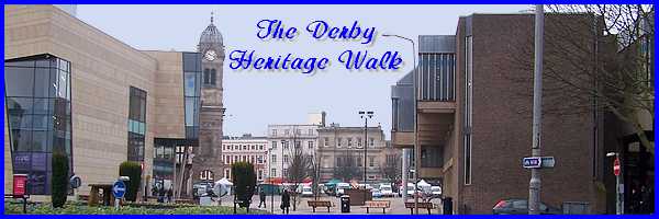
Derby's Heritage Part 18 - Corn Market to Victoria St
w/e 26 June 2011
All this week's pictures were taken
with a Kodak DX6490
Our walk so far in central Derby has involved much
toing and froing, down one street and up the next and the original
mediaeval layout means that as we begin our route south of the
Market Place in the street called Corn Market, we shall proceed
along St James's St only to return via Victoria Street to the
other end of the Corn Market in the next part. In this part however
we shall also touch once more on The Strand and The Wardwick,
two streets we have already set foot on previously.
 We'll
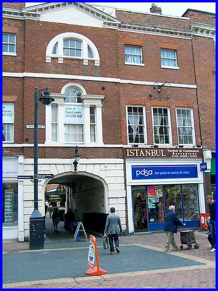
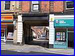
begin though in the Corn Market at the Grade II listed arch into
a yard that now also leads to the Market Hall, a place we shall
see much later in the walk. Most of the east side (left) of the
Corn Market was demolished in the 1960s together with a number
of adjoining yards but the yard that leads through to the Market
Hall survived the redevelopment. This yard is known as Lock-up
Yard but was previously called Tiger Yard after the Tiger Inn
that occupied the building at number 35 Corn Market. The building
around the arch probably designed by Joseph Pickford at numbers
37 and 38 was built for Heath's Bank about 1768. We'll
begin though in the Corn Market at the Grade II listed arch into
a yard that now also leads to the Market Hall, a place we shall
see much later in the walk. Most of the east side (left) of the
Corn Market was demolished in the 1960s together with a number
of adjoining yards but the yard that leads through to the Market
Hall survived the redevelopment. This yard is known as Lock-up
Yard but was previously called Tiger Yard after the Tiger Inn
that occupied the building at number 35 Corn Market. The building
around the arch probably designed by Joseph Pickford at numbers
37 and 38 was built for Heath's Bank about 1768.
|
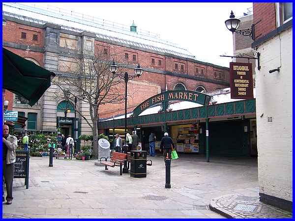
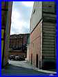
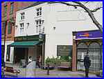 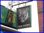 Passing through the archway into Lock-up
Yard, we find that the whole of the right hand side, sandwiched
between the Market Hall and the rear of the Istanbul Restaurant,
is Derby's Fish Market. Maps from the early part of the last
century label the far corner as the "Lock-up" but the
"Tiger" connection survives today in the name of the
Tiger Bar (left) and the inn sign (right) on the other side of
the yard. Passing through the archway into Lock-up
Yard, we find that the whole of the right hand side, sandwiched
between the Market Hall and the rear of the Istanbul Restaurant,
is Derby's Fish Market. Maps from the early part of the last
century label the far corner as the "Lock-up" but the
"Tiger" connection survives today in the name of the
Tiger Bar (left) and the inn sign (right) on the other side of
the yard.
|
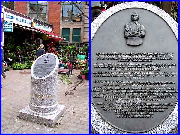
A more recent addition to the Lock-up Yard is a memorial to Steve Bloomer and the inscription reads as
follows:
"Steve Bloomer, the first king of English football goalscorers,
entered the 20th century with his fame as Derby County's outstanding
marksman already established.
As the next century beckoned - when this monument was erected
in 1996 - his Rams' all-games record of 332 goals was still unsurpassed.
His 353 Football League goals for Derby County and Middlesbrough
was a record until near his death in 1938 at 64.
Bloomer's 28 goals in 23 England games gave him a then unique
average of 1.21 per cap.
The son of a Midlands' blacksmith, Bloomer was a pupil at St
James' School in Derby. He was described as a 'Working Class
Hero' by Nottingham Trent University student Jonathan Belshaw
in his 1990's study of Victorian social changes.
The monument erected through the auction of Bloomer's England
caps, plus family contributions, has been presented to Derby
City Council by his descendants."
|
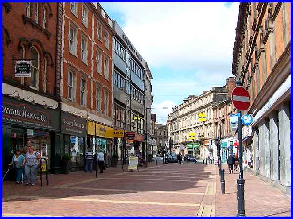
  Opposite
Lock-up Yard is St James's Street and this too has yards (left
and right) on each side. Recorded in 1250 as The Lane of St James
after a church it evolved to St James's Lane before adopting
its current name. A 1991 scheme to pedestrianise the town centre
included the eastern half of the street. Over a hundred years
earlier from 1869 to 1878 the whole street had been rebuilt and
widened by the Derby Hotel and Improvement Company, hardwood
setts being laid to reduce noise in 1874. Opposite
Lock-up Yard is St James's Street and this too has yards (left
and right) on each side. Recorded in 1250 as The Lane of St James
after a church it evolved to St James's Lane before adopting
its current name. A 1991 scheme to pedestrianise the town centre
included the eastern half of the street. Over a hundred years
earlier from 1869 to 1878 the whole street had been rebuilt and
widened by the Derby Hotel and Improvement Company, hardwood
setts being laid to reduce noise in 1874.
|
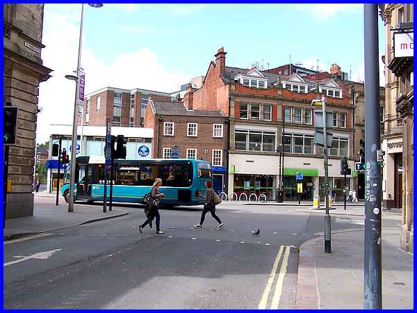
At the western end of St James's St a wooden bridge controlled
by monks who charged a toll to cross it led over the Markeaton
Brook into Brookside. Brookside was lost and incorporated into
Victoria Street to the left of the junction when the brook was
culverted in the 1830s. The two streets now seen to the right
at the road junction are The Strand and The Wardwick.
|
The Strand which we saw earlier from the far end after leaving
the museum was also built on the line of the culverted brook
in the 1870s, the foundation stone for buildings on east side
being laid in 1878 by Alderman Sir Henry Bemrose. The buildings
were designed by Giles & Brookhouse.
|
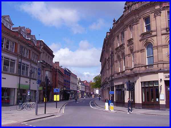
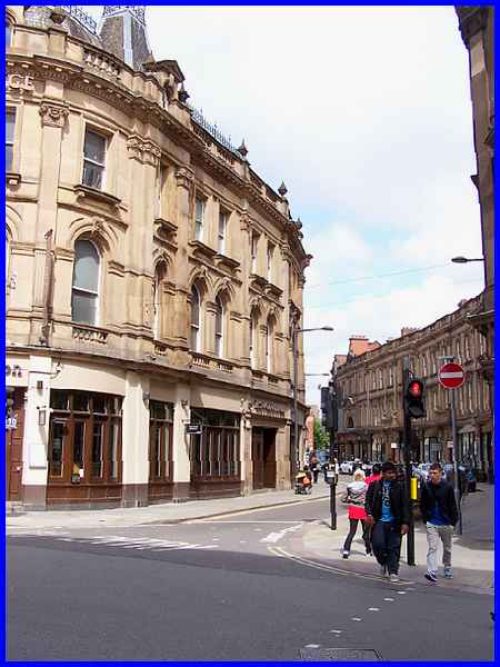
The Wardwick is the earliest street name to be on record in Derby
dating from 1085. Back then it was called Walwik Street which
is thought to have been derived from "wic" meaning
"market" and "Walda" the name of the possible
founder of a Saxon church in the area. In the centre of this
view is the Jacobean House that stands opposite the Central Library
both of which we saw earlier when we approached from Friar Gate
in the opposite direction. As I said earlier our route involves
a lot of toing and froing! The corner building on the right of
this image and also on the left of the previous image was originally
occupied by piano and organ merchants Edgar Horn, but later it
was the offices of the Refuge Assurance Company and is now the
Revolution Bar.
|
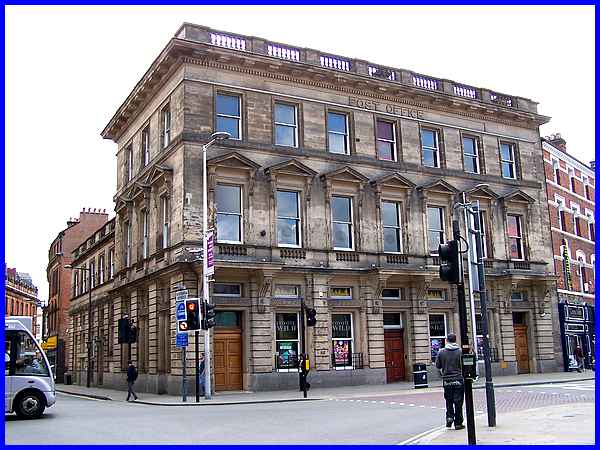
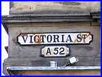 Another
bar, Coyote Wild, can be found in the impressive building on
the corner of St James's Street and Victoria Street despite the
name of "Post Office" to be seen high on the frontage.
Until 1997 this was the main central post office in Derby but
then it closed and moved to smaller offices in Victoria Street.
The building was first erected in 1865, and still carries a cast
iron nameplate for the street together with a similar one showing
the road identifier "A52" beneath (right) despite the
A52 now being rerouted around the city centre. Victoria Street
was completed in 1839 and named after the Queen who ascended
to the throne in 1837. Another
bar, Coyote Wild, can be found in the impressive building on
the corner of St James's Street and Victoria Street despite the
name of "Post Office" to be seen high on the frontage.
Until 1997 this was the main central post office in Derby but
then it closed and moved to smaller offices in Victoria Street.
The building was first erected in 1865, and still carries a cast
iron nameplate for the street together with a similar one showing
the road identifier "A52" beneath (right) despite the
A52 now being rerouted around the city centre. Victoria Street
was completed in 1839 and named after the Queen who ascended
to the throne in 1837.
In the next part we will follow Victoria Street back to Corn
Market where it also meets Albert Street but suffice it here
to say that Albert Street was completed in 1848 and named after
Victoria's husband, Prince Albert.
|
