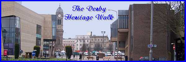
Derby's Heritage Part 07 - East Of The River
w/e 25 July 2010
All this week's pictures were taken
with a Kodak DX6490
The majority of the places already seen in this series
are mentioned in a "Derby Walks" leaflet available
from the Tourist Information Centre in the Market Place. They
feature in either the "Joseph Wright Walk", the "City
Circuit" or both and to paraphrase Eric Morecambe, my route
has visited all the right locations but not necessarily in the
right order.
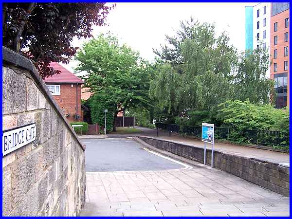
 We
now pick up a walk from another leaflet to investigate an area
that lies mainly to the east of the River Derwent in the Little
Chester area of the city. The leaflet describes a circular walk
and we join it about half way round outside St Mary's Catholic
Church on Bridge Gate. We will return here after completing the
circuit, again visiting places not necessarily in the right order,
but we begin by following the footpath (centre of the image above
and again in the thumbnail to the left) by the side of the ring
road. The leaflet titles the walk "Southern Gateway"
as it lies at the southern end of the Derwent Valley Mills World
Heritage Site. We
now pick up a walk from another leaflet to investigate an area
that lies mainly to the east of the River Derwent in the Little
Chester area of the city. The leaflet describes a circular walk
and we join it about half way round outside St Mary's Catholic
Church on Bridge Gate. We will return here after completing the
circuit, again visiting places not necessarily in the right order,
but we begin by following the footpath (centre of the image above
and again in the thumbnail to the left) by the side of the ring
road. The leaflet titles the walk "Southern Gateway"
as it lies at the southern end of the Derwent Valley Mills World
Heritage Site.
|
The footpath leads to Sowter Road near its junction with Duke
Street and directly ahead is the bridge over the river. The building
seen here at the end of the bridge houses an ancient chapel.
Two plaques on the side of the chapel read "Near this place
on 24th July 1588 Nicholas Garlick, Robert Ludlam, Richard Sympson,
Catholic Priests suffered martydom for their faith" and
"The 13th century chapel of St Mary on the Bridge, enlarged
about 1400AD was restored in 1930 by the Derbyshire Archaeological
Society as a memorial to Sir Alfred Haslam through the generosity
of his family." Derby became a centre of excellence for
engineering skills and Haslam a name well known for the manufacture
of refrigeration plants for use in ships and cold stores.
|
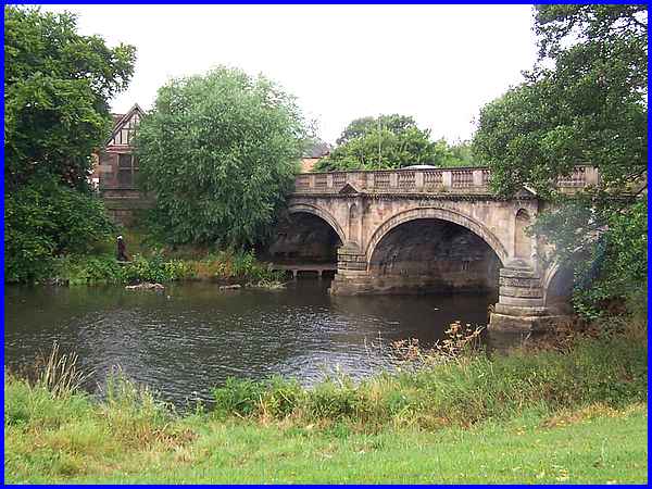
The chapel can be seen here from the opposite bank of the Derwent
which is crossed by a three arch bridge designed by Thomas Harrison
of Chester. One of the piers is carved with the date 1794 but
a bridge has spanned the river here since the 13th century and
a picture of 1728 shows a seven arch bridge. A toll was once
charged for crossing the bridge but a traffic census as industry
expanded in Derby was the forerunner to the bridge being replaced.
Today of course most of the traffic uses the ring road to the
left of this image from where drivers and passengers alike are
probably unaware of the river crossing.
A comparison between this image with a previous one taken in
2002 may be made by following this link to pages that contain more details
and images of both the outside and inside of the chapel.
|
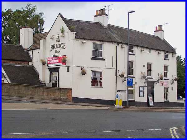
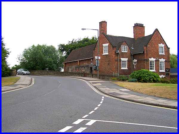
On the corner diagonally across the bridge from the chapel is
the Bridge Inn. Prior to the construction of the 1794 bridge
a miller called Mr Deveril had a shop and house here but the
bridge called for the demolition of the house and a new one was
built for him about 1790. By the middle of the 19th century the
house had become an inn and was a popular venue for regattas
on the river. By the 1940s the sporting focus had switched to
boxing and the Bridge Inn was home to the Derwent Amateur Boxing
Club.
|
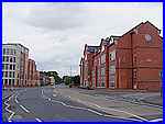 From the
Bridge Inn our route is now northwards along Mansfield Road (left)
and new buildings line the road at this point. The thumbnail
image shows some "modern" architecture on the left
but St James House on the right, completed in 1999, sympathetically
complements the surroundings. It stands close to Fox Street,
Fox being, like the aforementioned Haslam, another name highly
regarded in engineering circles. Fox Brothers made machine tools.
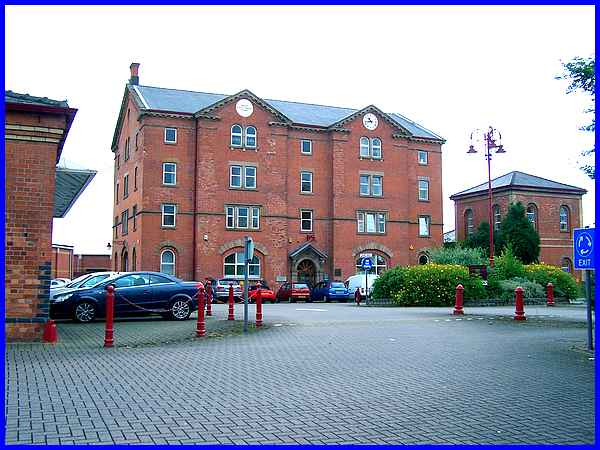
St James House is now occupied by the Derby City Mental Health
Department while St Katherine's House, a former grain warehouse
built in 1861 (above) houses the Coroners Office. From the
Bridge Inn our route is now northwards along Mansfield Road (left)
and new buildings line the road at this point. The thumbnail
image shows some "modern" architecture on the left
but St James House on the right, completed in 1999, sympathetically
complements the surroundings. It stands close to Fox Street,
Fox being, like the aforementioned Haslam, another name highly
regarded in engineering circles. Fox Brothers made machine tools.
St James House is now occupied by the Derby City Mental Health
Department while St Katherine's House, a former grain warehouse
built in 1861 (above) houses the Coroners Office.
|
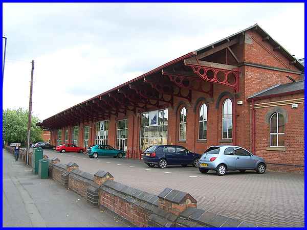
Following the onset of the railways in the 19th century, Derby
became an important "railway town" and had extensive
carriage and locomotive workshops. This cantilevered loading
bay also dating from about 1860 standing alongside St Katherine's
House along with other buildings on this side of Mansfield Road
were all part of St Mary's Railway Goods Wharf and although converted
for other uses, they are now all listed buildings. Derby's status
as a major railway town grew even more after 1844 when three
companies amalgamated to become the Midland Railway establishing
their headquarters in the town.
|
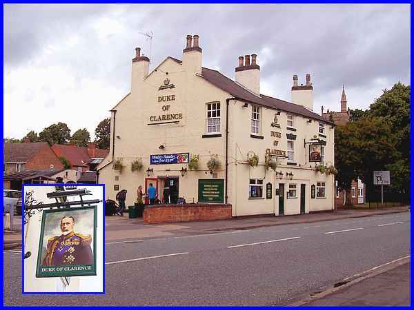
We shall come across a third name in the engineering world (Handyside)
who had premises in this area of the city in a later part but
our the leaflet now directs us past the Duke of Clarence pub
to St Paul's Church. With having already seen Duke Street, I
had expected there to be some relevance between the Duke of Clarence,
later to become King William IV, and Derby but I have yet to
find any significant connection.
|
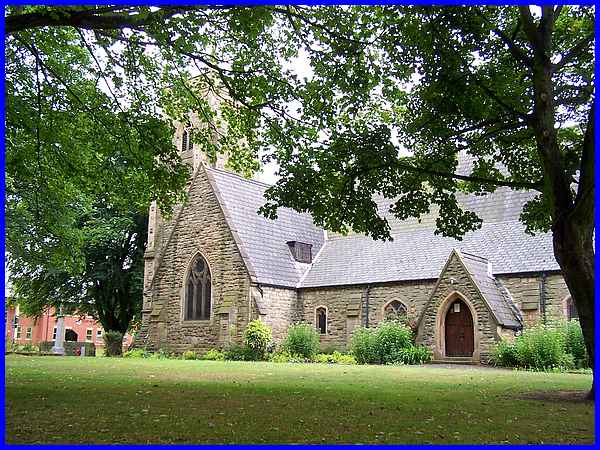
Trees between St Paul's Church and Mansfield Road made
it extremely difficult to capture a decent image from the front
so this one from the side, although still shielded by the leaves
on the trees shows more of the building. It was built in 1848
with locally quarried stone and cost £1,740. The church
was consecrated on 22 May 1850 by Rt Revd John Lonsdale, Bishop
of Lichfield. The church is also home to the Little Chester Heritage
Centre which is usually open free of charge on Sunday afternoons
during the summer months.
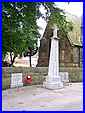 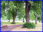 In front of the church is a war memorial
and although there is a plaque referring to the 1939-45 war the
inscription at the bottom of the main memorial (left) refers
to those who laid down their lives in the Great European War
of 1914-20 rather than the First World War of 1914-18 that I
had expected to see. Chester Green (right) to the north of the
church, a recreation area and one of the earliest public spaces
in Derby was created between 1882 and 1886 and is where we will
continue the walk in Part 08. In front of the church is a war memorial
and although there is a plaque referring to the 1939-45 war the
inscription at the bottom of the main memorial (left) refers
to those who laid down their lives in the Great European War
of 1914-20 rather than the First World War of 1914-18 that I
had expected to see. Chester Green (right) to the north of the
church, a recreation area and one of the earliest public spaces
in Derby was created between 1882 and 1886 and is where we will
continue the walk in Part 08.
|
