Shipley Park - Miller-Mundy
Memories
w/e 04 February 2007
All
this week's pictures were taken with a Kodak DX6490
Part 2 - To Harmer's Bridge
Following our introductory look at the four collieries owned
by the Miller-Mundy family in Part 1 we can now set off on our
walk around Shipley Country Park and in this part, we will head
off along the Nutbrook Trail 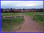 as far as as far as 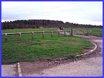 Harmer's Bridge noting some of the points
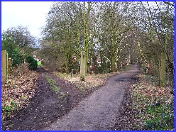
of interest and history along the way. A glance to the right
as we leave the car park (left) shows Cinderhill Coppice which
was planted up in 1976 on the former tip of Coppice Colliery.
We shall see this at closer quarters towards the conclusion of
the series but for now we must follow the downhill path (right)
towards the Country Park Tavern that can be seen on the Marlpool
housing estate. Harmer's Bridge noting some of the points
of interest and history along the way. A glance to the right
as we leave the car park (left) shows Cinderhill Coppice which
was planted up in 1976 on the former tip of Coppice Colliery.
We shall see this at closer quarters towards the conclusion of
the series but for now we must follow the downhill path (right)
towards the Country Park Tavern that can be seen on the Marlpool
housing estate.
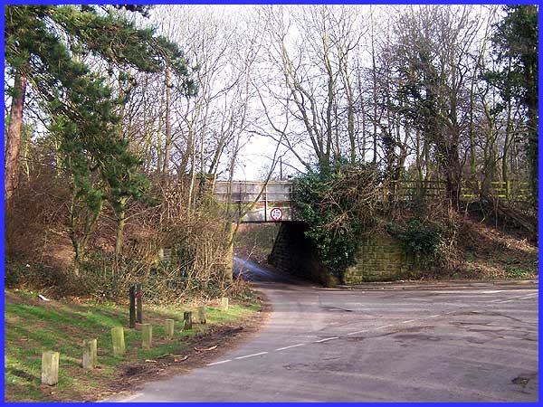
This path leads through to the housing estate but we must turn
right along the rear boundary of the Country Park Tavern at the
intersection with the Nutbrook Trail. The Trail here follows
the former route of the Great Northern Railway that opened in
1891. The passenger service closed in 1928 but the line was used
for the transportation of coal before finally closing in 1947.
Dr Beeching cannot be blamed for that one although the 1947 nationalisation
of the coal mining industry may have played a part.
|
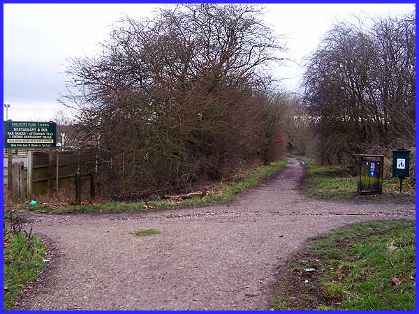
 Proceeding
along the Nutbrook Trail, we come to a number of concrete posts
either side of the track. The three in the image above and the
two in the small image left are fairly conspicuous but a sixth
is partially hidden in the trees and vegetation. All six were
erected to carry gates for this was the location of a level crossing.
The track off the the left in the picture above was the access
road from the Miller-Mundy's estate at Shipley to one of their
pits and it was here that it crossed the railway line. It now
provides a useful alternative access to both the Nutbrook Trail
and the Country Park for local residents. Proceeding
along the Nutbrook Trail, we come to a number of concrete posts
either side of the track. The three in the image above and the
two in the small image left are fairly conspicuous but a sixth
is partially hidden in the trees and vegetation. All six were
erected to carry gates for this was the location of a level crossing.
The track off the the left in the picture above was the access
road from the Miller-Mundy's estate at Shipley to one of their
pits and it was here that it crossed the railway line. It now
provides a useful alternative access to both the Nutbrook Trail
and the Country Park for local residents.
|
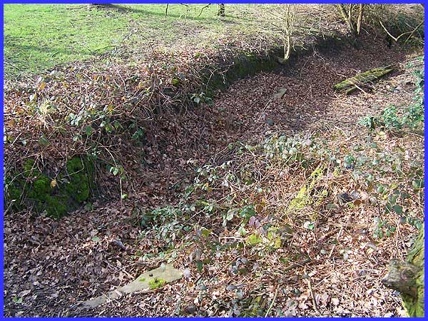
 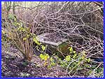 At this same location near the level crossing
(left) a ditch runs alongside the Nutbrook Trail and both wooden
and concrete sleepers from the railway can be found in it. They
are not immediately obvious to the unwary and fallen leaves and
creeping ground cover are doing their best to hide them altogether
(above). The same can also be said about the remains of the embankment
wall (right) nearby. At this same location near the level crossing
(left) a ditch runs alongside the Nutbrook Trail and both wooden
and concrete sleepers from the railway can be found in it. They
are not immediately obvious to the unwary and fallen leaves and
creeping ground cover are doing their best to hide them altogether
(above). The same can also be said about the remains of the embankment
wall (right) nearby.
|
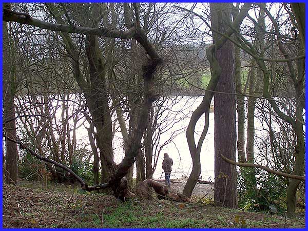
The Nutbrook Trail now runs along an embankment alongside the
expanse of water called Osborne's Pond and there are some very
pleasant views across the water. Osborne's Pond was built as
a feeder for the Nutbrook Canal construction of which started
in 1791. The four and a half mile long canal with thirteen locks
was opened in 1796 and Derbyshire's own Benjamin Outram was appointed
as the Consulting Engineer. Partially funded by Sir Henry Hunloke,
Bart. and E. M. Mundy, Esq. who owned the collieries at that
time, the canal costing £22,800 was built to transport
pottery, bricks and of course coal, to the Erewash Canal and
on to the Trent Valley routes.
|

A secondary footpath between the Nutbrook Trail and Osborne's
Pond runs by the water's edge and allows closer inspection of
some of the fishing platforms that have been constructed from
both the concrete and wooden sleepers from the old railway line.
By 1895 the railways had put paid to a lot of the canal transport
and the Nutbrook was mostly derelict but the Stanton to Erewash
section was still in use up until 1949. Even today water still
flows from Shipley Park to the Erewash Canal and part of the
original canal which was profitable for nearly a hundred years,
is still in water although it is no longer navigable.
|
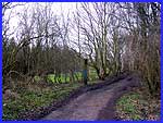
At the south-eastern extremity of Osborne's Pond, the Nutbrook
Trail crosses Harmer's Bridge. The 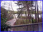 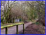 bridge is named after
a Mr Harmer who was a gamekeeper and came from a Norfolk family
in Cromer to live in a cottage here. Our route from here is to
continue along the Nutbrook Trail over the bridge (left) but
as we started this part with a glance to the right to see the
Cinderhill Coppice, so another look over our right shoulders
as we cross the bridge gives us another good view of Osborne's
Pond. bridge is named after
a Mr Harmer who was a gamekeeper and came from a Norfolk family
in Cromer to live in a cottage here. Our route from here is to
continue along the Nutbrook Trail over the bridge (left) but
as we started this part with a glance to the right to see the
Cinderhill Coppice, so another look over our right shoulders
as we cross the bridge gives us another good view of Osborne's
Pond.
Back to Part 1 -
Introduction & The Four Mines ------ Forward to Part 3 - Mainly About The Railway
Use the Quick Links below to access other pages.
|