Breadsall - Triangles
w/e 10 December 2017
All of this week's pictures were
taken with a Kodak DX6490
Breadsall is a small village just to the north of
Derby and four roads in the centre of the village are roughly
in the shape of a trapezium with a small triangular areas at
each of the four corners.
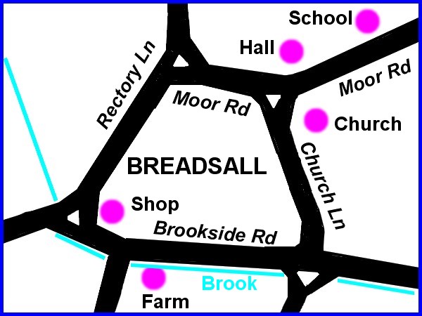
This sketch shows the four main roads, the triangular junctions
and the positions of some of the locations photographed.
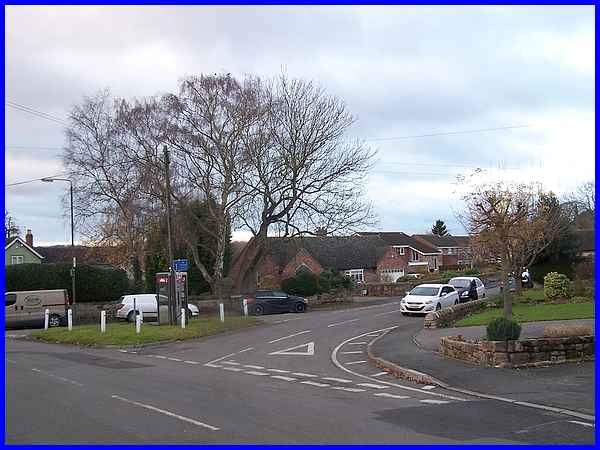
The first triangular island with a telephone kiosk in the middle
of it is at the junction of Rectory Lane (running left to right)
and Moor Road.
|
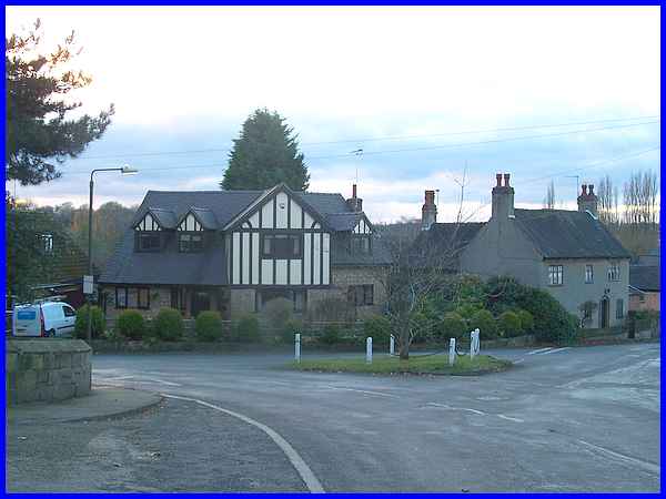
The second is the junction of Moor Road on the right with Church
Lane to the left with the entrance to the church itself on the
immediate left. The cottage on the right is called "Church
House".
|
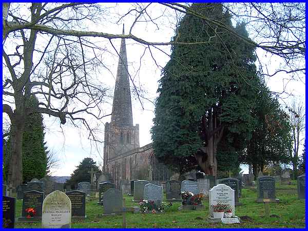
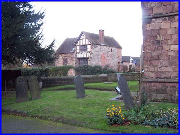
The Parish Church in Breadsall, All Saints, has parts that date
back many years and the oldest part in the South Door area is
believed to be from about 1150. The tower and chancel date from
the thirteenth century and further alterations and refurbishments
have been carried out as would be expected, over the years. Extensive
restoration took place in 1915/16 at a cost of about £11,000
following a fire thought to have been the work of militant suffragettes
that destroyed many ancient books.
|
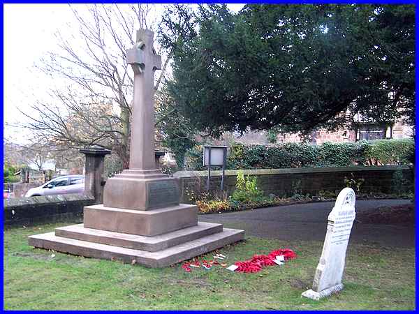
Breadsall's War Memorial, a Celtic Cross with Wheel, stands within
the churchyard at All Saints and records the names of those from
the village who gave their lives in the two World Wars.
|
Across Moor Road from the church and seen here from the churchyard
is the mediaeval Grade II* listed Old Hall. Formerly the residence
of the Harpur* family, it has served many purposes over the years
including that of a hunting lodge, school, public-house, shop,
rectory and village hall. Old maps from the 1880s and into the
next century show that it was the village Post Office.
*The Harpur-Crewe estate was founded in the early 1500s by Richard
Harpur who was a solicitor in London. One of his ancestors, Henry
Harpur married Lady Jane Crewe, and Heiress. The family seat
is at Calke Abbey, Melbourne, near Derby. (source BBC Domesday
Reloaded)
|
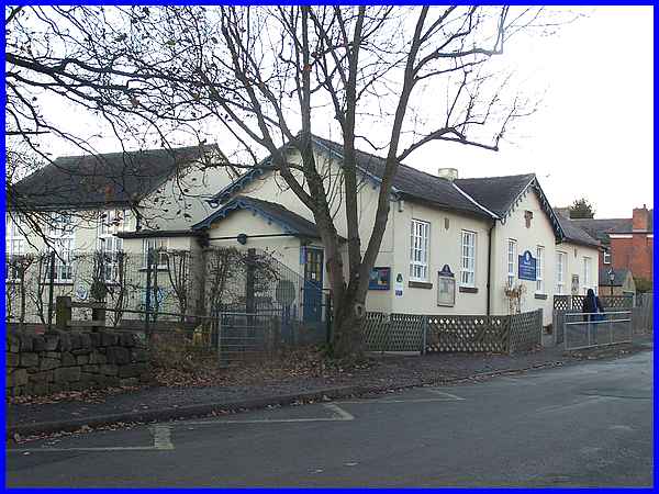
Also standing on Moor Road is the Church of England Primary School
. Sir John Harpur-Crewe, (1824 - 1886) who served as the High
Sheriff of Derbyshire in 1853 financed the building of the school
which was built by George Crewe in 1837.
|
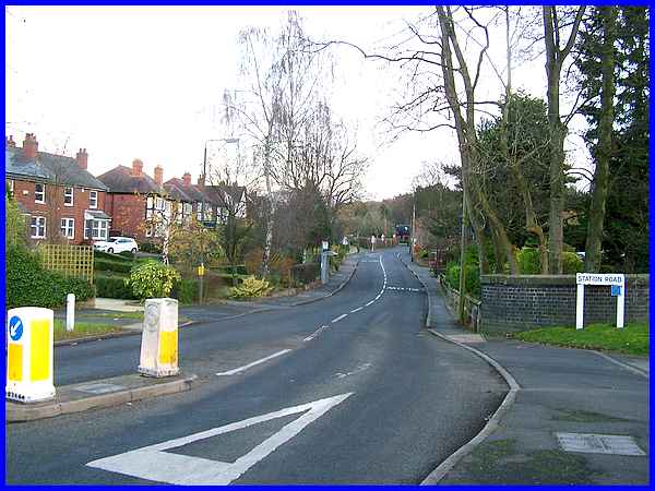
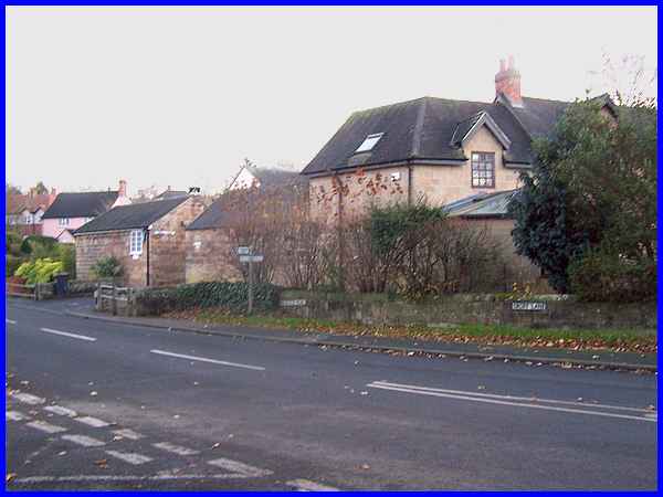
Another triangular area separates Station Road (right) from Brookside
Road with Church Lane joining the junction from the left.
|
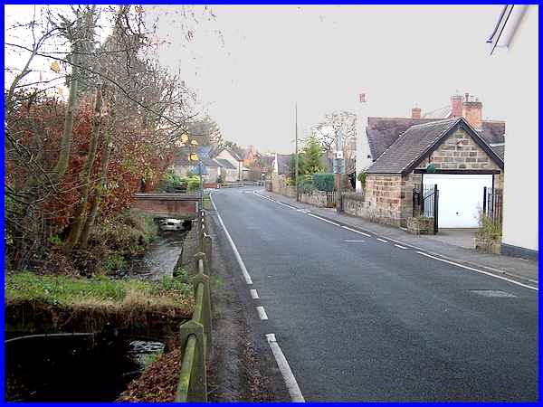
In the opposite direction along Brookside Road the left hand
side is flanked by Dam Brook, an ancient water course crossed
now by a number of small bridges giving access to the properties
on this side of the road.
|
At Brookfields Farm (now redeveloped as Osborne Court) opposite
Brookside Road's junction with Rectory Road, Dam Brook passes
under the road in a culvert before heading off towards Little
Eaton.
|
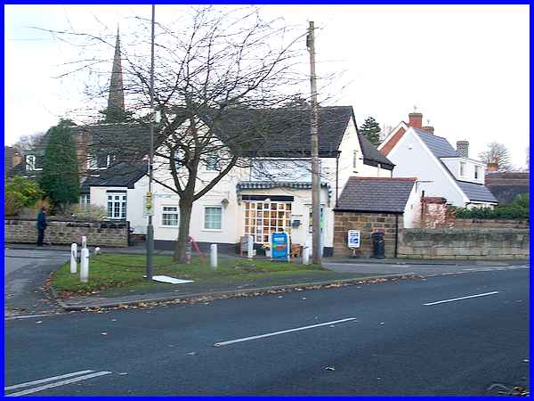
It's at that same junction there is yet another triangular area
overlooked by the Village Shop with the spire of All Saints clearly
visible behind. The shop made the news in July 2012 when the
brook overflowed following heavy rain causing extensive flooding
in the village. Although some people may have got lost around
the Breadsall triangles and even though the village was in the
news, I don't think, unlike the Bermuda Triangle, anyone has
actually disappeared here .... yet!
|
