Ilkeston - Views From A Bridge
w/e 24 November 2013
All this week's pictures were taken
with a Kodak DX6490
Many images on this site can be replicated on Google's
Street View and they have even now started a project on the towpaths
of canals. Others though are difficult to reproduce on Street
View such as this selection of "Views From A Bridge"
in Ilkeston.
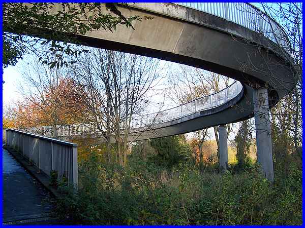
The bridge in question is the pedestrian footbridge that crosses
Chalons Way near its southern end. Whichever way you approach
it, it spirals up on one side and circles down on the other.
Whilst we regularly cross the bridge in the course of a week
in both directions, on this occasion we approached from the eastern
side on our way towards the town centre.
|
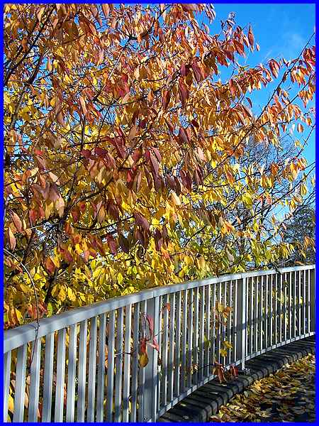
Shrubs and trees grow profusely at both sides of
Chalons Way and at times enshroud the path making it almost tunnel-like
but at this time of year as the leaves begin to change colour
and drop the the ground the rise of the path takes us up to the
higher branches of the trees and open up more extensive views.
|
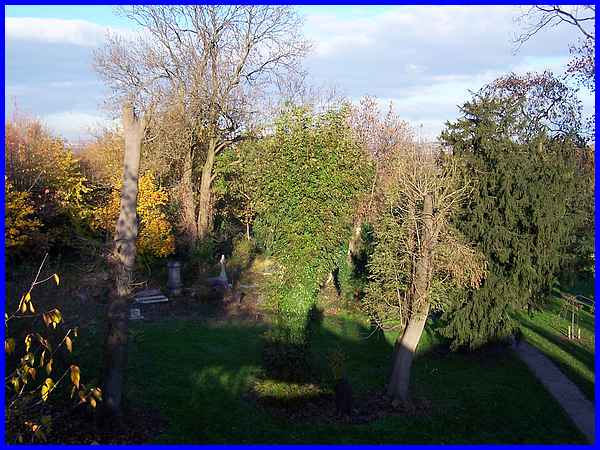
One of those views is over the old grave yard where with the
falling of the leaves some of the trees are showing signs of
some quite severe pruning. When Chalons Way was built, it clipped
the corner of the grave yard and although some of the headstones
are still in their original positions, there are some wide open
spaces and other headstones have been moved to the perimeter
wall.
|
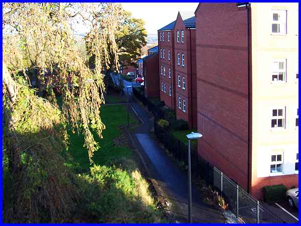
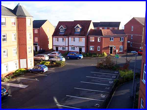
A path runs down the edge of the grave yard but the wall that
stood here which was familiar to many former pupils of Hallcroft
School (later Cantelupe) has been demolished. The schools too
have gone to be replaced by a housing estate. The path leads
to Vincent Avenue and when I was a pupil at Hallcroft, there
were two entrances from the path, one for boys and one for girls.
|
There were two main blocks at Hallcroft School separated by a
high wall. This view from the bridge is towards where the girls'
block stood but all signs of it have disappeared from all but
the memory.
|
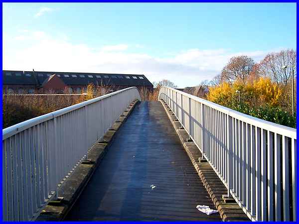
As the bridge straightens out it continues to rise to the high
point over the centre of the Chalons Way dual carriageway.
|
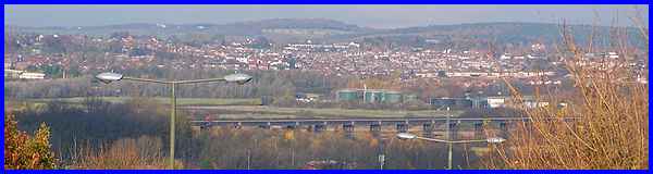
From close to that high point the view north along the Erewash
Valley shows the Bennerley Viaduct crossing the valley and beyond
that is first Newthorpe and then Eastwood, birthplace of D. H.
Lawrence. Notice the street lamps denoting the line of Chalons
Way.
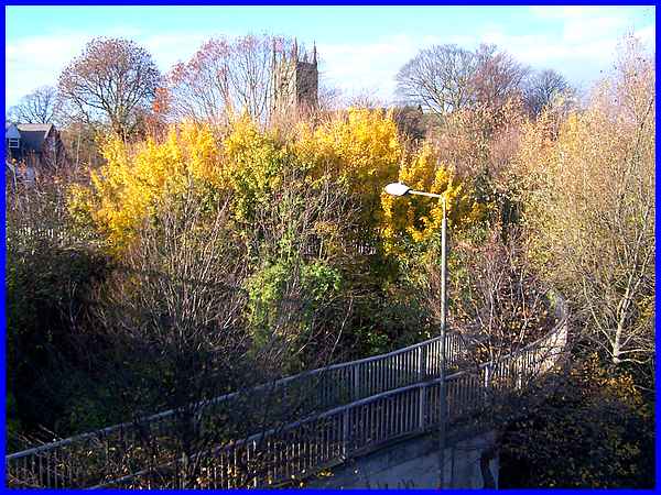
Before Hallcroft Schools were built, there was a similar block
which stood roughly where the bridge descends on the western
side of Chalons Way. This block was the St Mary's Schoolrooms
and by the time I attended Hallcroft, our gym was in one of those
rooms. The site of the sand pit where we practised long and high
jumps and the land where we put the shot and threw javelins has
all disappeared under the bridge and the new road but the footpath
through the churchyard that we followed when attending special
events in St Mary's church is still there but no longer accessible
from this side. The church tower however is visible and more
of the church will appear as more leaves fall from the trees.
|
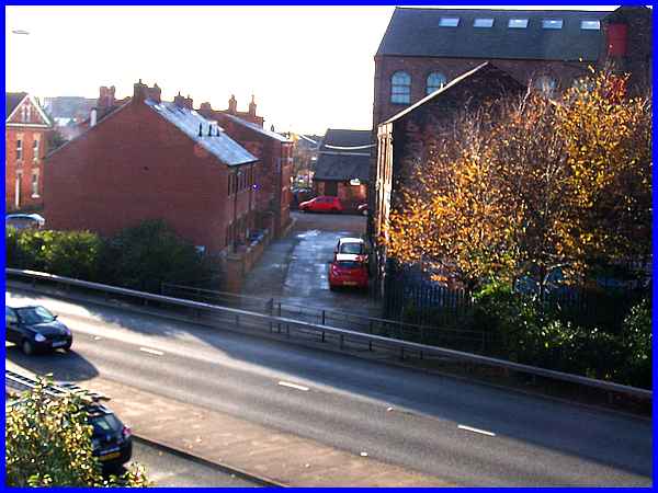
The entrance to the schoolrooms was off Hallcroft Road right
where Chalons Way cuts through. Hallcroft Road originally led
to the footpath we saw earlier to Vincent Avenue and the footbridge
now maintains the link. The terrace of cottages on the left of
Hallcroft Road is a fairly new construction but the building
at the end also on the left and on the corner of Market Street
used to be the Anchor Inn but it has now been converted into
flats. The houses on the extreme left are on Derby Street which
provided another access to the girls' school. Construction of
Chalons Way necessitated the demolition of some properties on
Derby Street. The large building fronting on to Market Street
on the right of the picture was the Rutland Garments factory.
|
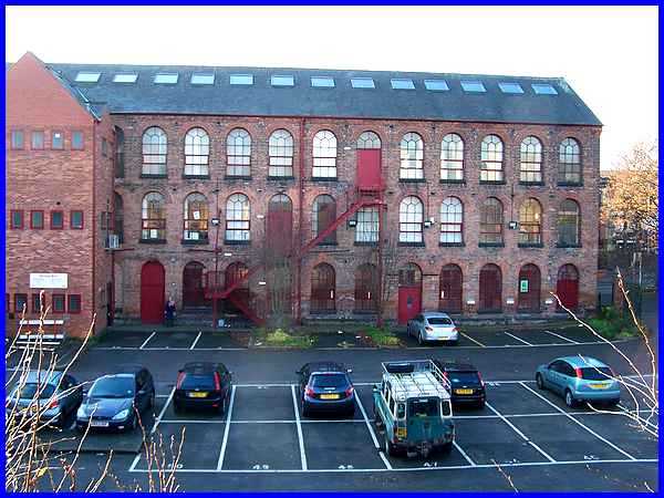
Large letters on the front of the building spell out "Rutland
Mills" but the building now contains office space although
part of it that was used as a snooker hall has recently closed.
From the bridge the view of the rear of the building is across
the private car park.
|
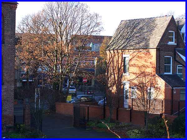
To reach the Market Place from the bridge means walking along
Hallcroft Road and in front of the Rutland Mills but we can actually
see the Cenotaph on the Market from the bridge between the Mills
and the properties at the end of Market Street.
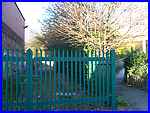  Leaving the bridge and turning into Hallcroft
Road, green gates (left) now bar the track that ran between the
Mills and St Mary's Schoolrooms. It is almost unrecognisable
now from my schooldays as is the view to the east over Chalons
Way towards Cossall and Swingate where a wind turbine (right)
spinning on the ridge is another recent addition to the landscape.
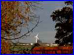
Of such things is progress. Leaving the bridge and turning into Hallcroft
Road, green gates (left) now bar the track that ran between the
Mills and St Mary's Schoolrooms. It is almost unrecognisable
now from my schooldays as is the view to the east over Chalons
Way towards Cossall and Swingate where a wind turbine (right)
spinning on the ridge is another recent addition to the landscape.
Of such things is progress.
|
