Ashleyhay - Alport Heights
w/e 01 August 2010
All this week's pictures were taken
with a Kodak DX6490
 A couple
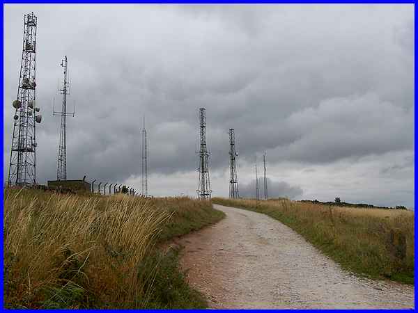
of miles from Wirksworth and not a great deal further from Belper
the high ground of Alport Heights is visible from miles around
but even more so since the communications masts that now number
seven were erected. Nine acres of land near the summit adjacent
to but not including the land occupied by the masts, were acquired
by the National Trust in 1930 and became the first acquisition
by the Trust of a scenic nature in Derbyshire. Access to the
Trust land is free of charge and on arrival we opted for the
lower of the two car parks but later followed this track (above)
to the second area near the masts. Alport Heights is a popular
picnic site and also on the hill is a motocross circuit. A couple
of miles from Wirksworth and not a great deal further from Belper
the high ground of Alport Heights is visible from miles around
but even more so since the communications masts that now number
seven were erected. Nine acres of land near the summit adjacent
to but not including the land occupied by the masts, were acquired
by the National Trust in 1930 and became the first acquisition
by the Trust of a scenic nature in Derbyshire. Access to the
Trust land is free of charge and on arrival we opted for the
lower of the two car parks but later followed this track (above)
to the second area near the masts. Alport Heights is a popular
picnic site and also on the hill is a motocross circuit.
|
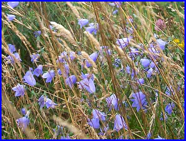
We had approached Alport Heights from the direction of Ambergate
along many narrow single track lanes lined with wildflowers and
a pretty little bell-shaped variety resembling bluebells and
probably part of the campanula family could be seen in abundance
all over the area. These were pictured along the track to the
car park among the thistles and the grasses.
|
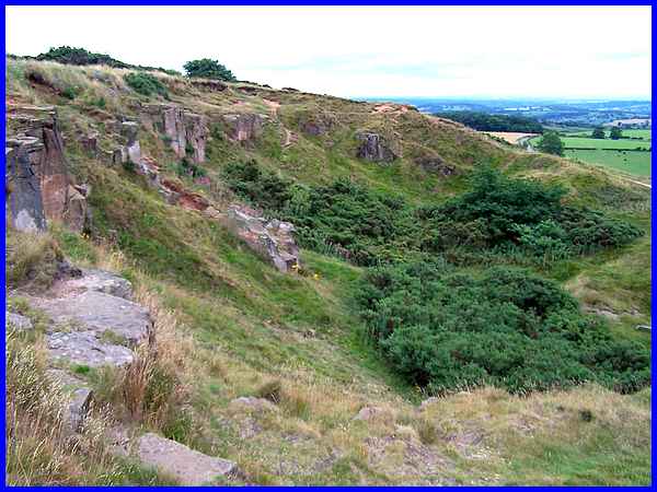
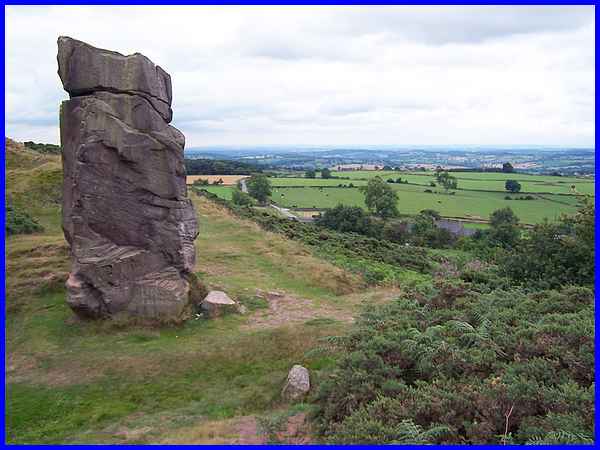
The car park sits above an old quarry and as the hill stands
over 1,000 ft (300 m) high there are extensive views especially
to the south - one of the attractions of the location. This view
over the quarry from just below the car park however is towards
the southeast.
|
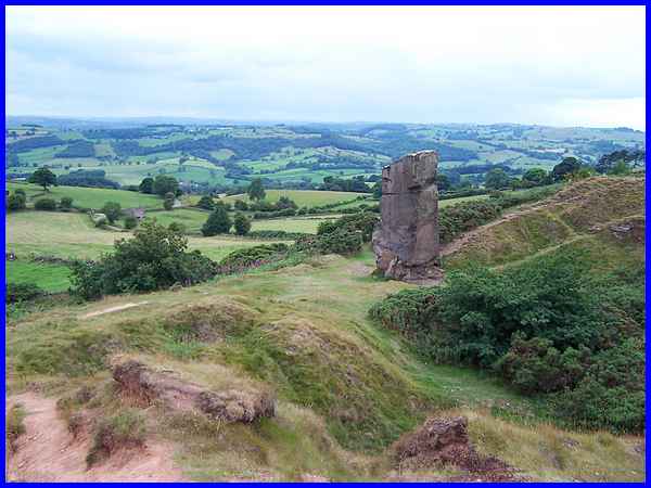
From the other side of the quarry and a little higher up the
landscape of the rolling countryside stretches out to the south
and the west. It is said that on a clear day it is not only possible
to see Derby from here but also as far away as The Wrekin and
the Malvern Hills but from all angles the eye is always drawn
to the stone pillar in the foreground.
|
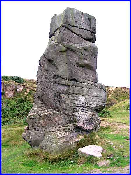
The pillar is the Alport Stone and is not a natural formation
but a result of the quarrying activities. It seems that graffiti
is not a modern phenomenon as a carving near the top of the stone
saying "G Waterfield 1883" can easily be made out.
To add some sort of scale to the stone, three men of average
height one on top of another would still fall short of its 20
ft top. The stone has gained recognition as a training ground
for prospective climbers having three or four recognised routes
up it. I'm just content to admire its setting!
|
There are three Alports in Derbyshire - a village near Youlgreave,
Alport Moor in the High Peak and Alport Heights - and all three
are connected by an ancient prehistoric track called the Portway.
From the Anglo-Saxon "Port-weg" where "port"
meant "market town" the Portway was "the road
to the market". Even in those days, the trading route was
old and the name Auld-Port (Old market town) gave rise to Alport
for significant places on the way.
|
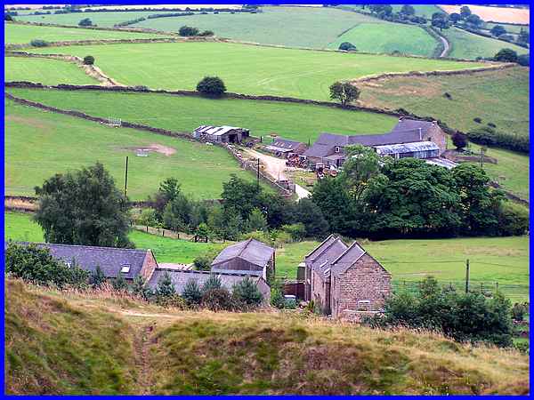
In his book "The Derbyshire Portway, Pilgrimage to the Past
- a walking guide" Stephen Bailey traces a forty five mile
route from just over the Nottinghamshire border at the Hemlock
Stone to Mam Tor near Castleton in the north of Derbyshire. A
review of the book says that the route is along quiet lanes through
some of Derbyshire's most delightful scenery and that Ashleyhay
is a picturesque little hamlet comprised mainly of farms. Zooming
down from the heights this image confirms that point of view.
|
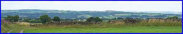
Before leaving the Heights we went up to the higher car park
near the masts where there were extensive views to the north
although perhaps not with the same impact as those over the quarry
site. One feature did stand out though to the right of centre
in this panoramic view.
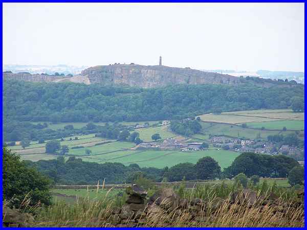
Again applying the zoom on the camera the feature was revealed
as the Sherwood Foresters Regimental Memorial at Crich also known
as Crich
Stand which like Alport Heights stands at over 1000 ft above
sea level.
|
