Bagthorpe - A Hidden Valley
w/e 17 August 2008
All this week's pictures were taken
with a Kodak DX6490
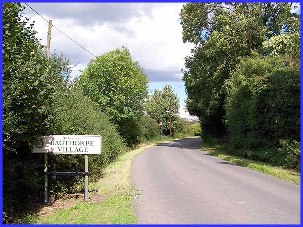
Ashfield District Council are proud of their links to Lord Byron
and D. H. Lawrence and promote an undulating expanse of countryside
under their jurisdiction to the north of Nottingham as the "Hidden
Valleys". The Council says that "the area boasts a
fascinating historical and literary heritage" and in one
of those hidden valleys lies the village of Bagthorpe where we
shall explore some of that heritage. This sign for the village
is at a high point just before the road drops down into the valley.
|
The village is a linear settlement running in a generally west
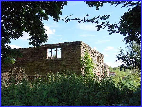
to east orientation and just inside the western boundary is the
first of that historical heritage for this is the site of Wansley
Hall. Although difficult to access to photograph, the ruins are
all that remain of a Norman Manor House that dates from about
1200AD. In the Domesday Book of 1086 the manor of Wandeslie,
as it was then known, was owned by a Saxon but it was given to
one of William the Conqueror's Norman followers and was rebuilt
and fortified. By 1279 the house was owned by the Norman, Sir
Ranulph (or Ralph) de Wandesley. In the 1830s the hall was being
used as a farm and was occupied by a Mr. E.Maltby and it was
about this time (1830) that an urn full of silver coins was found
nearby. From the 1940s onwards it has been left unoccupied and
open to the elements but is now designated as an ancient monument.
It is to be hoped that this status will prevent further deterioration.
|
Next to Wansley Hall stood a tithe barn that would have been
used to store farm produce paid by the serfs to the Lord of the
Manor in earlier times. The barn was constructed in the sixteenth
or seventeenth century but was restored and sympathetically converted
into two houses in 1980.
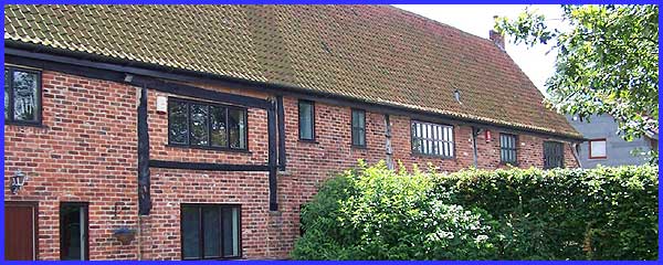
Again, like the Hall, the barn is difficult to photograph from
the road and not wanting to intrude too much on the owners' privacy
this was about the best shot I could get of what is now a Grade
II listed building.
|
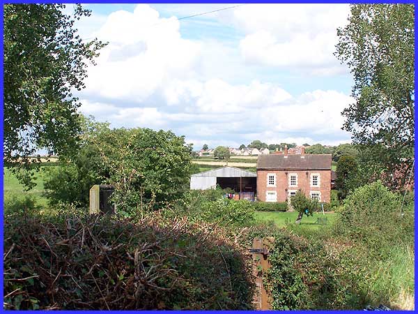
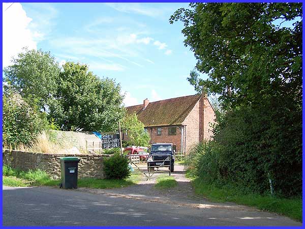
As we descend the hill towards Lower Bagthorpe, another Grade
II listed building comes into view. This is the Manor Farmhouse
which dates from the late eighteenth century and was once a working
mill with a water wheel.
The mill was powered by Bagthorpe Brook which at this point is
on the northern side of the road.
|
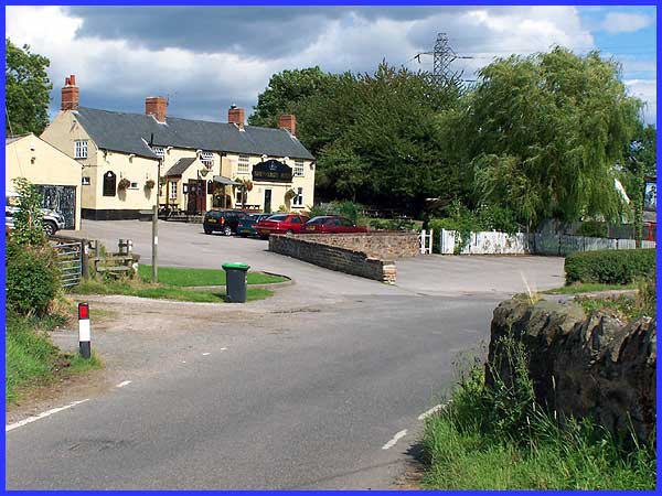
As we reach the bottom of the valley however the brook has passed
under the road and at the access gate to Manor Farm (on the left
of this image) it is on the southern side. Of far more interest
to most who travel this road though would be the Shepherds Rest
where I am led to believe good food and real ale are on offer.
|
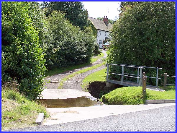
 The brook
continues along the side the road (left) for almost all of the
rest of the village and is crossed by a number of small footbridges
and at least a couple of fords like this one above to Brookside
Farm. The majority of the properties in this section of the village
are on the other side of the road though but there are plenty
of The brook
continues along the side the road (left) for almost all of the
rest of the village and is crossed by a number of small footbridges
and at least a couple of fords like this one above to Brookside
Farm. The majority of the properties in this section of the village
are on the other side of the road though but there are plenty
of 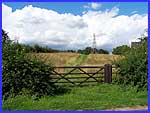 views between the
houses to open fields (right) some of which form the Bagthorpe
Meadows Sites of Special Scientific Interest. views between the
houses to open fields (right) some of which form the Bagthorpe
Meadows Sites of Special Scientific Interest.
The long narrow fields are thought to have originated by the
enclosure of strips allocated to tenants living in the village
during the tenth or eleventh centuries but another school of
thought leans towards the field patterns evolving between the
fifteenth and early eighteenth centuries as early piecemeal development
of enclosures.
|
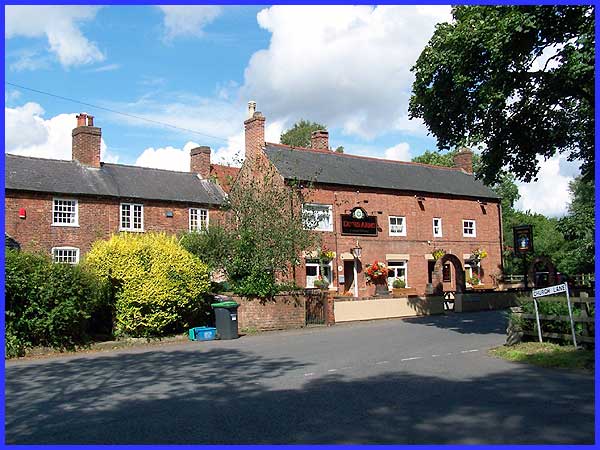
Continuing through the village we now reach the junction with
Church Lane which leads up into Underwood. Here is the second
of the village's three pubs, The Dixies Arms where once again
there are a variety of real ales to be tasted. Local folklore
suggests D. H. Lawrence's father drank here. The third pub is
the seventeenth century Red Lion (not pictured) which is on Church
Lane which once again has a reputation for good food and real
ale. Almost all of the village is within the Bagthorpe Conservation
Area which has benefitted from a lack of modern development and
the retention of grass verges without kerbs and pavements. Traditional
architectural features such as original chimney stacks and sash
windows among others only add to the charm of the village.
|
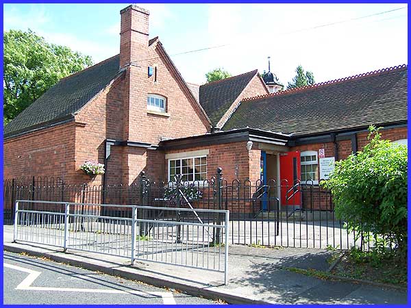
 As we near the
eastern end of the village, one of the last buildings within
the Conservation Area is the Selston Bagthorpe Primary School.
The name suggests that the capture area for the school now includes
neighbouring Selston as the school appears to be far too big
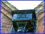
just for the children of Bagthorpe. Back in 1912 however when
the school was built as evidenced by the date on the ironwork
on the building (left) and families were much larger, it may
have been a different story. So that's Bagthorpe and I'll let
you decide whether it lives up to the Council claim that the
area boasts a fascinating historical and literary heritage. As we near the
eastern end of the village, one of the last buildings within
the Conservation Area is the Selston Bagthorpe Primary School.
The name suggests that the capture area for the school now includes
neighbouring Selston as the school appears to be far too big
just for the children of Bagthorpe. Back in 1912 however when
the school was built as evidenced by the date on the ironwork
on the building (left) and families were much larger, it may
have been a different story. So that's Bagthorpe and I'll let
you decide whether it lives up to the Council claim that the
area boasts a fascinating historical and literary heritage.
|
