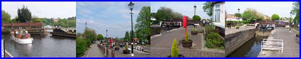
Beeston Rylands -
On The Waterfront
w/e 29 April 2007
All
this week's pictures were taken with a Kodak DX6490
 It's a fair
few years since my work took me down to the River Trent and the
Beeston Canal at Beeston Rylands and at that time there was only
a tatty caravan park, a dusty housing estate being constructed
during a dry summer and, in a cold, wet winter, a muddy towpath
leading to a rugby club. Now the caravan park is a pleasant mobile
home facility, the housing estate has matured and the canal bank
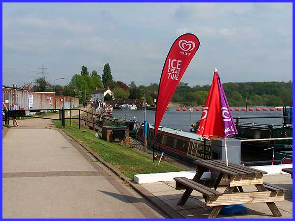
has been nicely landscaped. This look at the Beeston Waterfront
starts at the Marina where a pub, a cafe and a small shop adjacent
to the mobile homes at the side of the Trent are accessible to
both local residents and river traffic visitors. It's a fair
few years since my work took me down to the River Trent and the
Beeston Canal at Beeston Rylands and at that time there was only
a tatty caravan park, a dusty housing estate being constructed
during a dry summer and, in a cold, wet winter, a muddy towpath
leading to a rugby club. Now the caravan park is a pleasant mobile
home facility, the housing estate has matured and the canal bank
has been nicely landscaped. This look at the Beeston Waterfront
starts at the Marina where a pub, a cafe and a small shop adjacent
to the mobile homes at the side of the Trent are accessible to
both local residents and river traffic visitors.
|
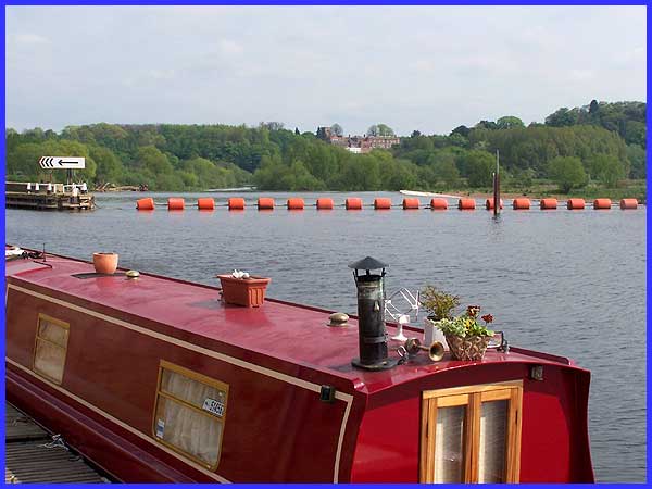
 The river traffic
here, heading downstream towards Nottingham is prevented from
progressing along the meandering river by means the floating
orange barrier strung out across the river. Boats are diverted
to the left into the Beeston Canal - or as it was originally
called when it opened in 1796, the Beeston Cut - the reason being
the weir just beyond the barrier (see left). The buildings seen
in the distance among the trees on the other side of the river
are at Clifton which, like Beeston and several more small towns
and villages, has grown from small beginnings to be part of the
conurbation of what is now the City of Nottingham. The river traffic
here, heading downstream towards Nottingham is prevented from
progressing along the meandering river by means the floating
orange barrier strung out across the river. Boats are diverted
to the left into the Beeston Canal - or as it was originally
called when it opened in 1796, the Beeston Cut - the reason being
the weir just beyond the barrier (see left). The buildings seen
in the distance among the trees on the other side of the river
are at Clifton which, like Beeston and several more small towns
and villages, has grown from small beginnings to be part of the
conurbation of what is now the City of Nottingham.
|
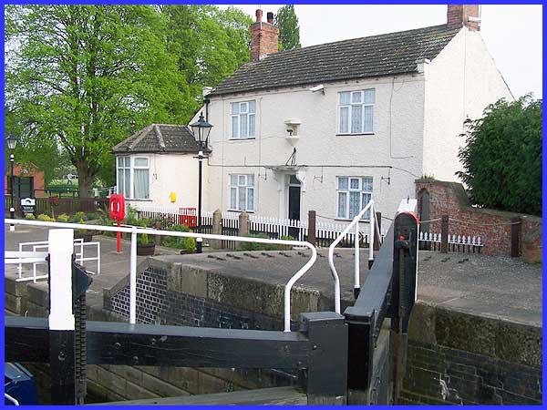
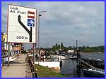
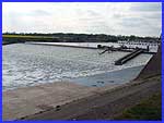
The boats enter the Beeston Canal (below left) via the Beeston
Lock which is overlooked by the lock keeper's cottage (above).
The other images immediately below show views of the lock taken
from both sides of the canal.
|
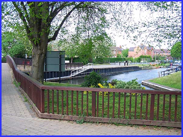
This bridge seen here on the left over the canal leads to some
playing fields and also to a good viewing point of the weir (see
the small image higher up this page). The bridge also offers
a pleasant view along the canal itself and from here at the side
of the lock keeper's cottage, the entrance to a side lock is
just visible on the right and above the fence. This side lock
once allowed boats to return to the Trent just below the weir
but is no longer in use save for a couple of narrow boats that
appear to be permanently anchored there. The road beyond the
gate near the centre of the image is called, appropriately enough,
Canal Side.
|
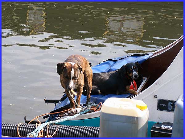
Many of the narrow boats and other craft moored along Canal Side
appear to be permanent fixtures but despite the now pleasant
surroundings, this pair of sea dogs (pun intended) did not appear
to be too happy with their lot.
|
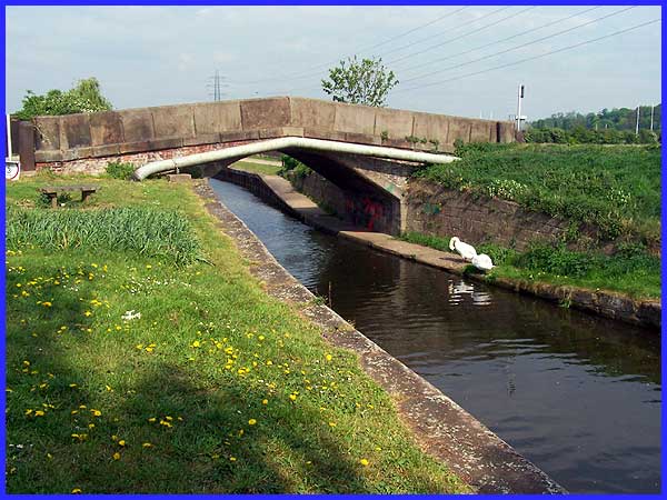
 A little further along the canal
where Canal Side turns away to become Meadow Road is the Turnover
Bridge. An information board nearby includes the following: "In
the days when canal boats were pulled by horses, turnover bridges
were used when the towpath moved from one side of the canal to
the other. The challenge was to get the horse across the canal
without interrupting towing. The horse towed the boat along the
path on the left and walked over the bridge from left to right.
It followed the slope under the bridge back onto the path - now
on the right of the canal. All whilst towing the boat!"
Now that's what you call ingenious. A little further along the canal
where Canal Side turns away to become Meadow Road is the Turnover
Bridge. An information board nearby includes the following: "In
the days when canal boats were pulled by horses, turnover bridges
were used when the towpath moved from one side of the canal to
the other. The challenge was to get the horse across the canal
without interrupting towing. The horse towed the boat along the
path on the left and walked over the bridge from left to right.
It followed the slope under the bridge back onto the path - now
on the right of the canal. All whilst towing the boat!"
Now that's what you call ingenious.
|
