Ilkeston - Requested Locations
A Nostalgia Trip For Jan And Alicia
w/e 22 May 2005
All this week's pictures were taken
with a Kodak DX6490
|
This selection of images were inspired by a couple of childhood
neighbours who both moved away from Ilkeston some time ago but
were reunited via Ilkeston Cam. The images all relate to an area
at the southern end of the town around Hallam Fields and Little
Hallam and show sights that although changed over the years,
will still be familiar to both of them. The views were suggested
by Jan Wasley and Alicia Faulkner (née Dickens). If there
is a particular area of the town, or in the vicinity that you
would like to see, just drop me a line and I'll do my best to
oblige.
|
|
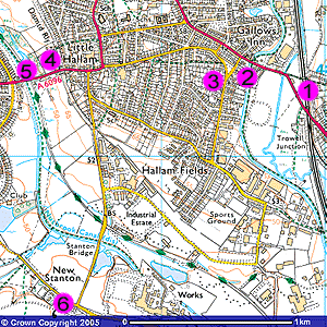
Jan Wasley was born in Ilkeston and spent the first 26 years
of his life growing up on the Middleton Estate which is just
south of the number 3 on the map above. Jan recalled some "specific
memory spots" 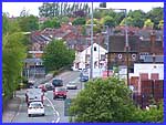 that
may or may not still exist. One of them was just over the border
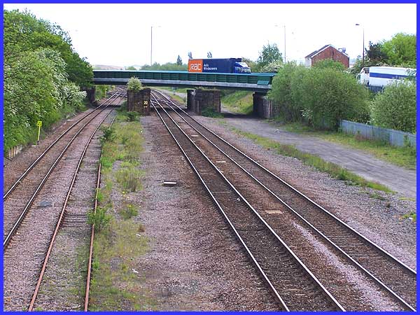
into Nottinghamshire where Trowell Railway Station once stood.
He also mentioned the footbridge from where he used to do his
trainspotting. Well the station has gone and the bridge carrying
the main Ilkeston to Trowell road was renewed last year but I
stood on the old footbridge to capture this image of the Trowell
Station site. Turning to look back over the border into Derbyshire
from a similar vantage point on the footbridge I also captured
the small image on the right showing the humpback bridge on Nottingham
Road over the Erewash Canal with the Gallows Inn on the right
- another of Jan's memory spots. that
may or may not still exist. One of them was just over the border
into Nottinghamshire where Trowell Railway Station once stood.
He also mentioned the footbridge from where he used to do his
trainspotting. Well the station has gone and the bridge carrying
the main Ilkeston to Trowell road was renewed last year but I
stood on the old footbridge to capture this image of the Trowell
Station site. Turning to look back over the border into Derbyshire
from a similar vantage point on the footbridge I also captured
the small image on the right showing the humpback bridge on Nottingham
Road over the Erewash Canal with the Gallows Inn on the right
- another of Jan's memory spots.
|
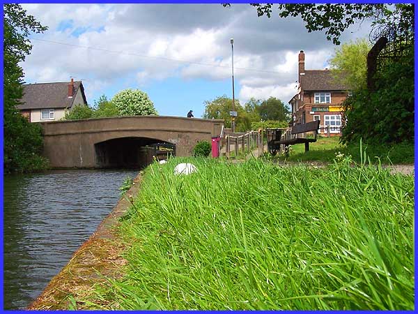
And this low level shot from the towpath on the canal also shows
the bridge with the inn on the opposite side of Nottingham Road
towards the right of the picture. Gallows Inn Lock is just visible
beneath the arch of the bridge. When Jan left for Connecticut
USA in 1962 this view would have been very similar but since
then a sloping footpath flanked by the railings in the middle
of the picture has been installed to facilitate disabled access
to the towpath.
|
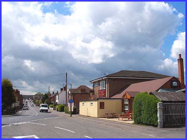
This view up Corporation Road from the junction with The Triangle
will be familiar to both Jan and Alicia. The Middleton Club stands
on the right of the road approximately where the white van in
the middle distance is. The former Pioneer Club (centre right)
has recently been renovated and converted into a public house
trading as The Davy Lamp. Hallam Fields Road in the far distance
is where Alicia's home was before she left the town. When Jan
and Alicia were children, their families and particularly their
mothers, were great friends especially during the war when Alicia's
father was off in the Army in North Africa. This view will no
doubt rekindle some nostalgic memories.
|
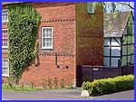 Alicia, born and brought up in
Ilkeston, now lives in Cambridge and remembers her mother playing
tennis during the war years on the courts at Hallam Fields, behind
her parents' home. She also recalls a visit with her mother to
The Old Hall in The Spinney off Little Hallam Hill and mentions
the old black and white building (small image left). Remembering
being shown around the house, Alicia says "It was marvellous,
I didn't know any building so old existed in Ilkeston."
My reference source tells me that The Old Hall is a 16th century
Jacobean half-timbered house. In the last decade the realigned
road passing the house has been widened to provide access to
new housing. Alicia, born and brought up in
Ilkeston, now lives in Cambridge and remembers her mother playing
tennis during the war years on the courts at Hallam Fields, behind
her parents' home. She also recalls a visit with her mother to
The Old Hall in The Spinney off Little Hallam Hill and mentions
the old black and white building (small image left). Remembering
being shown around the house, Alicia says "It was marvellous,
I didn't know any building so old existed in Ilkeston."
My reference source tells me that The Old Hall is a 16th century
Jacobean half-timbered house. In the last decade the realigned
road passing the house has been widened to provide access to
new housing.
|
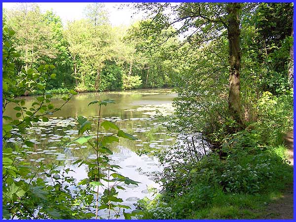
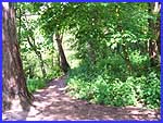 Not
far from The Old Hall is "The Beauty Spot" which both
Alicia and Jan remember with fondness. Jan recalls how their
mothers used to take them to this open space where they were
allowed to "run free". He particularly likes the vistas
over the pond and remembers seeing rowing boats and canoes bobbing
around on the pond. The area where children ran free described
by Alicia as "a delightful spot " has now become somewhat
overgrown and can best be described by the euphemistic term "returned
to nature" ( see left). It is a far cry from when carnival
events were held here but some of the views here probably now
give more credence to the name "Beauty Spot" than they
ever did before. Not
far from The Old Hall is "The Beauty Spot" which both
Alicia and Jan remember with fondness. Jan recalls how their
mothers used to take them to this open space where they were
allowed to "run free". He particularly likes the vistas
over the pond and remembers seeing rowing boats and canoes bobbing
around on the pond. The area where children ran free described
by Alicia as "a delightful spot " has now become somewhat
overgrown and can best be described by the euphemistic term "returned
to nature" ( see left). It is a far cry from when carnival
events were held here but some of the views here probably now
give more credence to the name "Beauty Spot" than they
ever did before.
|
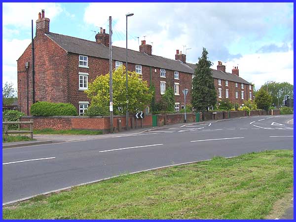
We began this selection of images just beyond the Ilkeston boundary
at Trowell Station and we close again with a view from just beyond
the town's southern boundary at New Stanton. Quarry Hill Road
leads out of town, changes to Ilkeston Road and at its junction
with Low's Lane (to the left in the picture above) and Sowbrook
Lane (to the right) where there is a row of a dozen terraced
houses. New Stanton, although the official name and marked on
all the maps is not a term in common use as most local people
would know the location merely as "Twelve Houses".
Jan says that the row was never much to look at 50 years ago
and its appearance has changed little in the intervening period,
but its proximity to Stanton's Dale Spun Plan where his Dad worked
for many years is the "link". It may come as a surprise
therefore to find that the workers' three storey cottages built
by Stanton Ironworks in 1848 are now classified as listed buildings.
These images will no doubt remind both Jan and Alicia of their
youth but I'll leave the last word to Jan. "Many of my old
haunts are in your archive so I can get a surfeit of Il'son nostalgia
whenever I feel like it. I have some very happy memories of those
years even though times were hard during the war so very long
ago now."
|
