Mapperley Village - North, South, East and West
w/e 27 February 2005
All this week's pictures were taken
with a Kodak DX6490
It's almost three years since we last looked around Mapperley
Village. Then the daffodils were in full bloom but this year
just as they are starting to put in an appearance, winter with
snow, sleet and freezing temperatures brought by cold easterly
winds finally arrived in the East Midlands. Even though we've
managed to escape the worst of it in our little corner of Derbyshire,
we awoke several mornings last week to a light dusting of snow.
On one of those mornings we left the urban landscape of Ilkeston
to enjoy a pleasant walk around the rural setting of Mapperley
Village.
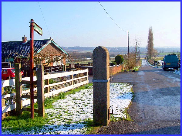
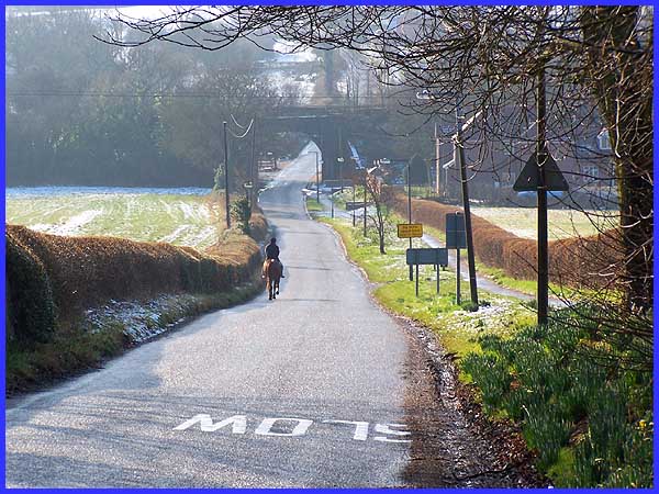
 Mapperley
is a compact village clustered around the junction of four lanes
that point in the direction of the main compass points. This
view along one of those lanes is to the east and as the signpost
on the left shows, Ilkeston is only two miles away. These days
the lane is used mainly by walkers and farm traffic although
the name Slack Road, bears testament to the coal mining past
of the area and suggests more vehicular movement. Mapperley
is a compact village clustered around the junction of four lanes
that point in the direction of the main compass points. This
view along one of those lanes is to the east and as the signpost
on the left shows, Ilkeston is only two miles away. These days
the lane is used mainly by walkers and farm traffic although
the name Slack Road, bears testament to the coal mining past
of the area and suggests more vehicular movement.
|
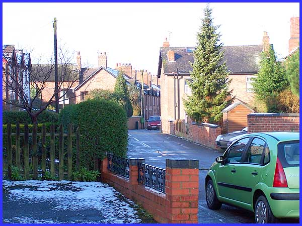
Looking in the opposite direction from a few steps closer to
the village centre we can catch a glimpse on the extreme right
of this view of the former Wesleyan Methodist Chapel that was
built in 1874/5 and closed in 1969. It is now a private dwelling.
I have always known this street as Slack Road but according to
the name plate, it is actually Coronation Road. The photo was
taken from a footpath that leads to the back of the properties
on the left.
|
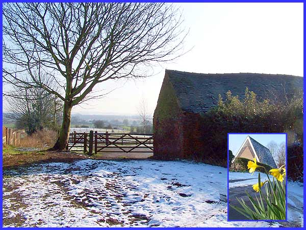
The footpath leads to a track behind the properties on Coronation
Road where the view to the east again in the direction of Ilkeston
looked quite wintry but to the west (inset) the first of this
year's daffodils were pushing up through the snow. The building
in the inset picture is the church that opened in 1966 after
the original church in the same place had to be demolished due
to mining subsidence.
|
From the front of the church we can look due south down Mapperley
Lane. This is the main access lane that leads into the village
from the cross roads on High Lane.
|
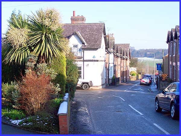
Heading back into the centre of the village one change from three
years ago is immediately obvious. Then I wrote that three buildings
usually found in any village are the church, pub and village
shop. Well since then the village shop which used to be housed
in the white building on the corner has closed. The lane north
leads only to Mapperley Reservoir and then up into Shipley Country
Park, the trees on Shipley Hill visible on the horizon. To complete
our walk through the village though we turn left here into Main
Street just beyond the tropical looking plants that would probably
look much more at home in a warmer scene.
|
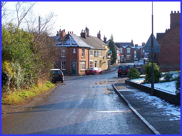
From a little way along Main Street we can again turn and look
eastwards back beyond the Old Black Horse public house to the
centre of the village. The pub staked its claim to some sort
of fame at the turn of the last century when it was kept by the
appropriately named Mr Beer. He also preceded Ilkeston with electricity
as he generated his own five candle power supply on the premises.
Main Street continues out of the village to become Park Hall
Lane before returning to another crossroads further along the
High Lane.
|
