  Part
6 of our walk through Sandiacre took us from the Starch Lane/Church
Drive junction to the Stoney Clouds Nature Reserve and now we
must retrace our steps to that junction before continuing in
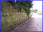
this part around the area of the original settlement. As we descend
the hill (left) there is a wall (right) that is worthy of closer
inspection. This distinctive type of long and short stonework
is local to the area. Part
6 of our walk through Sandiacre took us from the Starch Lane/Church
Drive junction to the Stoney Clouds Nature Reserve and now we
must retrace our steps to that junction before continuing in
this part around the area of the original settlement. As we descend
the hill (left) there is a wall (right) that is worthy of closer
inspection. This distinctive type of long and short stonework
is local to the area.
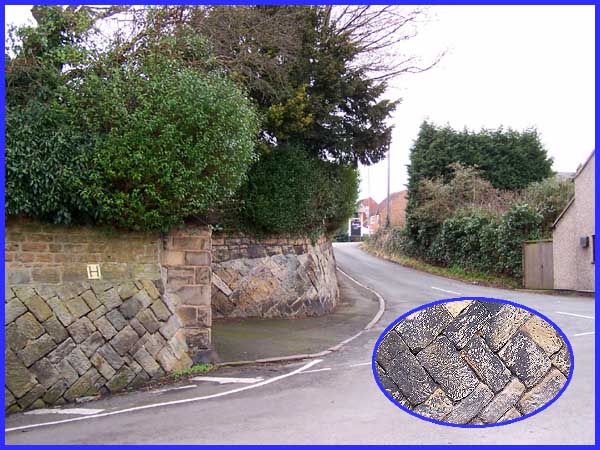
Where Church Drive crosses Starch Lane the walls that form the
boundary of the property on the corner are also of interest.
These are built in a herringbone style and are thought to contain
stones that originally came from the Abbey at Dale, just a few
miles away.
|
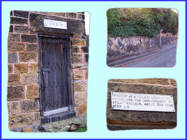
The herringbone wall (top right above) continues up the small
incline along the short section of Church Drive between Starch
Lane and Church Street until it meets a small building with an
old door set into the wall (left). A plaque above the door (bottom
right) reads: 'Erected as a village lock-up and pound for
the imprisonment of stray animals, about the year 1660 A.D.'
The lock-up is quite small but still contains a fireplace
although I doubt that it has housed any miscreants for many a
year.
|
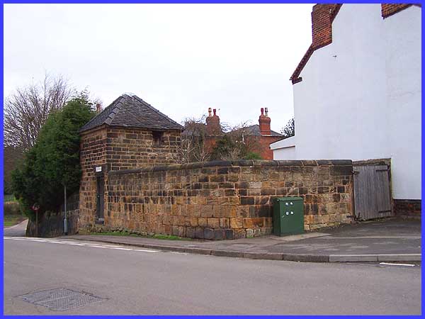
Looking back from across Church Street, both the lock-up and
the pinfold where the stray animals were kept can be seen but
the leaflet that details the route of this walk gives some information
that differs to the date given on the plaque. This says that
it is thought that the lock-up itself was not built until about
1790 although the pinfold is probably earlier. Either way, they've
both been there a long time!
|
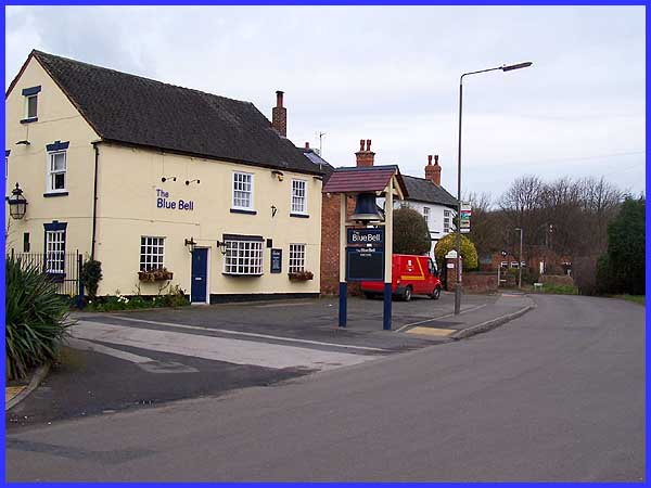
Another old building stands directly across Church Street from
the lock-up and this one is most definitely still in use. The
Blue Bell Inn was converted from a 300 year old farmhouse and
it is now a thriving hostelry that we must double back in front
of to regain the end of Starch Lane where it meets Stanton Road.
The name plates for the streets are visible in the distance towards
the right hand side of the image above.
|
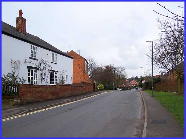
The road swings round now into Stanton Road and on the right
is the small St Giles' Park, the local Scout Hut and Sandiacre
Town Football Club's home ground. On the left (where the car
is peeping out) is Sandiacre Cloudside Junior School but despite
all these facilities and activities, the road is fairly quiet
these days with most of the traffic using Town Street and Lenton
Lane (see Part 6). At one time though as has been mentioned previously,
Stanton Road formed the main road to Ilkeston via the higher
ground through Stanton By Dale.
|
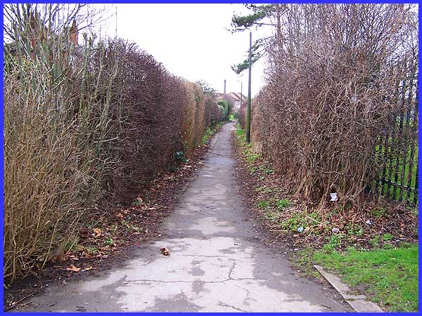
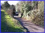
 A little way
along Stanton Road a narrow alleyway adjacent to the school boundary
leads through to a more recently built area of the village. In
these parts such an alleyway is often referred to as a 'twitchell'
or a 'jitty'. This particular twitchell follows the old field
boundaries of a farm that stood nearby and further evidence of
Sandiacre's agricultural past was once found in the location
of an old building near the other end of the twitchell (right).
Unfortunately, it has now been demolished - or I wasn't looking
in the right place - but our route now turns right into Kings
Road and then left into Albert Road which is where we'll continue
the walk in Part 08. A little way
along Stanton Road a narrow alleyway adjacent to the school boundary
leads through to a more recently built area of the village. In
these parts such an alleyway is often referred to as a 'twitchell'
or a 'jitty'. This particular twitchell follows the old field
boundaries of a farm that stood nearby and further evidence of
Sandiacre's agricultural past was once found in the location
of an old building near the other end of the twitchell (right).
Unfortunately, it has now been demolished - or I wasn't looking
in the right place - but our route now turns right into Kings
Road and then left into Albert Road which is where we'll continue
the walk in Part 08.
|