The Monk's Way - Strelley
Village
This page
was added to the site on 04 July 2004
Broxtowe Borough Council's leaflet entitled "The Stones
Of The Monk's Way" between Strelley and Ilkeston contains
a map of the route and can be seen here on the council's site.
The Domesday Book of 1086 records a settlement here
whilst the Strelley Estate originated in the twelfth century
when it was owned by the de Stradley family, the name evolving
through the passage of time to Strelley. The estate was bought
in 1651 by a Nottingham lawyer called Ralph Edge and remained
in that family until 1978 when the last surviving member died
leaving no heirs. Towards the end of the eighteenth century one
member of that family, Thomas Webb Edge, rebuilt the original
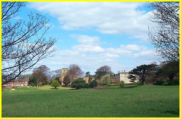
hall and laid out the estate. Seen here from a distance the parkland
setting as planned by Thomas Edge is still evident today and
is now protected as a Conservation Area.
|
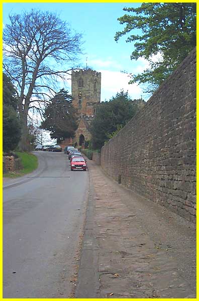
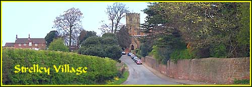
In truth there is only one road running through the
village and at its northern end it changes into little more than
a farm track but the All Saints Church still attracts a congregation.
Today's pilgrims attending Sunday services park their cars outside
but I wonder how many feet have trod on the stones of the Monk's
Way incorporated as they are here into the footpath on the approach
to the church. The original church was built in the thirteenth
century. It was rebuilt in the fourteenth by Sir Sampsom de Strelley
and contains several memorials (including two full size effigies
to Sir Sampson and his wife, Elizabeth Hercy) to both the Strelley
and Edge families.
|
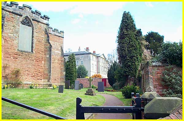
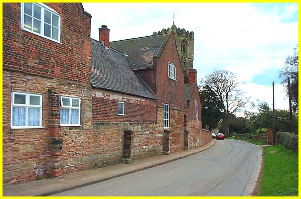
The churchyard offers some fine views of the Hall.
The Hall we see today was built for Thomas Webb Edge by Thomas
Gardner of Uttoxeter between 1789 and 1793 and stands to the
east of the original building which was built by Sir Sampson
de Strelley in 1356 on the site of a former mansion house. To
come right up to date, since 1980 the Hall has been used as office
accommodation following the death of Miss E M Edge two years
earlier.
|
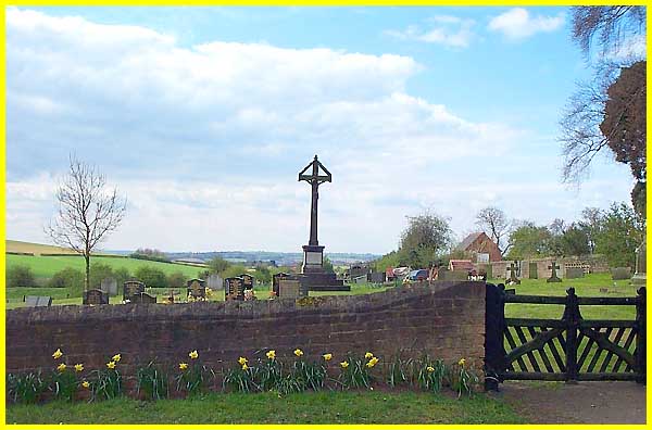
From the steps of the church the view in the general
direction of our final objective, Dale Abbey, is over Trowell
in the middle distance; Catstone Hill gently rising to the left
much closer. Seen here in early Spring with daffodils beneath
the wall the vista is dominated by the War Memorial in the graveyard
opposite.
|
The stones of the Monk's Way continue beyond All
Saints where many of the buildings date from the time of Thomas
Webb Edge although many of the cottages have been modernised
or replaced. The buttressed wall here though looks like the original
architecture.
|
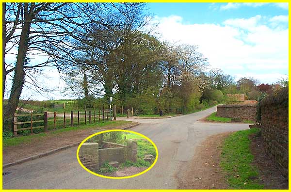
Towards the northern end of the village the stones
have disappeared and we leave the road to follow the track to
the left opposite the entrance to Strelley Hall. Farm buildings
used to stand on the corner but these were demolished in 1969.
All that remains now is a stone style which is inscribed with
these words. "T. W. Edge Armiger MDCCCIII completed this
cow-hovel farm yard and pump with sough from the quarry to supply
the same and sough to carry all the overplus and moisture of
farm yard into Smiths wheat-mill and Minnow New River Pond and
in the same year 1803 planted this and two plantations round
those buildings." (A sough is a drain; an Armiger is
someone entitled to Heraldic Arms).
|