Bridge Inn & Canal Loop - Part 02
w/e 30 March 2025
All of this week's pictures were taken with a Nikon D3300
This second part of the Walking
For Health route continues on Cotmanhay Road.

The route now crosses a pedestrian crossing next to this building
which has now been converted to a block of flats. Previously
it was the Nottingham Castle pub and to the left of the pub was
a railway bridge over the road. The bridge carried the continuation
of the line we walked earlier along the Manners Link footpath.
|

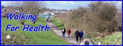
That former railway line now continues as the Cotmanhay Linear
Park which is also the next section of this WFH route.
|

The Linear Park is in three sections and this first part is the
shortest of the three.
|

It soon reaches Ebenezer Street and the second section continues
on the other side of the road to Duke Street.
|

The second and third sections of the park are the same route
we followed in Part
02 of the Cotmanhay Loop walk and lead
to Nelson Street. The routes diverge here with the Cotmanhay
Loop going to the right to go through the Nelson Street Estate
back to Duke Street and the Bridge Inn route, also through the
estate, turning left.
|

The Nelson Street estate is an extension of the much shorter
street which leads back to Cotmanhay Road.
|

At the end of Nelson Street a right turn leads past the Trumpet
Inn which like so many pubs these days, is looking for someone
to take over the lease. Could this soon be another that is destined
to be turned into flats?
|

A little further along Cotmanhay Road on the corner of Bennerley
Avenue is the former Bennerley School which is now the Cotmanhay
and Ilkeston Adult Community Education Centre.
|

The route continues almost to the end of Cotmanhay Road stopping
just short where it turns right into Stratford Street. Straight
ahead and beyond the traffic island at the Church Street/Bridge
Street junction, Skeavingtons Lane can be seen with the original
Cotmanhay Farm Estate on the left and the later Hopewell Farm
Estate on the right, both names harking back to earlier times
when agriculture was important in this area.
|

But it's to the right we must go to follow the route down Stratford
Street as we make our way toward the Erewash Canal for the return
leg of the walk.
|
