The Wollaton Trail - Part 02
w/e 28 January 2024
All of this week's
pictures were taken with a Nikon D3300
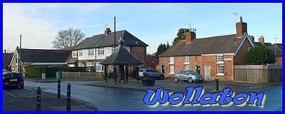
Continuing our exploration
of the old village based of the "Trail" as detailed
on this site:
https://www.spanglefish.com/WollatonHistorical/index.asp?pageid=731661
In the following descriptions if I refer to the "Trail"
it is information gleaned from these sites.
We left Wollaton Road in the middle of the village turning right
into Bramcote Lane and then turning right again almost immediately
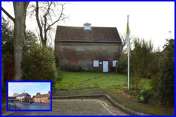
into the L-shaped cul-de-sac of Dovecote Drive. Three parts of
the way round the cul-de-sac is the access to the village dovecote
which we learned from the Trail, was built about 1565 by Sir
Francis Willoughby. This is now home to the Wollaton Historical
& Conservation Society's Local History Museum which is open
to the public during the summer from May to September on the
second Sunday of each month.
|
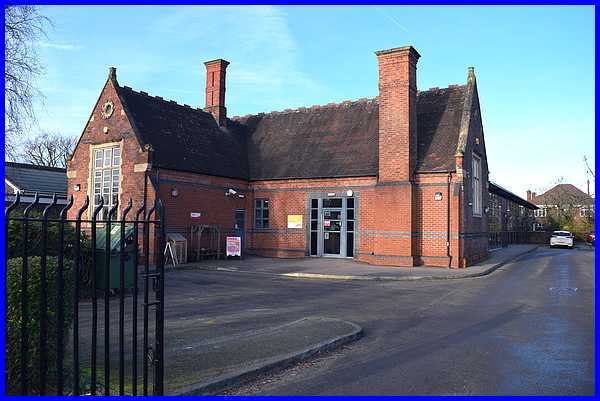
Returning to Bramcote Lane, the next building of interest is
the Russell School (1885) which now operates as a nursery. The
Trail also mentions an old school house for the headmaster but
as the area has now been developed since the building of the
school, I could only hazard a guess as to which house that was.
|
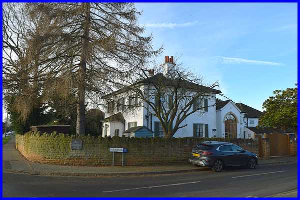
Also mentioned in the Trail is a cottage originally part of Nook
Farm - again difficult to determine unless you know the history
of the village - plus the much more obvious White House which
dates from the 1850s. (A return to Wollaton in the summer
to visit the museum and learn more about about the old geography
of the village is looking more and more likely! Perusal of old
maps has so far not proved fruitful.)
|
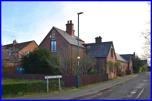
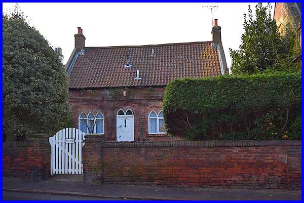
After the White House we crossed Bramcote Lane and returned along
the other side back towards Wollaton Road. We paused at Smythson
Drive (NB incorrectly spelt Smithson on Google maps) to
view what the Trail describes as a former farm building built
in the 1870s but which is now known as Bramcote Lodge. The road
is named after the architect of Wollaton Hall, Robert Smythson.
|
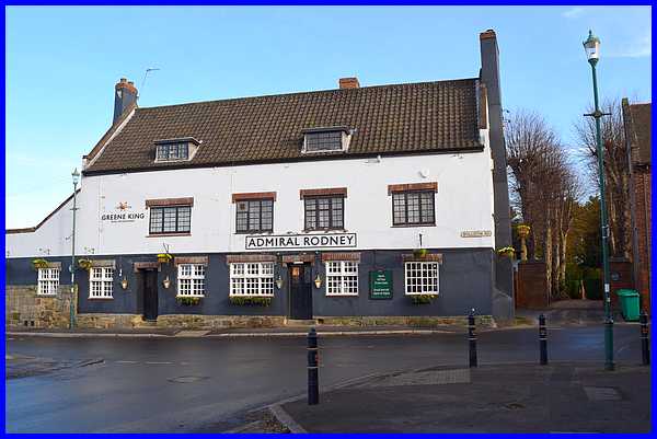
Back in the village centre and facing down Bramcote Lane from
Wollaton Road is the Admiral Rodney pub. Bramcote Lane according
to the Trail was originally known as Noggy Lane and led to coal
mines and a brickyard which have now been lost under the urban
expansion. The Rodney is named after the Admiral who was related
to the Middleton family by marriage. The Middleton family of
course are more commonly associated with Wollaton Hall together
with the Willoughbys and their history is worth following from
the websites linked above. To the right of the pub in this view
is a private drive which is thought to have led to the original
Manor House.
|
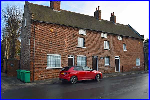
To the right of the drive is a row of three old cottages which,
the Trail informs, have small attic windows on the third floor.
It also says that the first cottage in the 1800s was a shop that
was large enough to accommodate only three people at a time and
that the third cottage was the Police Station.
|
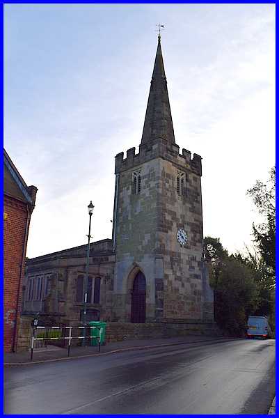
Next comes the fourteenth century St Leonard's Church, resting
place of one of the richest men in England, Sir Henry Willoughby
(1528) and the aforementioned Architect of Wollaton Hall, Robert
Smythson. Inside the church are memorials to Sir Richard Willoughby
(1491) and also to the Middletons.
|
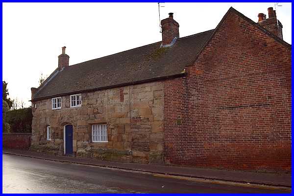
Opposite the church is the oldest house in the village, the Stone
Cottage, which dates from the 1400s. The Trail details its former
uses saying it may have been a Chantry or residence of the Priest,
or it may also have been, as referred to elsewhere, a school
in 1472. With more certainty, it is known to have been the village
Post Office in the 1850s.
|
The Trail also mentions Ivy Cottage with its pointed gothic windows
next to the Stone Cottage, and then Wollaton House next door.
Wollaton House however is obscured from the road by a high wall
and trees.
|
It is behind this wall on the right that
Wollaton House stands as Wollaton Road (formerly called Church
Hill at this point) continues towards the corner where it is
joined by Hirst Crescent on the right. Hirst Crescent is now
a small housing cul-de-sac but was previously the site of kennels.
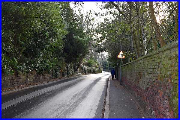
Beyond that Wollaton Road continues along the boundary wall of
Wollaton Deer Park and Hall but it is here that we ended our
exploration of the old village.
Back to Part 01
|
