The Wollaton Trail - Part 01
w/e 21 January 2024
All of this week's
pictures were taken with a Nikon D3300
It's become a tradition with
Ilkeston Cam to visit Wollaton in January each year and that
usually entails a walk through the Deer Park. Looking for something
different this year I searched the internet and found a site
that details a Trail through the old village.
The site doesn't include a Trail Map so rather than repeat what
is written there (and be guilty of plagiarism) I've picked a
few of the sites and buildings mentioned taken a few photos whilst
walking through the village. If you would like more information
about any of them I would recommend visiting:
https://www.spanglefish.com/WollatonHistorical/index.asp?pageid=731661
In the following descriptions if I refer
to the "Trail" it is information gleaned from this
site.
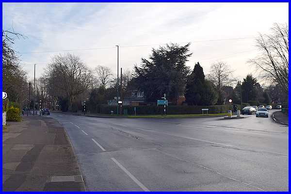
We started the walk at the place we've always known as Doctors'
Corner, the junction of Trowell Road, Russell Drive (straight
ahead) and Wollaton Road to the right. Russell Drive bypasses
the old village and the Trail informs that it dates from 1925
and was named after Rev. Russell.
|

Wollaton Village was once an entity in its own right but has
now been swallowed up into the conurbation of Nottingham and
has many large residential dwellings. It is something of a surprise
therefore that the old pinfold, an enclosure for stray animals,
has not been built on. It is situated on the left near the end
of Wollaton Road.
|
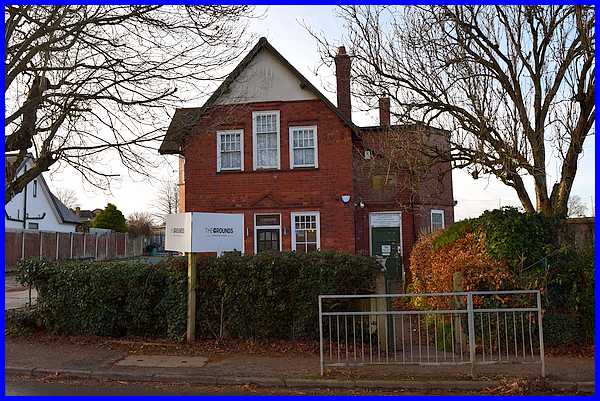
A little further down Wollaton Road and on the opposite side
to the pinfold is the Wright Institute.
|

Signs above the door show that it was built in 1900. To the left
of the Institute is the drive to the sports ground and there
is another sign showing the various clubs that use the facility.
It was here at the end of the 1985/86 football season that I
refereed the H. B. Poole Trophy match between Midland Amateur
Alliance players representing teams from the Derbyshire F.A.
and the Nottinghamshire F.A. following which I received a trophy
of my own as a memento of the game.
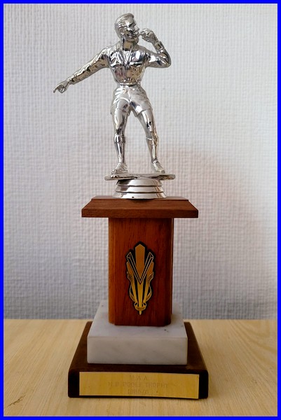
Inscription reads:
M.A.A.
H.B. Poole Trophy
1985/86
|
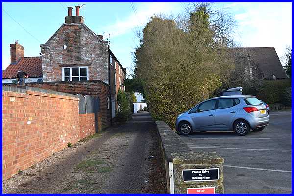
A little nearer the village centre and back on the other side
of the road, is a private drive called Rectory Avenue which the
Trail notes was formerly called Pig Lane leading to Pig Yard
on the corner of the Old Piggery. It also points out the three-storied
cottages on the left and the small distance between the top two
storeys.
|
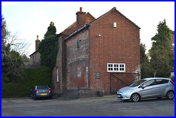
Next to Rectory Avenue is the Admiral Rodney pub car park at
the rear of which the Trail points out the Old Barn, a former
banqueting hall that in 1841 housed 80 three to eleven year old
children in the village school.
|

The Trail advises looking across from Rectory Avenue at the Old
Post House which was originally three cottages but unfortunately
it is now well hidden behind a high wall and several trees and
is hardly visible from the road. The gable end can just be seen
here beyond the lighting column at the end of the Playhouse Day
Nursery (which does not feature in the Trail notes).
|
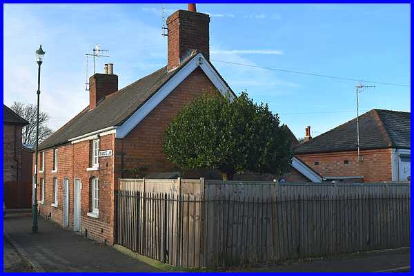
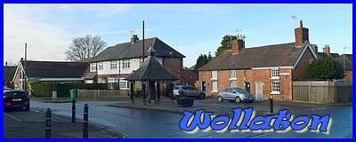
We've now reached the junction of Wollaton Road and Bramcote
Lane which in effect is the Village Square. On the north side
is a row of three small cottages, so small in fact that the middle
one goes by the name of "The Pokey 'Ole".
|
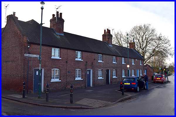
The south side on the Square also has a row of similar cottages
but these are larger than their opposite number. All of the cottages
around the square date from the 18th century and have survived
two demolition applications to be replaced by modern shops. Such
a move would surely have destroyed the whole character of the
village centre and thankfully opposition to the redevelopment
was successful and also led to the formation of a Preservation
Society which later became the Wollaton Historical and Conservation
Society - creators of the Trail.
|
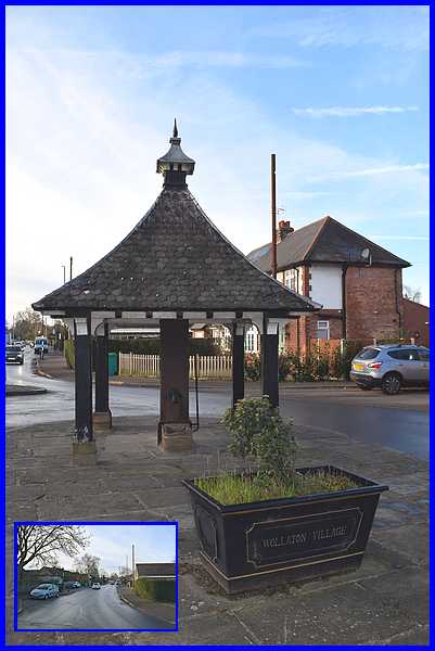
Between the two rows of cottages and in
the centre of the Square at the end of Bramcote Lane (inset)
is the Village Pump, another historic feature of the village.
In the next part we'll continue our exploration of the village
in Bramcote Lane before returning to continue along Wollaton
Road.
Forward to Part 02
|
