Draycott & Wilne - Part 03 - Into Hopwell Road
w/e 07 October 2012
All this week's pictures were taken
with a Kodak DX6490
In this third part of our Village Trail around Draycott
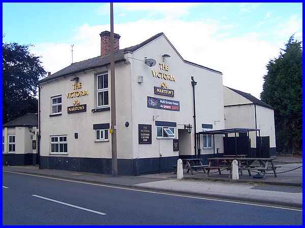
and Wilne, we resume back on Victoria Road directly opposite
Victoria Avenue where we find, quite naturally, The Victoria
public house.
 Previously
known as and still called by some, The Victoria Hotel it is also
known locally as "The Middle House", presumably because
it stands midway between other hostelries in the village, but
it's original name was The Axe and Cleaver. The smaller building
to the left of the main part of the pub is now the lounge bar
but at one time of day, this was a butcher's shop. A little further
along Victoria Road is a crossroads which marks the village centre
of Draycott today as opposed to the old village centre we passed
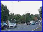
through in Part 02. A right turn here takes us into Hopwell Road
which is where we'll continue in the rest of Part 03. Previously
known as and still called by some, The Victoria Hotel it is also
known locally as "The Middle House", presumably because
it stands midway between other hostelries in the village, but
it's original name was The Axe and Cleaver. The smaller building
to the left of the main part of the pub is now the lounge bar
but at one time of day, this was a butcher's shop. A little further
along Victoria Road is a crossroads which marks the village centre
of Draycott today as opposed to the old village centre we passed
through in Part 02. A right turn here takes us into Hopwell Road
which is where we'll continue in the rest of Part 03.
|
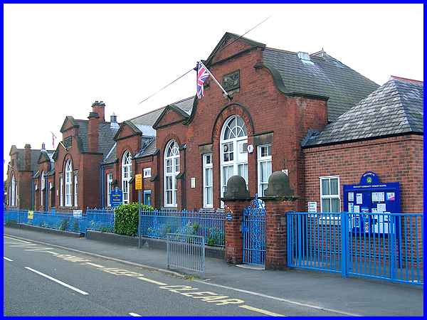
The first building of note in Hopwell Road stands on the left
and is Draycott Primary School which dates from the around the
early 1900s. This school replaced an earlier one that had been
sited on The Green.
|
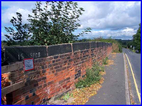
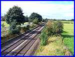
After the school, Hopwell Road rises up over the railway line
which in effect acts as the northern boundary to the built up
area of Draycott. Beyond this is agricultural land which was
one of the main sources of employment prior to 1870 when industry
became more of a major player.
|
Just to the north of the railway bridge on the right is Draycott
Cemetery and although the leaflet I am using for much of the
information in this series refers to the cemetery chapel of 1901
(similar to the school) some time during the last fifteen years
the chapel has been demolished and I am reliably informed that
it was a victim of wanton vandalism in the latter part of its
life. The footprint of the chapel can still be picked out in
the paving just inside the cemetery gates.
|
The route as described in the Village Trail leaflet includes
a walk along the disused Derby Canal but as we recently followed
that section whilst in Part 04 of The Coffin Walk I decided not to repeat it.
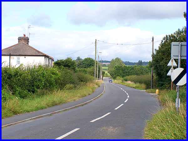
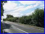
The canal however crosses Hopwell Road approximately where the
trees are, just beyond the approaching vehicle. There are only
a couple of isolated premises along Hopwell Road but the large
building in the far distance on the hillside is Hopwell Hall.
The Hall has an interesting history which includes being the
home of the Leicestershire attorney Thomas Pares (1716 - 1805),
being partially destroyed by fire in 1957 and serving later as
a special school. More of the history can be found in the National
Archives under Pares of Leicester and Hopwell Hall.
|
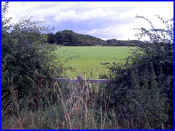
At some point we will double back and return down Hopwell Road
to the village centre and just how far to walk towards the Derby
Canal is a matter for the individual. Later in our look around
Draycott we will see the Mills Complex on Market Street which
was occupied in 1842 by brothers John and Benjamin Towle where
they were involved in cotton spinning and lace manufacture. Their
original mill however was south of and close to the Derby Canal
the route of which is through the wood seen here across the agricultural
land to the east of Hopwell Road. Today all signs of a mill have
disappeared.
|
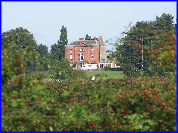
The other place of interest is to the west of Hopwell Road and
this zoomed shot taken from the Derby Canal shows Draycott House.
This Georgian building similar in style to The Hall in Long Eaton
which now houses the council offices, was used during the Second
World War as a military hospital and is thought to be designed
by Joseph Pickford of Derby.
(The building is partially visible from the railway bridge
on Hopwell Road but I ventured onto the canal path for the sake
of clarity. I could have enlarged the shot even more with the
zoom lens but bearing in mind the furore caused by the French
paparazzi recently I decided against it in case someone was sunbathing).
|
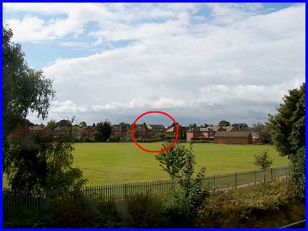
  So returning to the railway bridge (left)
we can look in the other direction over the recreation ground
next to the school to pick out another - if you know where to
look - interesting building (circled). This is a former lace
factory and the view of it from this side is supposed to give
a clearer indication of its former use. We will however get a
much closer view from the front in the next part. So returning to the railway bridge (left)
we can look in the other direction over the recreation ground
next to the school to pick out another - if you know where to
look - interesting building (circled). This is a former lace
factory and the view of it from this side is supposed to give
a clearer indication of its former use. We will however get a
much closer view from the front in the next part.
|
