Dale Abbey - Part 2 - Moor Lane
w/e 6 March 2005
All this week's pictures were taken with a Kodak DX6490

Mill
The main body of Dale Abbey lies directly opposite the Carpenter's Arms around a road called The Village and we shall explore there in a later part of this series but in Part 2 we continue from Arbour Hill passing in front of the pub to travel along Moor Lane to Woodpecker Hill. Our route will eventually lead us through Hermit's Wood back to The Village.

Arch

Moor Lane

From outside the Carpenter's Arms, Moor Lane runs out of the village turning sharp right to ascend Woodpecker Hill which can be seen in the centre of this picture. This is the route we will follow in this part looking mainly at the features on the left hand side of Moor Lane.
Trough

Just a few yards further on from the pub, a plant filled stone trough commemorates Dale Abbey winning the best kept village award in 1993.
School

The next building of import on Moor Lane is the Village School. This opened with 30 pupils on November 1st 1869 and by 1909 the number of pupils had increased to the 100 mark which just goes to show what a thriving community existed here at that time. By 1977 however the numbers had declined and it was closed as a state school by Derbyshire County Council, only to be re-opened in 1989 as an independant Church School.

Rural scene to colliery site

Isn't it strange that when you "look" at something you very often never actually "see" it. It was not until I read the leaflet published by the Erewash Groundwork Trust in 1992 that my attention was drawn to the roof of the school but this close up view - it's part of the same image as the one above - shows the decorative tiling.


Beyond the school is a more open landscape. It's hard to believe looking at this rural scene with horses grazing in the fields and signposts indicating public footpaths that industry once held sway here but old maps (1884-89) show that Dale Abbey Colliery No. 2 lay in the vicinity of the trees in the distance. It was connected by a tramway to the No. 1 Colliery which was further to the right between Ladywood Farm and Bassett Farm or as it was called then, Bassett Barn. Those 19th century maps however, show this same footpath heading across the fields in the direction of Ilkeston and it might well be the original route of the Monk's Way.

Churchyard Extension
 
Right hand bendWoodpecker Hill
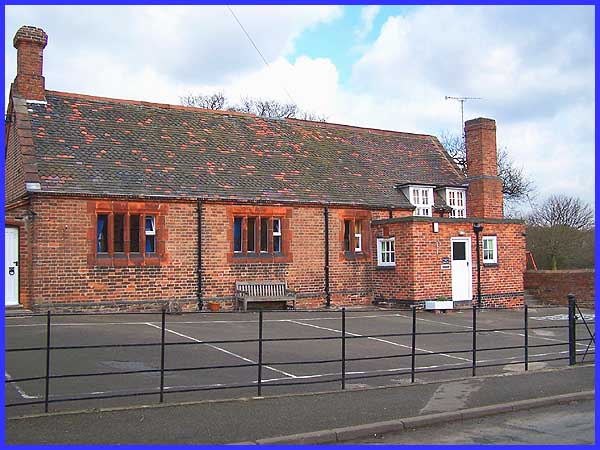
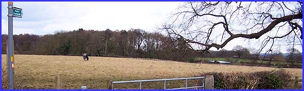
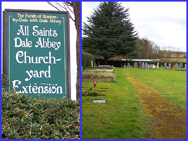
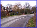
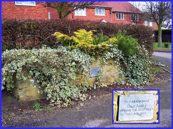
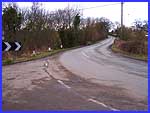
When space ran out at the All Saints Church on the other side of the village, an alternative site had to be found for burials. That extension to the churchyard is here on Moor Lane and is announced by the sign peeping over the hedge. We will see All Saints Church when we return to the village later but now we have almost reached the corner (left) where Moor Lane changes to Woodpecker Hill (right).
The Ford

From the corner, Moor Lane continues as a minor lane leading only to a few properties and then to footpaths across the fields but it is worth making a short detour to see the ford.
Sow Brook

The ford marks where the Sow Brook crosses the road and the brook can be seen here behind the railings on the right hand side as we look back towards Woodpecker Hill/Moor Lane. In dry weather the brook dwindles to nothing but the raised path where the water briefly disappears underground (inset) gives a good indication of the depth to which the water can rise when in flood. Our route now is up Woodpecker Hill but care should be taken as there are no footpaths on either side of the road.

 Back to Part 1
 Forward to Part 3

Home Page
Back to Dale Abbey Index
Special Features Index

Terms & Conditions of Use
This website is copyright but licensed under a Creative Commons Attribution-NonCommercial-ShareAlike 2.0 Licence.
Please credit the photographer Garth Newton, or add a link to these pages.