Attenborough - At Fifty Part 02
w/e 15 May 2016
All of this week's pictures were
taken with a Kodak DX6490
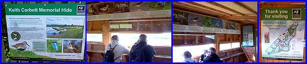
The last image in Part 01 of this walk around Attenborough Nature
Reserve shows that the Keith Corbett Memorial Hide is, in essence,
a large elevated shed with a small platform at one end. The board
at the foot of the steps that lead up to the hide shows that
it was opened in 2009 to the memory of the wildlife lover who
was one of the campaigners in the early 1960s whose aim was to
establish the site as a Nature Reserve. Inside the hide there
are slit windows providing views over the Reserve above which
are images and information to assist in identifying many of the
birds that can be seen. There is also a map of the site on the
door which indicates the location of other hides.
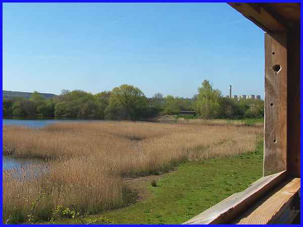
One of those other hides, the Kingfisher Hide, can be seen through
the windows across Clifton Pond in the trees to the right whilst
in the distance the Power Station at Radcliffe On Soar is clearly
visible.
|
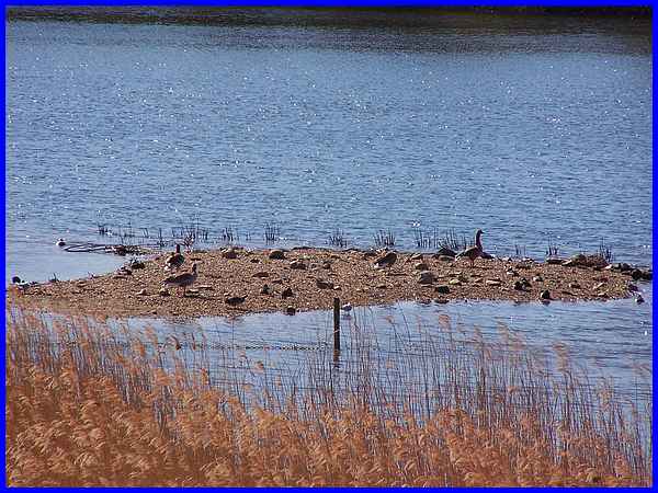
I don't profess to be an ornithologist at all but those that
are would benefit greatly from a pair of binoculars to view the
many birds on a small gravel island in Clifton Pond which appears
to be a popular nesting spot.
|
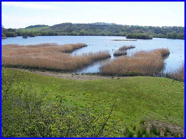
Looking from the hide to the south east across Clifton Pond,
the hedge line in the distance marks the position of the River
Trent whilst the trees on the other side of the river are at
Brandshill Wood. All of the reedbeds on the nearside of the pond
are named Millennium Reedbeds which surely must indicate when
they were established.
|
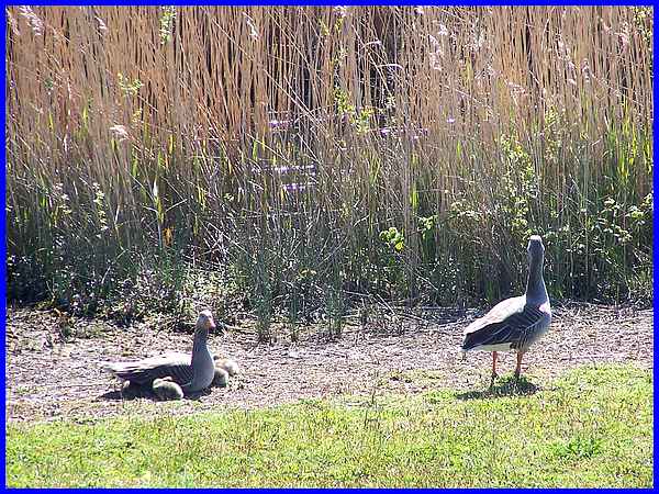
A pair of Greylag geese with a family of three chicks were making
the most of the fine weather at the edge of the reeds. I said
I'm not much of an ornithologist but these can be distinguished
from the more common Canada geese by their orange bills.
|
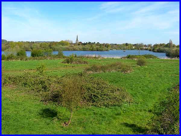
As we left the hide, this view from the platform is to the north
towards the church in Attenborough Village and over Wheatear
Field and Tween Pond. Between the two is another reedbed known
as Tween Pond Reedbed. The information board we passed earlier
in the walk on Wet Marsh Path includes a lot more detail in a
section headed "Life amongst the reeds".
|
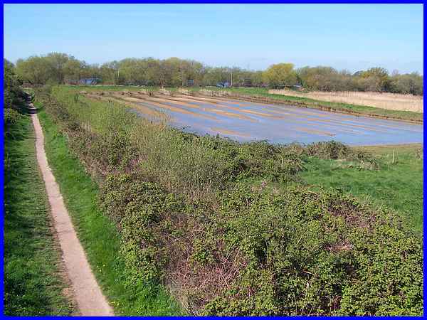
We returned to the Wet Marsh Path from the Keith Corbett Hide
passing the area on the right known as Wheatear Field Scrape
to turn right onto the path that leads to Barton Lane which is
the main access to the site, the Visitor Centre and the car park.
|
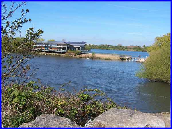
As that path rises to cross one of the bridges over the water
there is a good view of the state-of-the-art eco-friendly Visitor
Centre which sits on an island in Conneries Pond.
|

On this occasion we didn't visit the Centre but turned right
at the entrance near the end of Barton Lane to follow Church
Path between Church Pond and Tween Pond. Regular events and activities
are held and on this particular day there was one for toddlers
to find out more about nature. One youngster certainly didn't
need much encouragement to make friends with a swan on Tween
Lake.
|
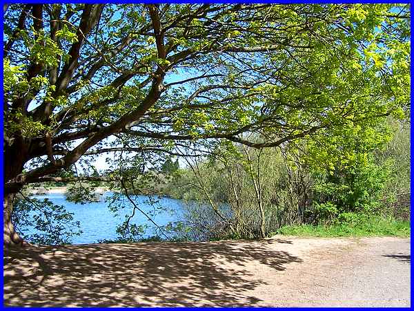
We continued along Church Path enjoying lovely views through
the trees of the blue waters in Church Pond. This was in marked
contrast to the grey day last September during the Autumn Footprints
walk.
|
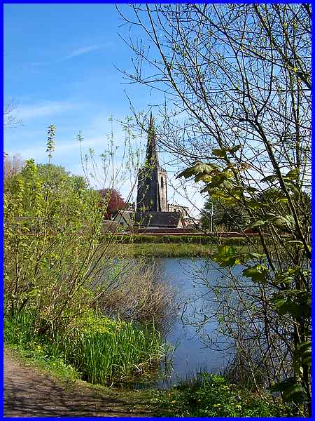
  Church Path is joined on the
right by Brookside Path which would have taken us back to where
we started the walk but we opted to continue along Church Path
through Education Wood into the village and the church of St
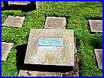
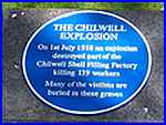
Mary. Before returning home we paid our respects in the churchyard
at the unmarked graves of some of the 139 victims of the Chilwell
Explosion that took place on July 1st 1918. Church Path is joined on the
right by Brookside Path which would have taken us back to where
we started the walk but we opted to continue along Church Path
through Education Wood into the village and the church of St
Mary. Before returning home we paid our respects in the churchyard
at the unmarked graves of some of the 139 victims of the Chilwell
Explosion that took place on July 1st 1918.
Back to Part 01
|
