The Three Parishes Walk - Part 01
w/e 26 January 2014
All of this week's pictures were
taken with a Kodak DX6490
At this time of year, there are many dull, dark,
dismal and, let's face it, depressing days but there are also
those bright and sunny days that just cry out for you to be in
the great outdoors. The day I took this walk through the three
parishes of West Hallam, Mapperley and Shipley was one of those
when it was just a joy to be out and about. For an hour or so
I was able to forget about the cares of the world and found the
walk to be very therapeutic.
I have often thought when walking in Shipley Country Park that
it would be good to walk through Mapperley Village to the High
Lane at West Hallam and catch a bus from there back into Ilkeston.
With the car usually parked at the Shipley end however, I have
never actually executed that plan. When I decided to undertake
this "Three Parishes" walk though, I decided it would
be better to start at the West Hallam end with the low-in-the-sky
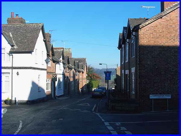
sun on my back so I caught the Derby bus to the Mapperley crossroads.
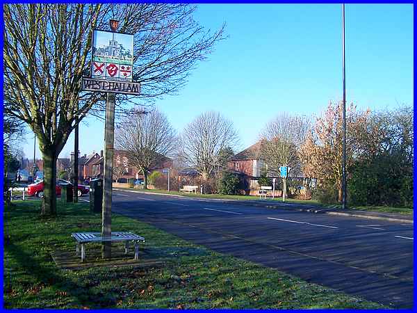
I alighted at the Bottle Kiln bus stop just beyond the crossroads
and walked back towards Ilkeston to capture this image on High
Lane Central to show the crossroads and also to include the West
Hallam Village sign.
|
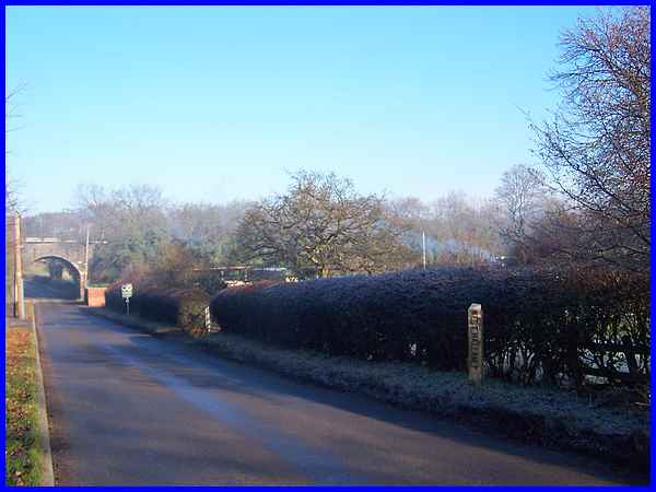
Turning right I walked down Mapperley Lane and left the West
Hallam parish to enter Mapperley at the marker post in the hedgerow
which is also where Mapperley Brook crosses under the road. Smoke
drifting across from the right added to the already misty atmosphere
on the cold and frosty morning.
|
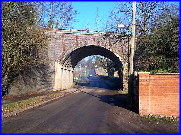
The lane passes under the old railway bridge and the footpath
that leads to Mapperley Castle (see The Whittlestone Walk) is on the left on
the other side of the bridge. I walked past that path on this
occasion and continued up the hill into Mapperley Village.
|
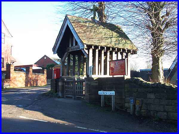
One of the first buildings in the village is the church which
dates from the mid 1960s when it replaced the former church that
had to be demolished due to mining subsidence. The Lych Gate
however is older than that being dedicated as Mapperley's War
Memorial in 1922. (For much more about the village including
an old photo of the dedication ceremony, I'd recommend Elaine
Sarson's excellent site at www.mapperleyhistory.com)
|
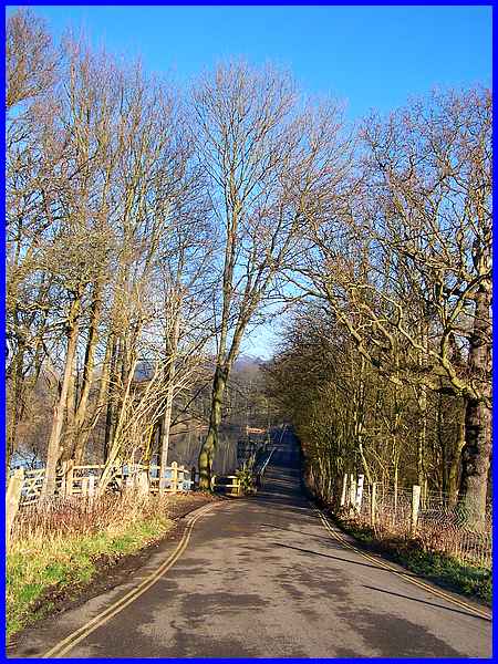
I continued straight on at the crossroads in the village passing
the building on the corner of Main Street that used to be the
Post Office and then by the former Wesley Methodist Chapel that
has been converted into a residential building, the Primary School
and the Lodge Houses to follow Shipley Lane towards the trees
seen here in the distance in the Country Park.
|
Shipley Lane first of all drops down to run alongside Mapperley
Reservoir seen here on the left.
|
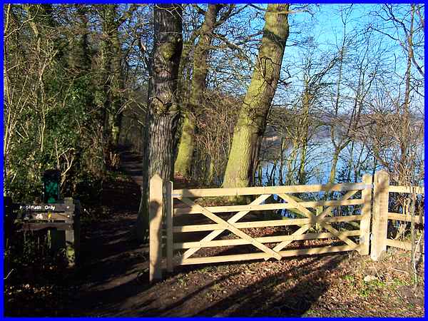
A sign on the Mapperley side of the reservoir says "Footpath
Only" and this is a route we have often walked right round
the water to a similar sign on the Shipley side.
|
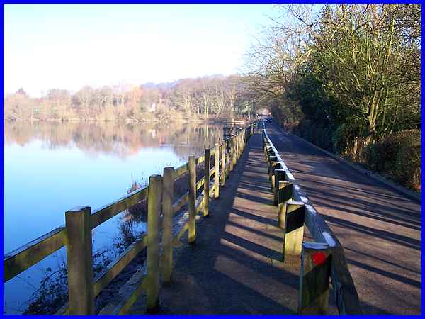
I continued along Shipley Lane by the reservoir which was created
in 1820 as a feeder for the Nutbrook Canal that served local
collieries at Shipley and West Hallam.
|
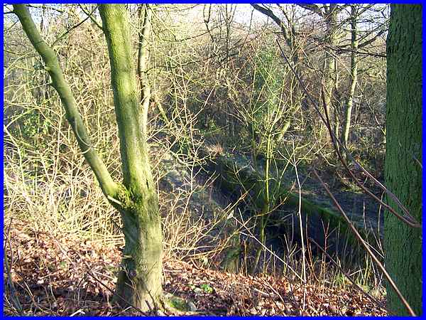
About halfway along I crossed over the lane to look into the
Nature Reserve, a place we have visited previously but that was
in May 2005 when the trees were in full leaf and there was also
a dense undergrowth. A number of small birds and squirrels scuttled
away as I approached and I am not sure which of us was more startled.
Looking into the reserve the absence of the leaves meant the
the overflow channel from the reservoir was clearly visible.
|
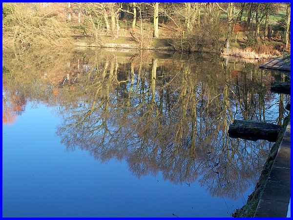
Returning to the reservoir side it seemed almost possible to
"taste" the silence in the still frosty air and it
was not only the air that was still as this reflection of the
trees in the still waters of the reservoir shows.
This point by the reservoir marks the end of the first mile of
the walk and the route continues in Part 02 but to see an aerial
view of the whole route click here.
|
