The Whittlestone Walk - Part 01
w/e 20 November 2011
All this week's pictures were taken
with a Kodak DX6490
It is possible to download many of the leaflets of
the walks in Erewash, Broxtowe and Amber Valley and there are
links to them from the Country Walks, Rambles and Routeways index
page on this site. The Whittlestone Walk though, number six in
the series of "Country Walks in and around Erewash"
is an exception and I'm surmising that it may have been discontinued
for a variety of reasons some of which I'll point out as we progress.
I do have a leaflet describing the walk however but it is about
eleven years old, dated 2000 and includes a map from prior to
that date which has some obvious differences to the current landscape.
The walk is of about five miles in length but at this point in
time, I'm not sure how it will pan out due to the changed features.
So with some reservations we set out on a damp and misty autumn
afternoon and covered approximately the first mile of the route
before returning home via another footpath.
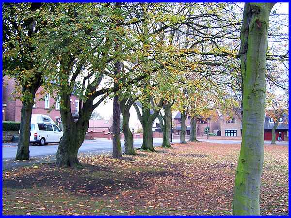
The walk which is named after the late Ron Whittlestone starts
at the car park in Victoria Park near the children's playground
and heads to the corner where Drummond Road meets Manners Road.
Mr. Whittlestone was a tireless campaigner for greater access
to the countryside and was the former Parks Manager for Erewash
Borough Council.
|
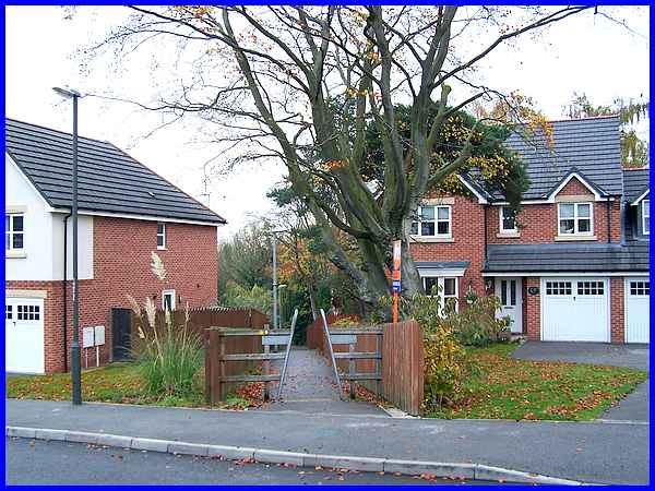
 There
is an immediate obvious difference to the published leaflet which
says to "proceed down track" and "turn right through
gardens to reach sandy path" which, when written, would
have referred to the allotments that were here. In fact my maternal
grandmother had an allotment here and I remember visiting it
as a boy with an uncle on the back of his motorbike. A new housing
estate now occupies the site with the entrance road where the
track used to be (left) but there is still a footpath between
the houses.The path in question once led to a footbridge over
the railway line but both bridge and line have now disappeared. There
is an immediate obvious difference to the published leaflet which
says to "proceed down track" and "turn right through
gardens to reach sandy path" which, when written, would
have referred to the allotments that were here. In fact my maternal
grandmother had an allotment here and I remember visiting it
as a boy with an uncle on the back of his motorbike. A new housing
estate now occupies the site with the entrance road where the
track used to be (left) but there is still a footpath between
the houses.The path in question once led to a footbridge over
the railway line but both bridge and line have now disappeared.
|
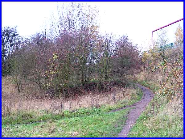
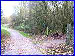 The sandy path
is now known as the Manners Link (left), a path we followed in
April of this year. It was at the meeting of the paths that we
turned left but there was an encouraging sight of a way marker
with the number six on a post directly ahead. Even if the leaflet
is no longer available, it looked as though the direction pointers
would still be in situ. The leaflet continues "bear right
at fork" but this is not way marked and initially we missed
the turning. We soon realised our mistake and backtracked to
pick up the indistinct path skirting the industrial estate, mentioned
in the leaflet but absent on the map in the same. The sandy path
is now known as the Manners Link (left), a path we followed in
April of this year. It was at the meeting of the paths that we
turned left but there was an encouraging sight of a way marker
with the number six on a post directly ahead. Even if the leaflet
is no longer available, it looked as though the direction pointers
would still be in situ. The leaflet continues "bear right
at fork" but this is not way marked and initially we missed
the turning. We soon realised our mistake and backtracked to
pick up the indistinct path skirting the industrial estate, mentioned
in the leaflet but absent on the map in the same.
|
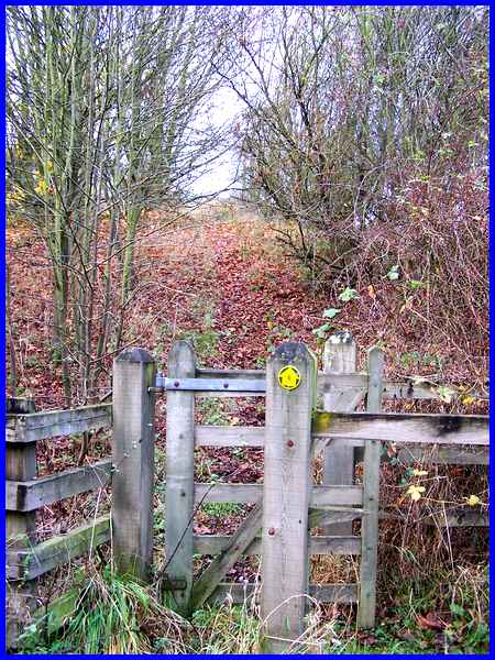
The industrial site to the right, like the housing estate, was
also built on an area full of allotments many of which were accessed
from a lane down to Manner Floods. The route we are following
is actually a former LNER branch line towards Heanor which crossed
the lane. The bottom part of the lane still exists but the railway
bridge over it has been demolished and the path now descends
from the embankment to rise up again on the other side after
passing through the gate where another marker points the way.
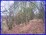
The climb up the embankment is much steeper than it appears here
and the slippery conditions on the fallen leaves are perhaps
a reason in these health and safety conscious days why the walk
leaflet is no longer available.
|
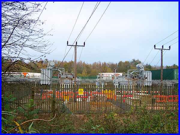
 From the
top of the embankment (left) a major electricity installation
to the right is one of the differences that has occurred since
the publication of the 2000 leaflet. The leaflet includes a sketch
of the "old EMEB warehouse"on this site which I always
knew as Central Stores when I was employed by East Midlands Electricity.
Even in 2000 the building was described as having suffered "repeated
damage by fire and vandalism" and had an uncertain future
despite being listed as having historical interest once being
Ilkeston's power station. (Although no longer here, I found
a photo of the building on the English Heritage site - click here to view). From the
top of the embankment (left) a major electricity installation
to the right is one of the differences that has occurred since
the publication of the 2000 leaflet. The leaflet includes a sketch
of the "old EMEB warehouse"on this site which I always
knew as Central Stores when I was employed by East Midlands Electricity.
Even in 2000 the building was described as having suffered "repeated
damage by fire and vandalism" and had an uncertain future
despite being listed as having historical interest once being
Ilkeston's power station. (Although no longer here, I found
a photo of the building on the English Heritage site - click here to view).
|
 A
little further on the descent (right) from the embankment was
equally as hazardous as the climb up to it. A
little further on the descent (right) from the embankment was
equally as hazardous as the climb up to it.
The descent was only temporary though and to continue on the
route of the old railway line it was necessary to climb back
up again onto the embankment and pass the last of the industrial
units. In passing I must mention that this low point on the walk
opens out to an expanse of overgrown open ground crossed by several
footpaths but where there used to be a football pitch in my schooldays.
This walk is fast turning into a trip down memory lane.
|
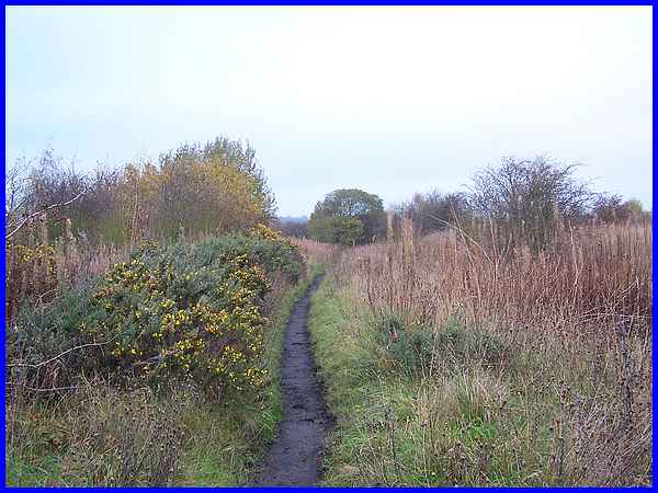
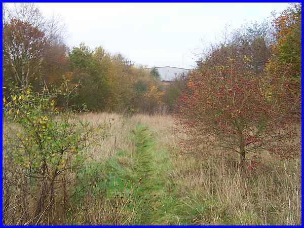
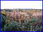  Back on the embankment,
the views over the gorse (left) revealed the tops of many trees
along the Nutbrook Trail displaying their autumn colours but
it was more important to keep an eye on the narrow path where
horseshoe shapes in the soft surface showed it is well used by
horse riders. Eventually we reached another path (right) crossing
the railway route where we turned left towards the Nutbrook Trail. Back on the embankment,
the views over the gorse (left) revealed the tops of many trees
along the Nutbrook Trail displaying their autumn colours but
it was more important to keep an eye on the narrow path where
horseshoe shapes in the soft surface showed it is well used by
horse riders. Eventually we reached another path (right) crossing
the railway route where we turned left towards the Nutbrook Trail.
|
We have often walked this part of the route before approaching
here by a different route from the Manners Industrial Estate
and it's only a short walk across a field to pass through a gap
in the fence to reach the Trail.
|
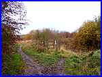
The familiar path joins the Nutbrook Trail at a right-angled
bend. Ahead in this view is the route to the south and is actually
the way we followed back home. To the right the Nutbrook Trail
continues to Shipley and Heanor but the Whittlestone Walk continues
through the fence on the right. Although we have often passed
this point many times I never previously realised that there
was another footpath on the other side of the hedge!
|
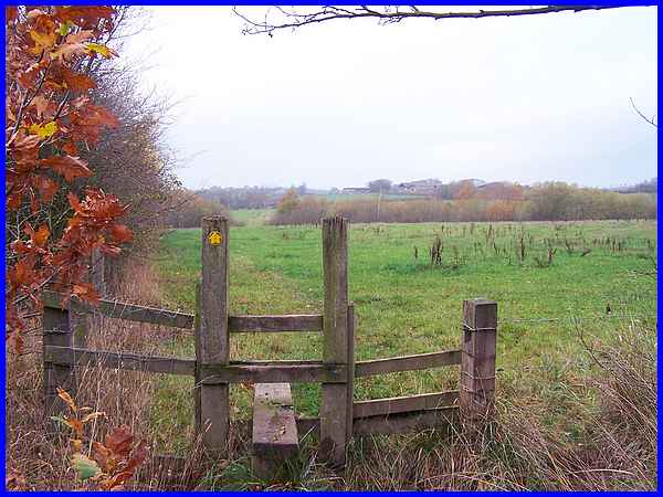
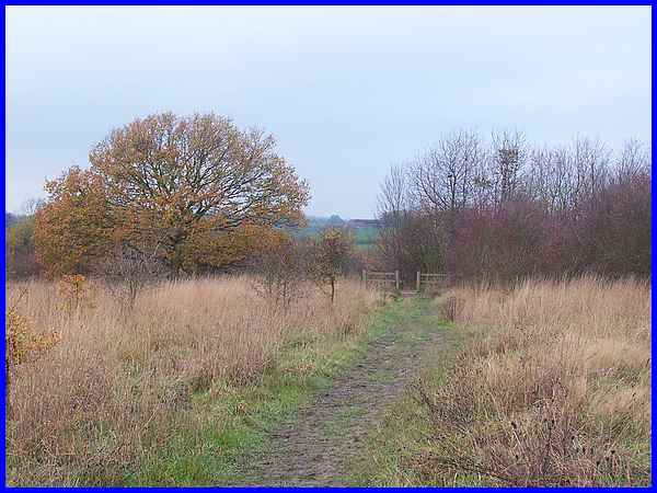
And this is the other side of the hedge where once again the
reassuring yellow arrow on the stile with a number six in the
middle points us ever onwards towards Mapperley - and that is
the way we will go when we return to continue the Whittlestone
Walk.
|
