Ockbrook Walk No. 1
w/e 16 June 2013
All this week's pictures were taken
with a Kodak DX6490
The starting point for all three Family Walks in
Ockbrook is the Queen's Head public house on Victoria Avenue
and this first one is particularly suitable for younger children
as it is only about a mile and a quarter in length. An aerial
view of the route is available here and it may prove useful to answer the
questions that are a feature of the leaflets that describe the
routes.
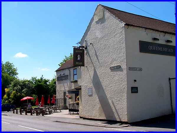
The Queen's Head stands on the corner of Victoria Avenue and
Bakehouse Lane and the route runs in a clockwise direction returning
along the latter.
|
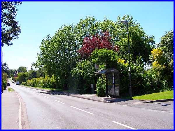
  The
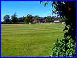
first part of the walk though is along Victoria Avenue passing
the Ockbrook and Borrowash Cricket Ground on the way. A gap in
the hedge not only allows pedestrian access to the ground but
also enables a good view of the impressive pavilion (left). The
ground was renamed in 2008 after Arthur Honeybun who died aged
81 in 2005 having been a member of the club for 57 years. The
first part of the walk though is along Victoria Avenue passing
the Ockbrook and Borrowash Cricket Ground on the way. A gap in
the hedge not only allows pedestrian access to the ground but
also enables a good view of the impressive pavilion (left). The
ground was renamed in 2008 after Arthur Honeybun who died aged
81 in 2005 having been a member of the club for 57 years.
|
At the side of number 267 Victoria Avenue a track leads off to
a stile into the fields behind the properties.
|
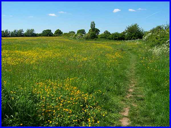
Keeping to the hedgeline on the right the path leads to another
stile and into the next field which was awash with buttercups.
|
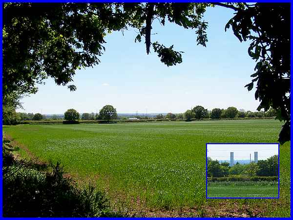
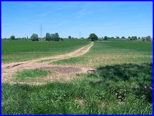
It is at the next stile at the top of the buttercup field that
the leaflet poses the first two questions. Question 1asks you
to identify the road on the left where distant traffic can just
be seen in this image. (This is where the map could come in
useful). Question 2 asks for the name of the power station
(inset) that has the same name as a nearby village. It is worth
noting here that the leaflet was published in 1996 and there
are now alternative answers (which you will find below) to both
questions.
|
After crossing the next field the route turns to the right to
follow the track through the young crop heading straight for
the tree on the other side.
|
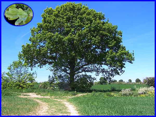
That particular tree is the subject of the third question which
is to identify the type of tree. The inset of the leaf should
help with the identification.
|
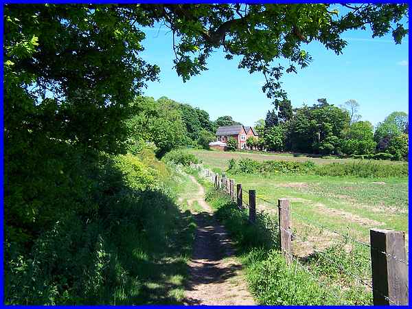
Another right turn at the tree then follows the footpath towards
the Moravian Settlement where the building seen here is part
of the Ockbrook School, this building catering for the younger
students.
|
The path expands into a track at the side of the school building
and soon reaches the end of Bakehouse Lane. To the left is The
Settlement which we explored in greater detail in the Village
Trail around Ockbrook elsewhere on this site. Briefly the Moravian
Settlement was established by the congregation of the Moravian
Church during the eighteenth century, the church being formed
by followers of John Hus in 1457. Hus was a Bohemian Christian
reformer who was burned at the stake in 1415.
|
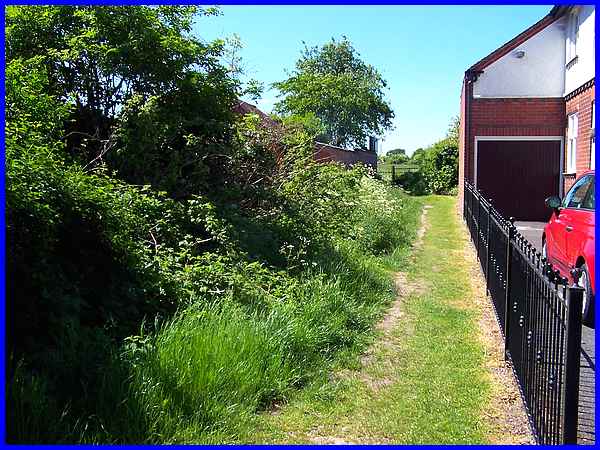
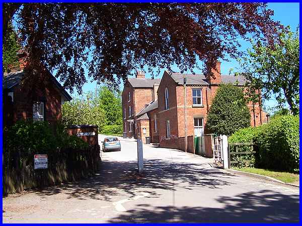
  The
Settlement makes an interesting detour but the route of this
Family Walk is to turn right and follow Bakehouse Lane. This
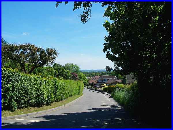
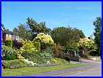
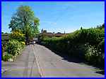
is predominantly a residential area (left) but after passing
the vehicular access to the Arthur Honeybun Cricket Ground where
a large board proudly displays the name just inside the gate,
it is only a short walk (right) back to the Queen's Head. The
Settlement makes an interesting detour but the route of this
Family Walk is to turn right and follow Bakehouse Lane. This
is predominantly a residential area (left) but after passing
the vehicular access to the Arthur Honeybun Cricket Ground where
a large board proudly displays the name just inside the gate,
it is only a short walk (right) back to the Queen's Head.
Now for the answers to the questions. The answers given in the
leaflet are: Q1 The A52; Q2 Spondon Power Station and Q3 Oak.
Since the leaflet's publication though the A52 has been named
Brian Clough Way after the legendary football manager of both
Derby County and Nottingham Forest, the A52 being the road that
links the two East Midland cities. As for the power station,
the former Spondon A and Spondon H stations were demolished and
replaced by the gas-fired Derwent Power Station which opened
in 1995 on the same site. The chimneys visible across the fields
are part of the Derwent Station.
|
