The Cranfleet Trail - Part 01
w/e 07 February 2010
All this week's pictures were taken
with a Kodak DX6490
This is a relatively short walk of only about two
and a half miles but there is much of interest to be seen along
the way. We first completed the route last September during the
Autumn Footprints Walking Festival but have now repeated it paying
more attention to the points of interest along the way.
The route can be extended by another couple of miles by using
public transport and walking down Lock Lane but the route proper
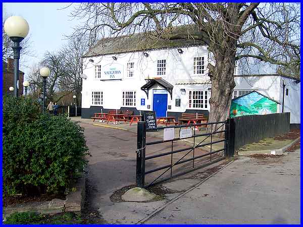
begins on the car park behind the Navigation Inn at Trent Lock
(also called Trentlock).
|
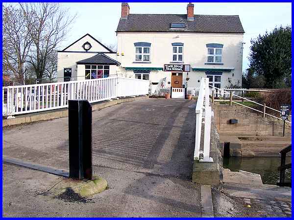
Leaving the Navigation behind the route is to follow the path
and cross the bridge over the Erewash Canal towards the Lock
House Tea Rooms.
|
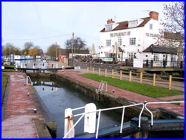
We have often seen the Erewash Canal further north as it
passes Ilkeston on its way to Langley Mill and the Cromford Canal
but this is the start of its eleven/twelve mile run where it
meets the River Trent. It was built in 1779 to facilitate the
transport of coal from the Derbyshire and Nottinghamshire mines
to the River Trent but is now used for leisure activities which
no doubt include visits to the Steamboat here seen here on the
right. The inn was built by the canal company in 1791 when it
was known as the Erewash Navigation Inn doubling as a farmhouse.
It later became the Fisherman's Rest before adopting its current
name, a former landlord operating a ferry across the Trent.
|
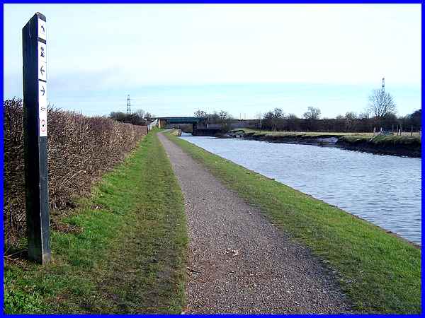
Familiar as we are with the Erewash Canal our way here is to
turn right after crossing the bridge to meet the Trent where
the towpath immediately runs alongside the Cranfleet Cut. The
Cut was built in 1797 and at the time of construction the river
was managed by the Trent Navigation Company. The Cranfleet Cut
was one of a number of improvements to the river that allowed
the 40-tonne Trent barges to by-pass difficult and shallow parts
of the river. All boats must now use the Cut to avoid the Thrumpton
Weir.
|
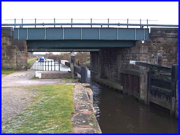
A little way along the towpath the Cranfleet Cut is crossed by
a railway bridge or to be more precise, by two adjacent bridges.
At this same location there is a flood gate which can be closed
to protect the Cut when the river is in flood.
|
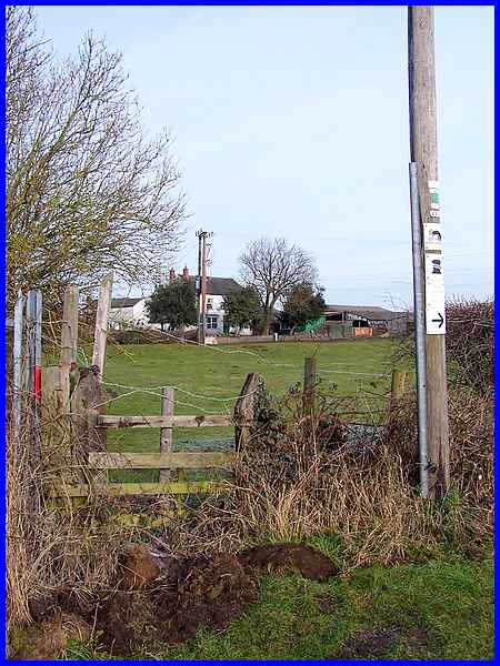
Just beyond the bridges a gap in the hedgerow reveals buildings
at Cranfleet Farm. When the Cut was built, it created an island
in the river and access to this land from the farm is via an
eighteenth century bridge which can be seen in the next two images
below.
|
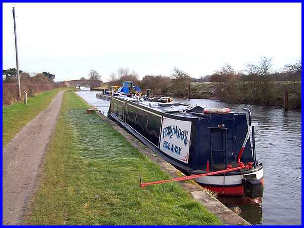
As we walked along the towpath, we passed a number of narrow
boats moored at various points all along its length. A feature
of the boats that you are recommended to look for is the bright
decoration that traditionally includes castles and roses but
but the decorative script of "Fernando's Hide Away"
was perhaps the closest we came to it on this stretch. A much
wider barge was making its way slowly down the Cut and we soon
caught up (and passed) with it at a steady walking pace.
|
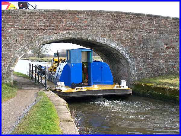
In fact we reached the old bridge almost simultaneously so paused
to see it squeeze through. It was almost a case of breath in
but expert positioning meant the barge passed through without
touching either side. In front of the barge were two swans that
were probably inhibiting its progress but the driver (is that
the right word?) told us in twenty four years he had not yet
hit one. He also said that the British Waterways vessel was used
for keeping the Cut and the River Trent free of obstructions
and some crane-like machinery on board were testament to that.
|
