Stanley Village -
Part 1 - From The South
w/e 30 July 2006
All
this week's pictures were taken with a Kodak DX6490
Introduction
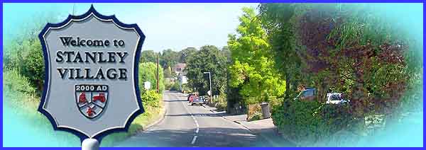
The rural setting of Stanley Village in the early years of the
twenty first century belies the fact that the county town of
Derby (or city as it now is) is a mere six miles away to the
southwest while the county's second largest town, Ilkeston is
three miles to the east. It also hides the industrial background
of the previous century when coal mining and brick making were
major means of making a living for the residents. But Stanley's
history goes back much further than that and there is a strong
possibility that it was a Saxon settlement. In Anglo-Saxon Staen
or Stan means stone and Ley or Ley means clearing. This first
part of a planned six part monthly series should take us through
the village and show some of the major places of interest in
three of the four seasons of the year beginning on the southern
outskirts of Stanley at the entrance to Manor Farm (below).
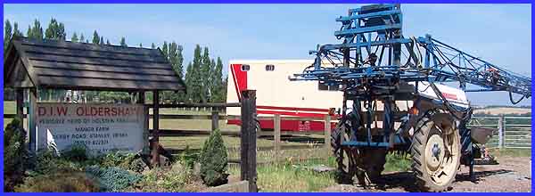
Today as the sign at the entrance tells us, the farm is home
to a pedigree herd of Holstein Friesians. From here we will follow
the main road through the village first to the north and and
then eastwards towards West Hallam and Ilkeston but there will
be frequent detours both to the left and right to see points
of interest on the way. As in previous Village Walks on this
website I shall be using a leaflet produced by Groundwork Erewash Valley for much of the
information but will also be gleaning snippets from other sources
as well. So, if you're sitting comfortably, let's begin.
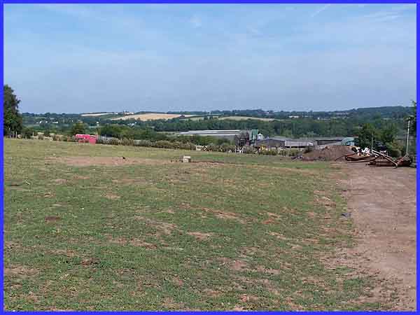
From the entrance to Manor Farm, we can look across the valley
through which Stanley Brook flows to the farmland beyond. In
the middle distance is Manor Farm itself which according to the
leaflet is "a modern farm with high-tech machinery and up-to-date
buildings." There is also a glimpse of that pedigree herd.
The original Manor stood in this area but opencast mining as
recently as 1959 destroyed any surviving features.
|
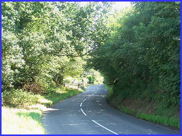
Leaving the farm we can now make our way into the village proper
via Derby Road by descending the hill and passing through the
former sandstone quarry that was backfilled in the early 1960s.
|
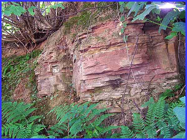
Evidence of the quarry which led to the formation of the Stanley
Excelsior Rubbing Stone Company in the 1920s can still be seen
from the road. It was found that the sandstone made ideal rubbing
stones which were used for whitening thresholds and polishing
woodwork. Even now, I can remember from my childhood, ladies
on their knees scrubbing the steps to their front doors with
such stones but don't ever recollect seeing them used on woodwork.
As time went on and terrazzo steps and other materials started
to be used in the building trade, the need for rubbing stones
declined even though they contributed to the export trade by
being exported to places as far away as India. The company survived
for a while though as in 1929 the owner of the quarry had discovered
another use for the waste material created in the manufacture
of the stones and this was used to make concrete blocks - the
Stanley Building Blocks. Examples of these blocks can still be
seen in buildings not only in Stanley but also in places closer
to Derby such as Chaddesden and Allenton.
|
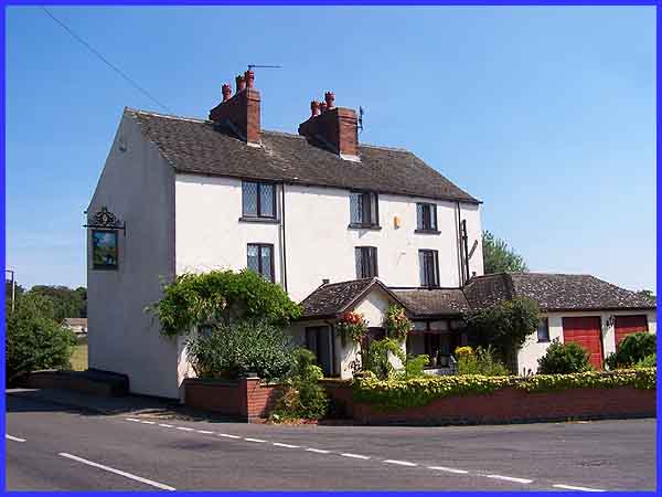
 After passing through
the site of the quarry the road levels out (see title image)
as it approaches Stanley Brook in the bottom of the valley. The
road crosses the brook by a small bridge, seen on the left of
the image above but hardly noticeable to the passing motorist.
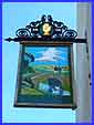
The brook flows directly behind this building on the corner of
Dale Road. Previously, and still given away by the inn sign,
this was a public house appropriately called the Bridge Inn although
the sign now says Bridge Cottage. Dale Road was formerly called
Sough Lane which hints at the village's industrial past as a
sough is an underground channel for draining water out of a mine.
It is here that we make our first detour from the main route
to investigate the lane. After passing through
the site of the quarry the road levels out (see title image)
as it approaches Stanley Brook in the bottom of the valley. The
road crosses the brook by a small bridge, seen on the left of
the image above but hardly noticeable to the passing motorist.
The brook flows directly behind this building on the corner of
Dale Road. Previously, and still given away by the inn sign,
this was a public house appropriately called the Bridge Inn although
the sign now says Bridge Cottage. Dale Road was formerly called
Sough Lane which hints at the village's industrial past as a
sough is an underground channel for draining water out of a mine.
It is here that we make our first detour from the main route
to investigate the lane.
|
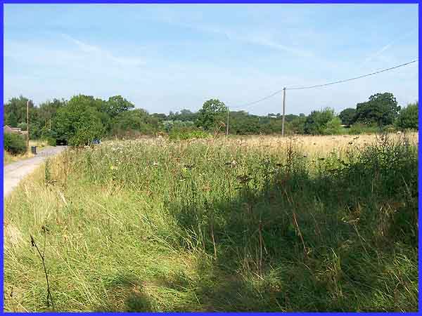
About half a mile along Dale Road, the narrow lane leads to a
farm and a network of footpaths continues to Locko, Dunshill
and Dale Abbey. Looking back from the farm gate, the area of
overgrown land on the right was the site of the brickyard that
developed here in the mid 1800s but there is little left now.
To the left of the lane opposite the brickyard a small community
of homes for colliers grew up in the later part of the nineteenth
century but these too, like the brick works have now been demolished.
|
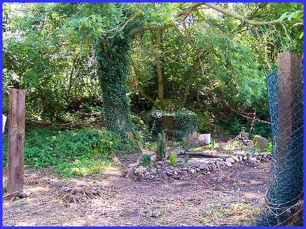
The colliers would no doubt have been employed at Stanley Kilburn
Colliery which was just around a slight bend in the road from
the brick works and can be seen here as we head back along Dale
Road although it is hard to tell from its present appearance
that there ever was a colliery here. It can be argued though
that the success of the colliery between 1870 and 1885 resulted
in the development of the village at that time. During the 1890s
 however,
the company was taken over by the Derby Kilburn Company, the
new owners driving a drift mine, Stanley Footrill to the southwest
of Manor Farm near where we started our walk. By the end of the
First World War, mining had ceased but as we now know, extensive
opencast mining has taken place since destroying much of what
remained from earlier times. however,
the company was taken over by the Derby Kilburn Company, the
new owners driving a drift mine, Stanley Footrill to the southwest
of Manor Farm near where we started our walk. By the end of the
First World War, mining had ceased but as we now know, extensive
opencast mining has taken place since destroying much of what
remained from earlier times.
Returning now to the junction with Derby Road we'll turn right
by Bridge Cottage, and head deeper into the village where we'll
continue our explorations in Part 2.
|
