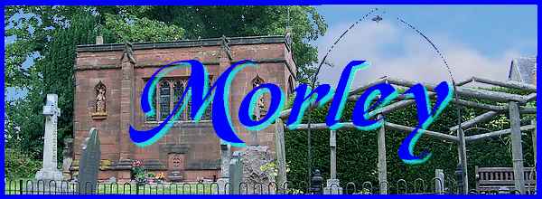
Morley - Part 06 - Around The Almshouses
w/e 11 January 2015
All of this week's pictures were
taken with a Kodak DX6490
I wrote at the beginning of this series about Morley
that there are five distinct settlement areas that go to make
up the village. They were identified as Brackley Gate, The Croft,
Morley Smithy, Morley Moor and Church Lane. Including Morley
Hayes in the Church Lane area we have already visited four of
the five and the only one remaining (identified in the Village
Trail leaflet as Morley Moor) is centred on the area around Morley
Almshouses Lane. I also wrote that it was nigh on impossible
to devise a circular route around Morley that did not involve
some backtracking and revisiting places and this sixth part begins
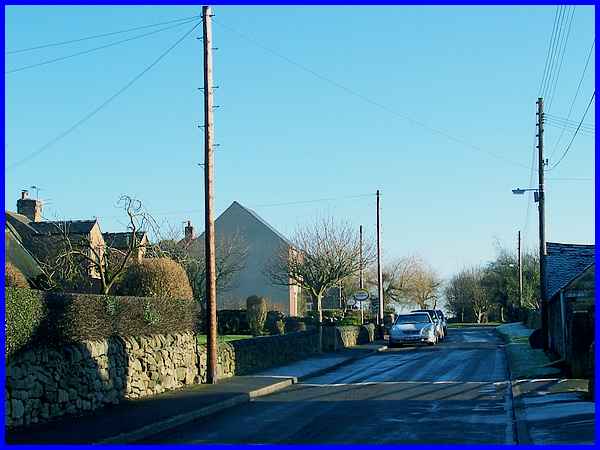
on Brick Kiln lane near the Nature Reserve that we first saw
in the third part about Morley Smithy.
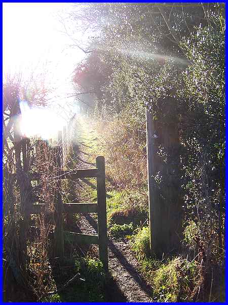
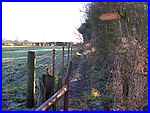
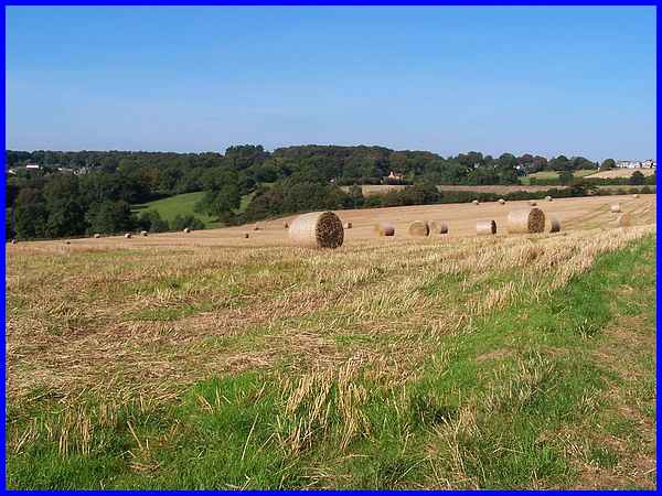
 This
point on Brick Kiln Lane can also be reached by the farm track
from Moor Farm where we ended Part 05 which on a clear winter's
afternoon early in 2015 would involve climbing a stile to descend
into an ice covered puddle (left). I always knew that after crossing
the road that pictures of the way ahead by the side of the This
point on Brick Kiln Lane can also be reached by the farm track
from Moor Farm where we ended Part 05 which on a clear winter's
afternoon early in 2015 would involve climbing a stile to descend
into an ice covered puddle (left). I always knew that after crossing
the road that pictures of the way ahead by the side of the  Nature Reserve
with the sun low in the clear sky would be difficult so this
image of that same path on Morley Moor (right) as it approaches
the end of Morley Almshouses Lane is from an Autumn Footprints
walk in September 2009. On other similar walks we have left this
path about half way between the Nature Reserve and the Lane to
cross over a ploughed field reaching the Morley Almshouse Lane
about halfway along it via a jitty between the houses. Nature Reserve
with the sun low in the clear sky would be difficult so this
image of that same path on Morley Moor (right) as it approaches
the end of Morley Almshouses Lane is from an Autumn Footprints
walk in September 2009. On other similar walks we have left this
path about half way between the Nature Reserve and the Lane to
cross over a ploughed field reaching the Morley Almshouse Lane
about halfway along it via a jitty between the houses.
|
Morley Almshouses Lane has a mix of old and new properties and
as with most villages a certain amount of folklore. One story
relates how a Mr. Burt Stennett who lived in a cottage on the
lane used to pull out teeth for half a crown (12½p) without
availing his "patients" with any anaesthetic. He also
had an off licence and sold cigarettes. Maybe the alcohol and
nicotine sales were increased as a result of his dentistry exploits.
|
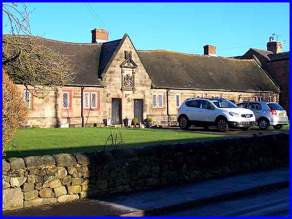
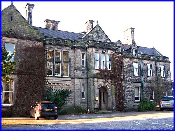
The Almshouses, after which the lane takes its name of course,
were built at the behest of Jacinth Sacheverell sometime after
1656. He left instructions in his will for his wife to arrange
for the building of "an hospital on Morley Moor for the
habitation of six poor, lame or impotent men" and although
she too died a few months later, the arrangements had already
been made. Originally six dwellings under a common roof, three
each for Morley and Smalley, the Almshouses have been modernised
several times and in 1974/5 they were converted into four properties,
two for each parish.
|
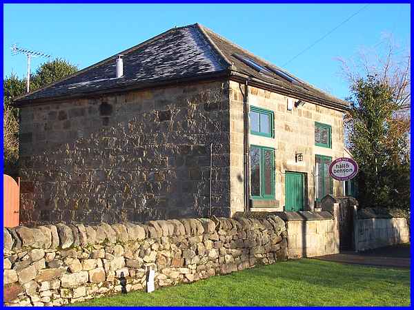
Another old building on Morley Almshouses Lane, although not
as old as the Almshouses, is the former chapel for which permission
was granted in 1861. This ran alongside an earlier chapel until
1892 when the older one was converted to a dwelling house. The
stone building above continued as a chapel until 1977 when the
last service was held on 19th February until it too became a
private house. It had been heated by an iron stove until 1934
when electricity was installed but a toilet and kitchen were
not added until the 1950s when an extension was added.
|
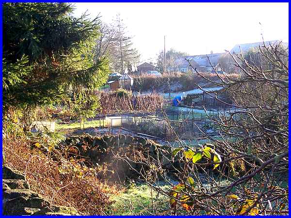
On the opposite side of the lane are seven allotments and Morley's
only piece of common land. It was here that the former Church
of England School operated from 1816 until it closed in 1879
to be replaced by the Board School at Morley Smithy. It had been
demolished by 1910 but on the same site however, there is still
evidence of a former cobbler's shop.
|
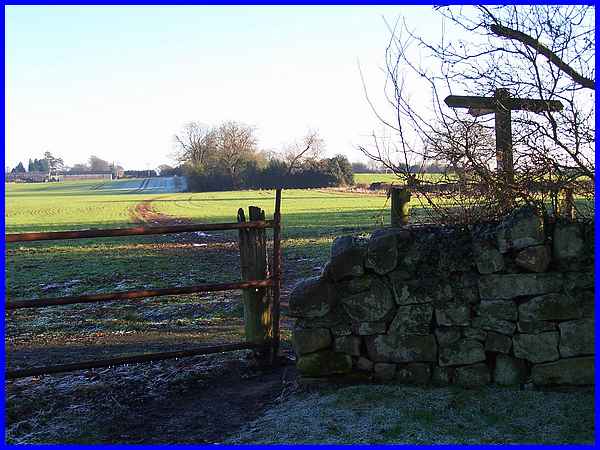
Towards the end of the lane there is access to the network of
footpaths across Morley Moor as the three way signpost indicates.
|
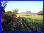  To the
left a path (left) leads back to Brick Kiln Lane whilst straight
ahead is the Portway, an ancient packhorse trail that heads off
to Morley House Farm, Church Lane and on towards Dale Abbey and
which was in use long before the Romans came on the scene with
Ryknield Street. To the right the path (right) leads southwards
towards Derby and is a route we have followed several times on
guided walks. To the
left a path (left) leads back to Brick Kiln Lane whilst straight
ahead is the Portway, an ancient packhorse trail that heads off
to Morley House Farm, Church Lane and on towards Dale Abbey and
which was in use long before the Romans came on the scene with
Ryknield Street. To the right the path (right) leads southwards
towards Derby and is a route we have followed several times on
guided walks.
|
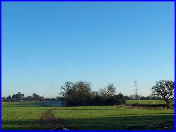
It was on one of those walks back in September 2009 that I took
this photo which serves here to illustrate the spread out nature
of Morley. On the horizon to the right are properties on Morley
Almshouses Lane. Across the farmland towards the centre are the
buildings of Lodge Farm which sits approximately on the line
of Ryknield Street now called Moor Road and to the left among
the trees is Breadsall Priory.
As we discovered earlier Morley Manor is in Smalley and Breadsall
Priory is also a bit of an anomaly. The boundary between Morley
and Breadsall actually runs along Moor Road but the Priory is
closer to the Almshouses at Morley than to the village at Breadsall.
Consequently it is included in the Morley Village Trail leaflet
and is often mentioned by leaders of Heritage Walks around Morley.
The Priory today is a hotel, golf and country club but has an
interesting history. It was built in the sixteenth century on
the site of a thirteenth century Augustinian Priory which was
dissolved by Henry VIII in 1536. Purchased by Erasmus Darwin
Jnr. in 1799, he intended to move in on Lady Day 25th March 1800.
Unfortunately he fell into the River Derwent on 29th December
1799, drowned and was buried in Breadsall Churchyard. The Priory
passed to his father Dr. Erasmus Darwin, grandfather of the more
famous Charles Darwin. Dr. Erasmus actually moved in but only
survived for a month before dying and being buried next to his
son at Breadsall Church where there is now a Darwin memorial.
It seems the Priory was not destined to be in the hands of the
Darwin family long term and it eventually became the home of
another prominent Derbean, Alfred Seale Haslam, born in 1844
as the fourth son of an engineering family. He designed the Haslam
Refrigerator which was installed on the steamship "Orient"
which sailed from London to Australia and returned with the world's
first cargo of frozen food. Much more could be written about
Alfred Haslam but as this series is about Morley, that can wait
for another day.
|
There are several options when following the path south from
Morley Almshouses Lane, one of which we followed in the Autumn
Footprints programme to emerge onto the main road into Derby.
Previously on a similar walk we had turned off to cross the moor
back to the Church Lane area. These two routes pass either side
of Broomfield Hall which was originally the country home of Charles
Schwind and built in 1873 in 107 acres of parkland. It was purchased
by Derbyshire County Council in 1947 and developed as the County
Agricultural College. In recent years with a variety of much
newer buildings surrounding it, the original Hall has become
part of the Derby College which has campuses at several other
locations as well.
|
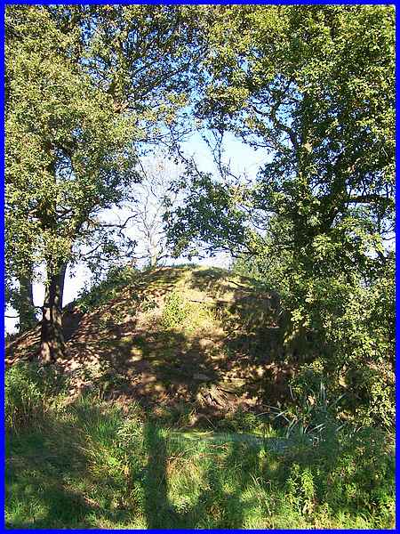
To conclude this series, there is one last thing that must be
included. The path across the moor to the north of Broomfield
Hall leads back to Church Lane but a short diversion from it
will pick up the Portway again. The Portway too is diverted around
a conical flat topped hill about twenty feet high. This is the
Morley Mound and it has been the object of many and various theories
about its purpose. There is evidence of a moat surrounding it
and the theories expounded include it being a defensive mound,
a lookout post, a meeting place or a survey point erected by
the Romans to survey the building of Ryknield Street. It is recorded
in history as far back as 1086 but its purpose is still a mystery
and there is no conclusive proof to support any of the theories.
|
