Morley - Part 04 - Morley Hayes
w/e 02 November 2014
All this week's pictures were taken
with a Kodak DX6490
I have been trying to discover the origin of the
term "Hayes" but with little success. A number of locations
in the east of the Parish of Morley bear the name as we shall
see in this part of the Village Trail but the leaflet for Morley
describing the village concentrates mainly on the western side
with scarcely a mention of the east. All of the images in this
part have been captured at various times during the last six
years (since 2008) but are appearing here for the first time.
The first half of this part will take us to the point where we
ended Part 02 to cross the field to Morley Smithy but the second
half will continue from there to Morley Hayes Golf Club.
We begin however back on Church Lane and this image from September
2011 is from near to where the long distance path between Ilkeston
and Ashbourne called the Centenary Way meets another long distance
path, the Midshires Way, from the right. Both routes continue
together along Church Lane toward St Matthew's Church. In 2011
I had enjoyed a solo walk along the Centenary Way from Stanley
Village in wonderful autumn sunshine but this year with the Erewash
Ramblers I had approached this point from the left on an Autumn
Footprints walk.
|
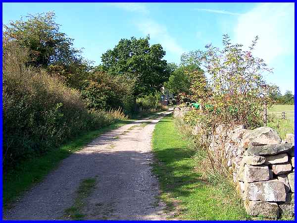
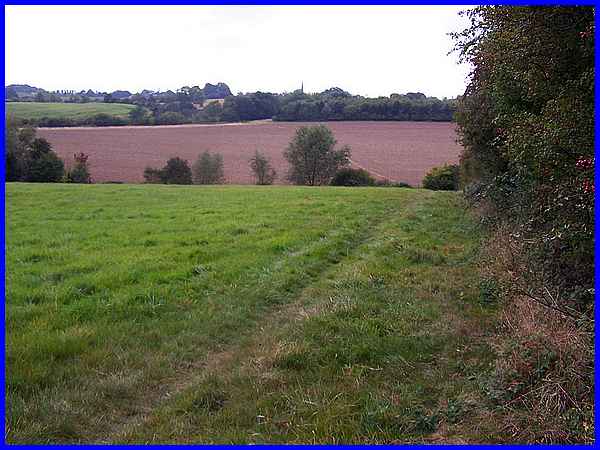
The latter walk followed the Centenary Way in the opposite direction
to my solo excursion passing through the undulating countryside
between Morley and Stanley of which the above image is typical.
The Village Trail leaflet does say that Morley is "surrounded
by farms with a mixture of arable and pasture land" adding
that "Even today it still draws most of its livelihood from
farming."
The Centenary Way leads to one of those farms or perhaps it is
more correct to say, two of them. The Ordnance Survey map for
the area displays two names for this complex of farm buildings.
On the left is Park Farm and to the right Hayes Park Farm. Both
the above images were taken in September 2014.
|
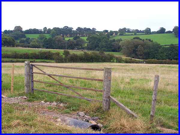
These three images too all come from this year's Autumn Footprints
walk and show the farmland we walked through after passing Hayes
Park Farm.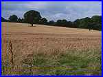 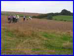 We followed
the Centenary Way as far as Little Wood and then, instead of
carrying on to another farm with the name of Hayeswood, we almost
doubled back on ourselves to walk across some more of that arable
and pasture land to head for St Matthew's Church, the spire of
which is visible on the horizon in the large image above. The
path across the ploughed field can also be made out in the image
above as it heads towards the gap in the distant trees. We followed
the Centenary Way as far as Little Wood and then, instead of
carrying on to another farm with the name of Hayeswood, we almost
doubled back on ourselves to walk across some more of that arable
and pasture land to head for St Matthew's Church, the spire of
which is visible on the horizon in the large image above. The
path across the ploughed field can also be made out in the image
above as it heads towards the gap in the distant trees.
|
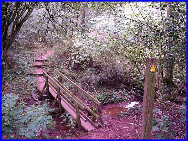
That gap in the trees enabled us to drop down into and cross
the narrow wooded valley that is called The Gripps. This valley
takes water from the Brick Kiln Ponds that we encountered at
Morley Smithy in Part 03 and various other deep dykes and ditches
on Morley Moor.
|
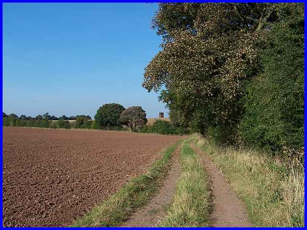
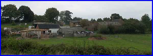
After crossing The Gripps, the path continues across the farmland
to eventually reach the corner of St Matthew's churchyard and
a right turn soon leads to the point where we had the choice
to cross the field to Morley Smithy or carry straight on alng
the farm track towards Morley Hayes Golf Club. This image from
September 2009 was captured on a Heritage Walk when we followed
the route to the Golf Club the first objective being the brick
tower straight ahead.
|
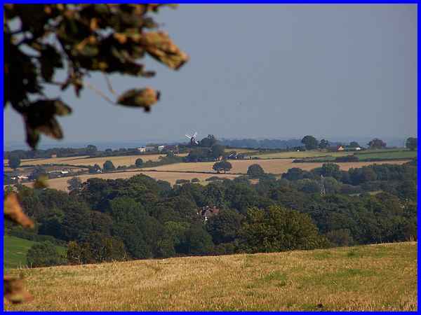
Although still heading for the tower our guide on that occasion
pointed out over The Gripps and Stanley Village to the east,
the Cat and Fiddle windmill at Dale. This view once again highlights
the patchwork of arable and pasture landscape.
|
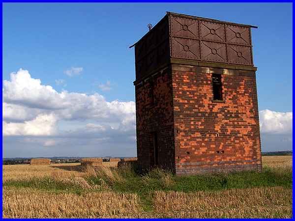
Probably just as prominent from Dale as the windmill is from
Morley, is the Victorian Water Tower that stands in isolation
on a high point here. The tower was built in 1890 to provide
piped water to Morley Manor (not to be confused with Morley Hall
near the church) although it also supplied Hayes Farm and Smithy
Farm. There is evidence in The Gripps of an old bore hole pump
where the foundations can be seen and local residents believe
it was an old fashioned wind pump. Water was pumped up to the
tower to supply the Manor and farms. This image is from yet another
walk in the area in September 2008 and when we walked this route
this year the tower looked pretty much the same but the views
were not half as good in the fine drizzle that was falling at
the time.
|
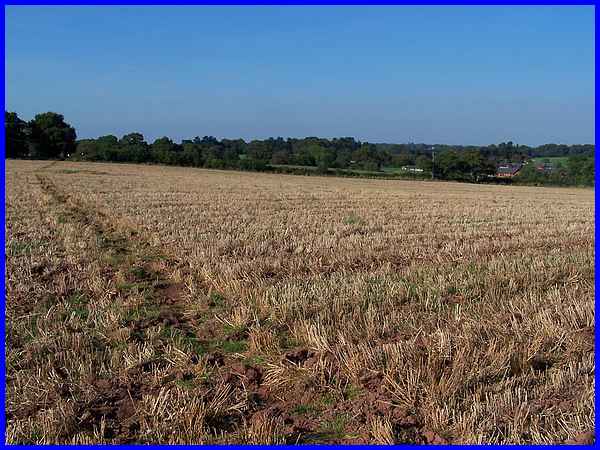
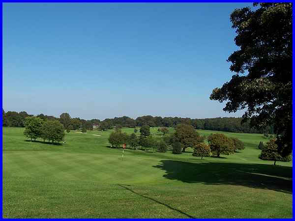
From the tower the path leads across through the stubble to the
edge of the Morley Hayes Golf Course, the buildings of which
are visible beyond the hedgeline. In September 2009 the path
was uneven across the hard ground but I have known this path
to be through a muddy ploughed field at other times.
|
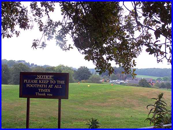
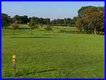 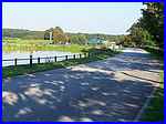 That
fine drizzle was still in the air when we reached the course
this year (above) where a warning notice advises walkers to keep
to the footpath which is identified across the course by a line
of yellow-topped posts (left) as seen here in 2009 in much brighter
conditions. The path leads directly across the course to the
entrance road to the club also seen here (right) in 2009. That
fine drizzle was still in the air when we reached the course
this year (above) where a warning notice advises walkers to keep
to the footpath which is identified across the course by a line
of yellow-topped posts (left) as seen here in 2009 in much brighter
conditions. The path leads directly across the course to the
entrance road to the club also seen here (right) in 2009.
|
Part 05 of this Village Trail will begin at the entrance to the
Golf Club but in 2009 an Autumn Footprints walk in September
actually began on the car park of the club. The first thing we
did was to ascend a small mound overlooking one of the greens
where we, as a group, were given some interesting facts which
I'll summarise before continuing our exploration of the parish.
So far I have referred to the Golf Club but the complex is also
a Hotel, Restaurant, Conference Centre and Wedding Venue, the
original Hayes Farm being built about the same time in the 1890s
as the Manor House, also being part of the Morley Manor Estate.
The original farmhouse was demolished in the 1980s as part of
the development of the complex but back in the 1940s the land
had been outcropped for coal. Between the two, it had returned
to farming and had been home to a herd of pedigree Friesians
but an ever constant was the wood seen in the distance. This
is Morleyhayes Wood and is where Sir Hugh Alleyne Sacheverell
Bateman suffered the riding accident that led to his subsequent
death and interment in the mausoleum at St Matthew's Church.
|
