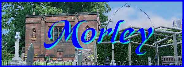
Morley - Part 02 - Still Near The Church
w/e 07 September 2014
All of this week's pictures were
taken with a Kodak DX6490
For this second instalment of the Village Trail around
Morley, we returned to the Church Lane area for another look
at some other interesting features near St Matthew's Church.
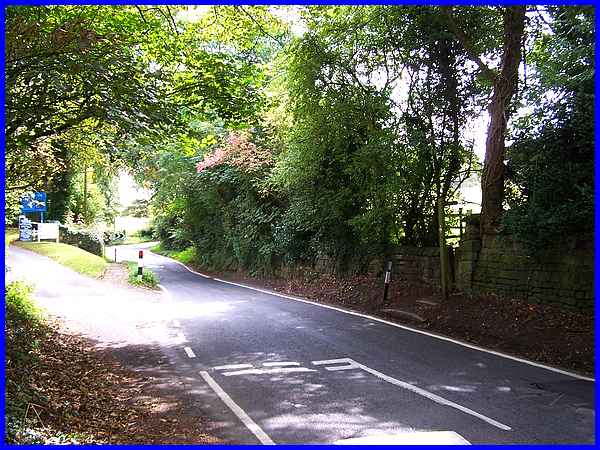
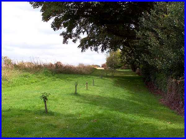
As we approached again down Church Lane my thoughts went back
to previous walks in the area both alone and as part of walking
groups. There is a raised path on the left of this narrow sunken
lane which is what I knew many years ago as Donkey's Hollow.
A previous solo walk from Stanley had brought me to the church
along the path seen here but with walking groups we had also
walked down Church Lane in the opposite direction. But that's
not all - we had also reached Church Lane along footpaths across
the fields of Church Farm and dropped down to the lane via a
narrow and awkward stile at the signpost on the right.
|
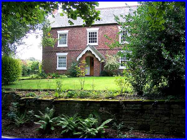
The Grade II listed farmhouse standing to the right of that footpath
through the fields also previously served as Morley's Post Office.
From the raised path on the opposite side of the road I thought
the engraved stone in the archway over the door said 1812 but
the British Listed Buildings website records that the property
was built "Early C18 and 1842" and it also says that
the stone panel is "inscribed OBJUS/1842".
(Note to self - time to get your eyes tested again!)
|
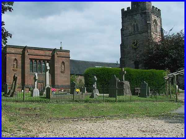
All the walks we have followed previously generally head towards
St Matthew's and another building that is obvious on the approach
is the Grade II* listed Bateman family mausoleum in the southwest
corner of the churchyard. It was built in the perpendicular style
by G F Bodley in 1897.
|
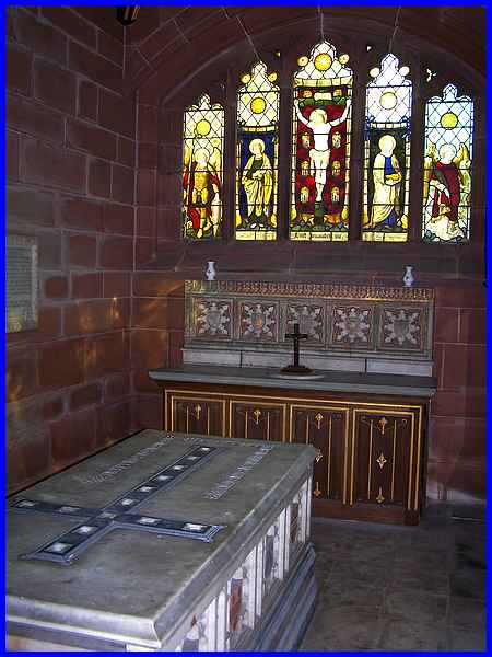
This picture taken on one of those earlier walks when access
to the mausoleum was possible shows some of the interior including
the altar, the Bateman tomb and some of the stained glass windows.
|
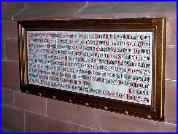
These three images were also captured during that previous visit
and show some of the panels that adorn the interior walls. The
large one (above) in an ornate script begins "Here resteth
Sir Hugh Alleyne Sacheverell Bateman of Morley and Etwall ....
" The circumstances of his passing are a little unusual
and frankly quite gruesome in part. Read on only if you are not
squeamish. Briefly he was involved in a riding accident in Morley
Hayes Wood in 1896. Apparently he had a "skill" of
sleeping in the saddle whilst letting his horse find its own
way home. He was also a pipe smoker and unfortunately the horse
passed under an oak tree and a low bough hit Sir Hugh full in
the face. The pipe penetrated the roof of his mouth and entered
his brain and although his injuries were not immediately fatal,
he contracted an infection and died several months later.
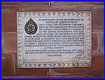 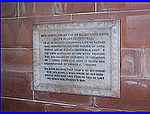 Other
memorial plaques are for Lieut Ronald Greenfield (left) of the
First Battalion of the Rifle Brigade who died at the Somme in
1916 and his mother Edith Mary Greenfield (right). Edith, whose
body also lies in the mausoleum was Sir Hugh's wife's sister,
Anna Lister-Kaye. Anna had remarried Commander Russell Lister-Kaye,
Deputy Director of Naval Intelligence during WW1 in 1913. Other
memorial plaques are for Lieut Ronald Greenfield (left) of the
First Battalion of the Rifle Brigade who died at the Somme in
1916 and his mother Edith Mary Greenfield (right). Edith, whose
body also lies in the mausoleum was Sir Hugh's wife's sister,
Anna Lister-Kaye. Anna had remarried Commander Russell Lister-Kaye,
Deputy Director of Naval Intelligence during WW1 in 1913.
|
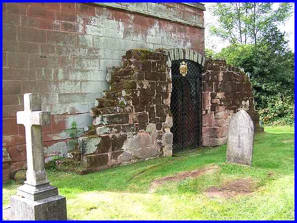
The entrance to the mausoleum is via the north facing wall and
the doorway is surrounded by gritstone walling and an archway
which is thought to be the Loaf Gate, the only remaining portion
of the old manor house. The Loaf Gate was where the Lord of the
Manor distributed bread to the poor.
|
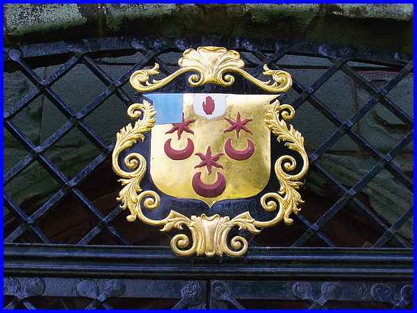
The mausoleum underwent some significant restoration in 1996
following a grant from the Heritage Lottery Fund and with the
help of the Mausolea and Monuments Trust and English Heritage.
The work included the wrought iron gates at the entrance and
the restored family crest above the doorway among many other
features of the mausoleum too.
|
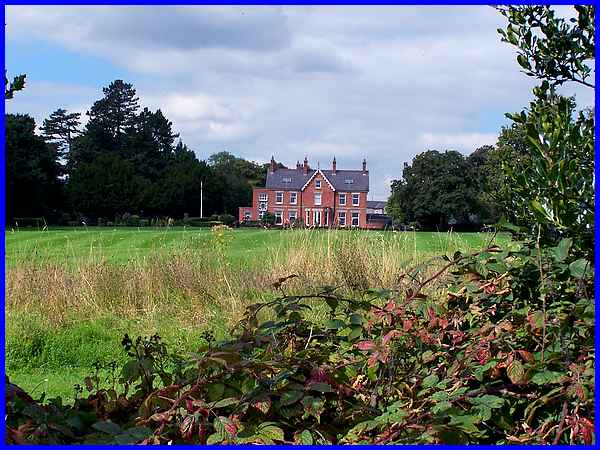
The manor house had been built in the seventeenth century by
William Sacheverell and was demolished (apart from the aforementioned
Loaf Gate) in 1757. Evidence of the old Manor House can be found
on the other side of the church wall and the shadow of the foundations
are visible in aerial images of the area (link). The new Morley Hall, seen here
from outside the mausoleum, was built near the site of the old
manor house by Mr Sitwell in 1837 for the Wilmot-Sitwell family
and has since undergone several extensions and restorations.
A public footpath runs between Morley Hall and the church and
most of the walks we have previously followed take that route.
|
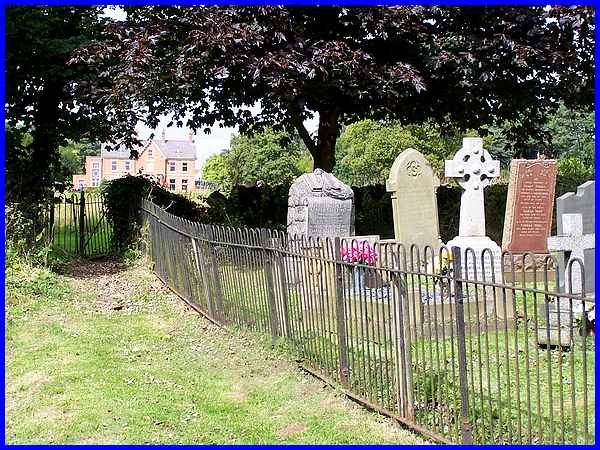
To access the footpath means leaving the churchyard and passing
through the kissing-gate at the corner of the churchyard.
|
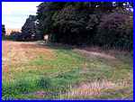  Following the path by the church wall
leads across an open space to another gate. From here there are
two options. One is to carry on to Morley Hayes around the edge
of the field (left) and the other is to follow another path diagonally
across the field (right) through the crops to Morley Smithy.
This is one reason why it is so difficult to devise a circular
route around the village without backtracking. Following the path by the church wall
leads across an open space to another gate. From here there are
two options. One is to carry on to Morley Hayes around the edge
of the field (left) and the other is to follow another path diagonally
across the field (right) through the crops to Morley Smithy.
This is one reason why it is so difficult to devise a circular
route around the village without backtracking.
We will head for Morley Hayes later but in Part 03, our objective
will be Morley Smithy.
|
