Draycott & Wilne - Part 05 - Market Street & Wilne
Road
w/e 02 December 2012
All this week's pictures were taken
with a Kodak DX6490
This is the final part of the Village Trail in Draycott
as after this we will head along Wilne Road to continue in the
settlement of Wilne. Before that though we will continue along
Market Street towards the village centre to explore the Mill
Complex and then double back to follow Wilne Road out of the
village.
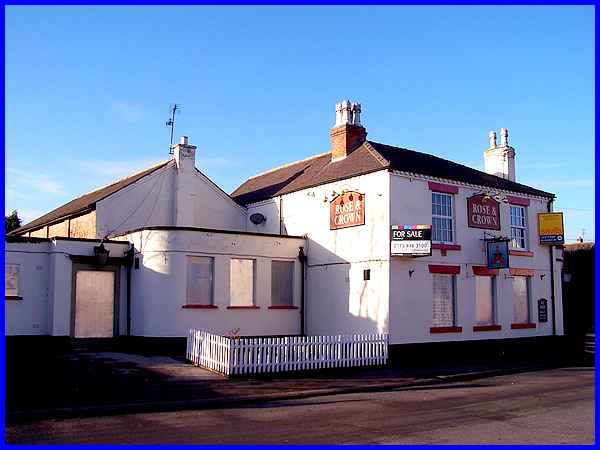
We'll resume in Market Street then at the Rose and Crown pub.
Currently closed and up for sale the pub was formerly a farmhouse
but became an inn in the early nineteenth century. It's original
name was simply The Crown with the Rose being added at a later
date.
|
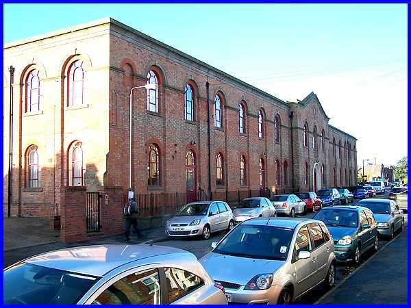
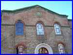 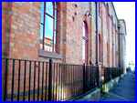 The most dominant feature on Market Street is
the former Mill Complex. Dating from about 1860 the building
with its central pediment (left), gritstone coping and cast iron
window frames has been modernised and converted into apartments.
The original cast iron railings were removed as part of the war
effort but the appearance of the building has been restored with
the addition of new ones (right). The most dominant feature on Market Street is
the former Mill Complex. Dating from about 1860 the building
with its central pediment (left), gritstone coping and cast iron
window frames has been modernised and converted into apartments.
The original cast iron railings were removed as part of the war
effort but the appearance of the building has been restored with
the addition of new ones (right).
|
Earlier in this walk around Draycott we saw the former
site of Towle's Mill near the Derby Canal of Hopwell Road but
by 1842 the brothers, John and Benjamin, had moved their cotton
and lace manufacture to occupy this mill in Market Street.
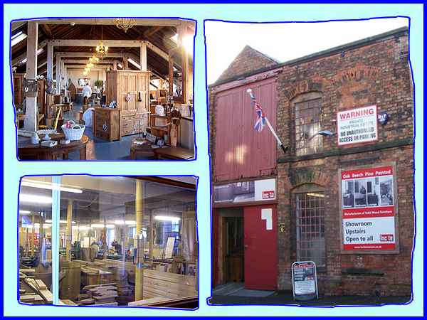
Behind the impressive frontage of the former Draycott Lace Factory
the site contains a number of other buildings. An early nineteenth
century factory is still in use with a woodworking workshop on
the ground floor and a showroom above.
|
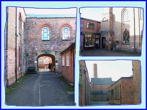
Between the old factory and the apartment building a passageway
leads to The Court Yard where other small businesses have been
established in the old buildings. The mill complex also includes
an interesting octagonal brick chimney dating from 1850.
|
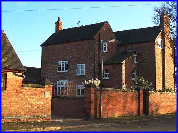
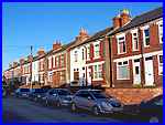  Opposite the mill on Market Street a row of
houses (left) was probably once occupied by mill workers but
as we retrace our steps across the wide mouth of South Street
(right) a large Grade 2 listed building shows that agricultural
work was not far away. This eighteenth century building with
a small nineteenth century extension, is Cedars Farm. Adjacent
barns incorporate some early village housing. Opposite the mill on Market Street a row of
houses (left) was probably once occupied by mill workers but
as we retrace our steps across the wide mouth of South Street
(right) a large Grade 2 listed building shows that agricultural
work was not far away. This eighteenth century building with
a small nineteenth century extension, is Cedars Farm. Adjacent
barns incorporate some early village housing.
|
We are now nearing the edge of the village and heading for Wilne
Road but cannot leave Draycott without mentioning that it is
also known affectionately known as Neddy Town with the inhabitants
called Neddies. This is because before industry staked a claim
in the village, it was for centuries a farming community but
when industrial activities started, donkey drawn carts hauled
coal from the north to the waterways. The Market Place became
the place where the donkeys were changed and thus gave rise to
the nickname.
|
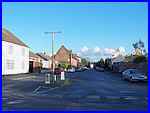
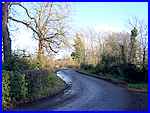  Wilne Road (left) weaves its way around the
buildings (above) collectively known as The Boathouse whilst
a footpath behind them leads to the flood bank (right) by the
River Derwent. The flood bank and the footpath reacquaint us
with the Coffin Walk that we recently followed in the opposite
direction but we will soon leave that route to continue about
three-quarters of a mile down Wilne Road to Church Wilne. Wilne Road (left) weaves its way around the
buildings (above) collectively known as The Boathouse whilst
a footpath behind them leads to the flood bank (right) by the
River Derwent. The flood bank and the footpath reacquaint us
with the Coffin Walk that we recently followed in the opposite
direction but we will soon leave that route to continue about
three-quarters of a mile down Wilne Road to Church Wilne.
|
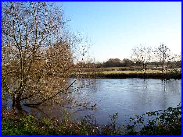
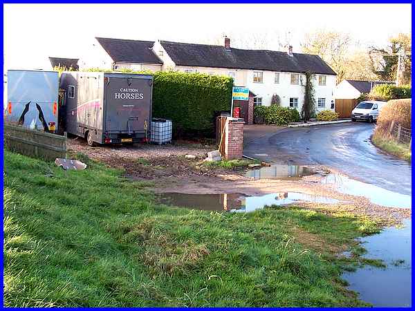
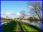
After recent and prolonged heavy rain the river was fast flowing
and the water level high but in years gone by it was possible
to take a small ferry across the river here from adjacent to
The Boathouse.
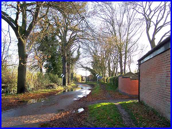
That concludes the first section of this Village Trail but we
will continue and approach Wilne in the next part. Some years
ago I had cause to visit Wilne whilst at work and found the road
flooded and almost indistinguishable from the river so I am hoping
for drier conditions when we make our next visit.
|
